 Old Cumbria Gazetteer
 |
 |
|
| included in:- |
 Derwent Water Derwent Water |
|
| viewpoint, Latrigg | ||
| site name:- | Latrigg | |
| civil parish:- | Underskiddaw (formerly Cumberland) | |
| county:- | Cumbria | |
| locality type:- | viewpoint | |
| coordinates:- | NY278246 | |
| 1Km square:- | NY2724 | |
| 10Km square:- | NY22 | |
|
|
||
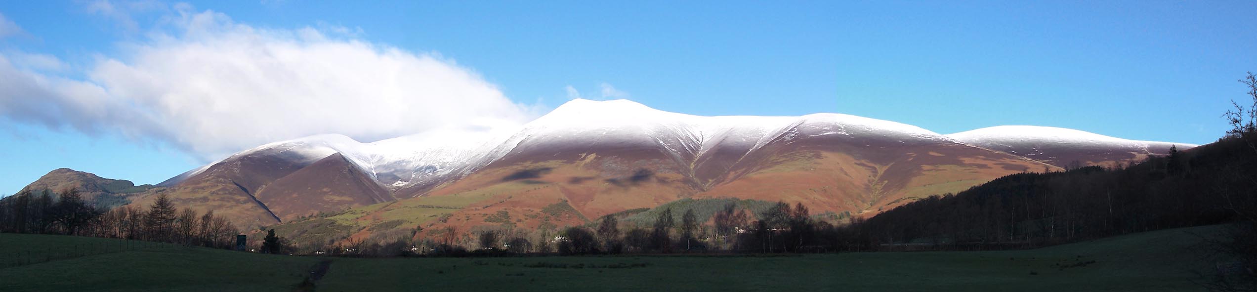 Click to enlarge BXT24.jpg View N - Dodd, Carlside, Carsleddam, Sca Fell in cloud, Little Man on Skiddaw, Lonscale Fell (taken 5.12.2012) |
||
|
|
||
| evidence:- | descriptive text:- West 1778 (11th edn 1821) placename:- station, Derwent Water, West 7 |
|
| source data:- | Guide book, A Guide to the Lakes, by Thomas West, published by
William Pennington, Kendal, Cumbria once Westmorland, and in
London, 1778 to 1821. goto source Page 106:- "STATION VII. Another select station for a morning view, is on Latrig, a soft green hill that interposes between the town and Skiddaw. The ascent is by Monk's-hall, leaving Ormathwaite on the left, and following mountain road about due east till you approach the gate in the stone-wall inclosure; then slant the hill to the right, looking towards Keswick, till you gain the brow of the hill, which exhibits a fine terrace of verdant turf, as smooth as velvet. Below you, rolls the Greta, and, in its course, visits the town before it joins the Derwent, where it issues from the lake, and then their united streams are seen meandering through the vale till they meet the floods of Bassenthwaite, under the verdant skirts of Wythop brows." goto sourcePage 107:- "The prospect to the south is the reverse of that from Castle-crag. The view is full into the rocky jaws of Borrowdale, through which the Derwent is seen pouring his crystal stream, and, after winding through some verdant meadows, which skirt the rocky coast, joining the lake at Lowdore. The lake itself is seen in its full extent, on all sides, with variety of shore, and its bosom spotted with diversity of islands. Castle-crag, in Borrowdale, stands first of all the forest of embattled rocks, whose forked heads, reared to the sky, shine in the sun like spears of burnished steel. In the rear, Langdale-pike, advancing to the clouds his cone-like head, overlooks them all. What charms the eye, in wandering over the vale, is, that not one straight line offends. The roads all serpentize round the mountains, and the hedges wave with the inclosures. Every thing is thrown into some path of beauty, or agreeable line of nature. But to describe every picturesque view that this region of landscape presents, would be an endless labour. And, did language furnish expression to convey ideas of inexhaustible variety that is found in the many grand constituent objects of these magnificent scenes, the imagination would be fatigued with the detail, and description weakened by redundancy. ..." |
|
|
|
||
| evidence:- | old map:- Crosthwaite 1783-94 (Der) placename:- station, Derwent Water, West 8 |
|
| source data:- | Map, uncoloured engraving, An Accurate Map of the Matchless Lake
of Derwent, ie Derwent Water, scale about 3 inches to 1 mile, by
Peter Crosthwaite, Keswick, Cumberland, 1783, version published
1800.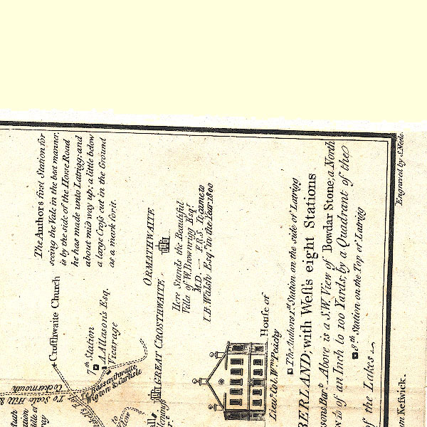 CT2NY22R.jpg "8th. Station on the Top of Latrigg" item:- Armitt Library : 1959.191.3 Image © see bottom of page |
|
|
|
||
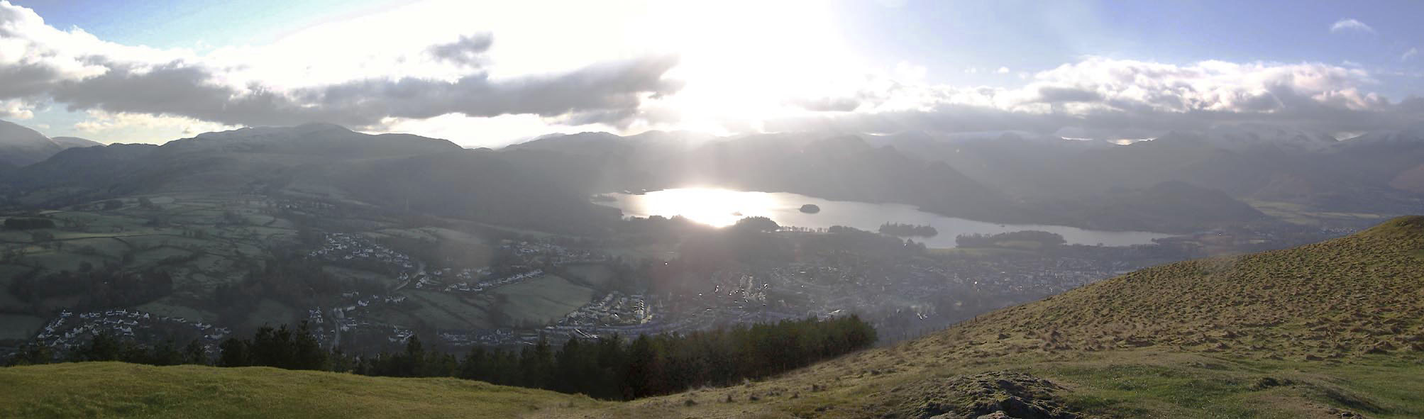 Click to enlarge BXT23.jpg Panorama S - High Rigg, Keswick, Derwent Water, Derwent Fells. (taken 5.12.2012) 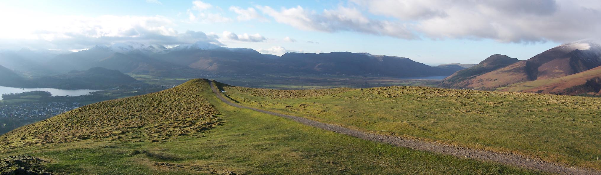 Click to enlarge BXT20.jpg Panorama W - Derwent Water, Derwent Fells, Bassenthwaite Lake, Dodd, Carlside. (taken 5.12.2012) 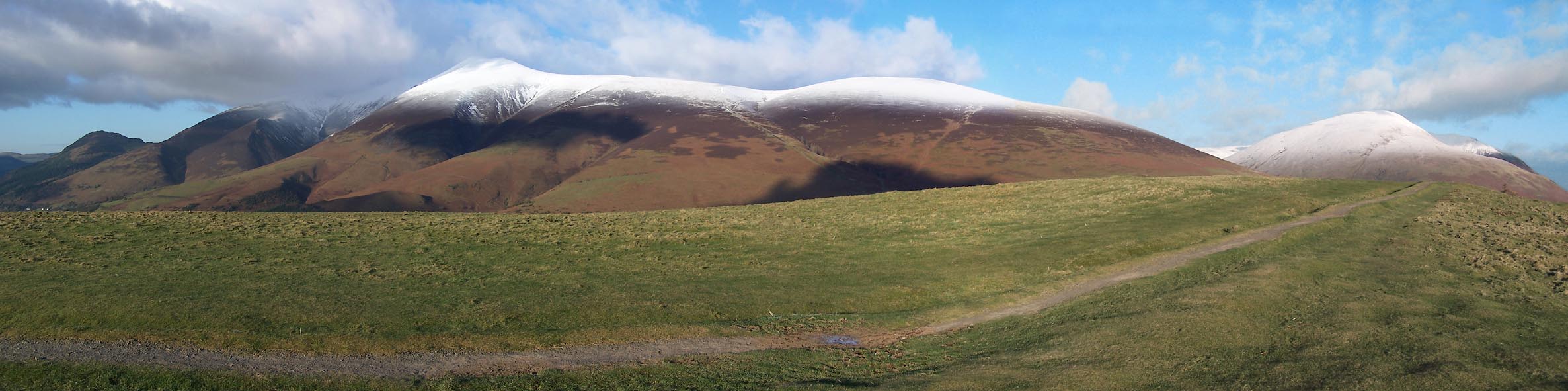 Click to enlarge BXT21.jpg Panorama N - Dodd, Carlside, Sca Fell, Little Man on Skiddaw, Lonscale Fell, Blease Fell. (taken 5.12.2012) 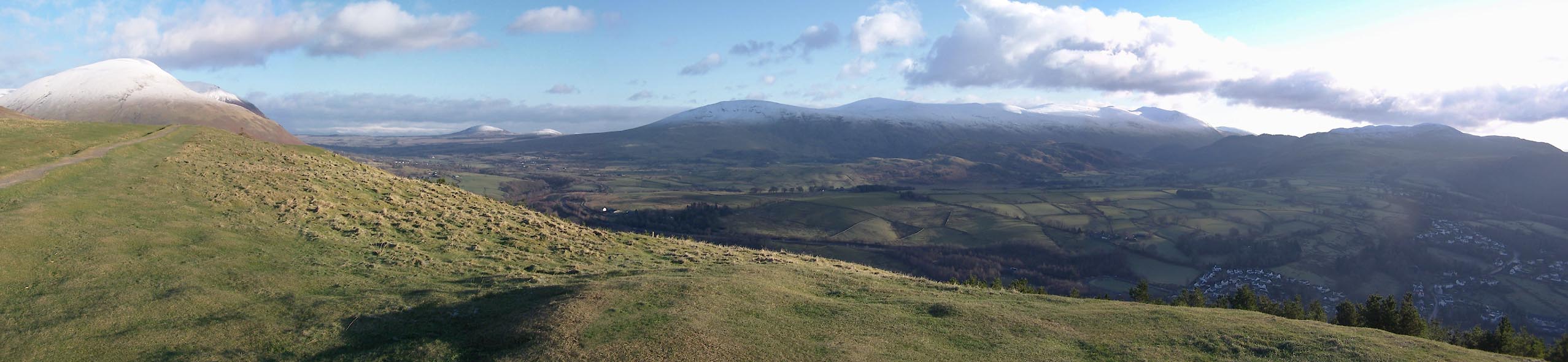 Click to enlarge BXT22.jpg Panorama E - Blease Fell, Hutton Moor with Little Mell Fell and Great Mell Fell, the Dodds, Helvellyn, High Rigg. (taken 5.12.2012) |
||
|
|
||
| indexing | ||
| person:- | author : West, Thomas |
|
| place:- | Derwent Water | |
| date:- | 1778 |
|
| period:- | 18th century, late | |
| period:- | 1780s | |
| item:- | guide book; Guide to the Lakes |
|
|
|
||
Lakes Guides menu.