Old Cumbria Gazetteer
 |
 |
|
||
| South Tyne, River | ||||
| civil parish:- | Alston Moor (formerly Cumberland) | |||
| county:- | Cumbria | |||
| locality type:- | river | |||
| 1Km square:- | NY7441 (etc) | |||
| 10Km square:- | NY74 | |||
| 10Km square:- | NY73 | |||
| county:- | Northumberland | |||
| locality type:- | river | |||
| 10Km square:- | NY65 | |||
| current boundary | ||||
| locality:- | Cumbria boundary | |||
| coordinates:- | NY70514892 | |||
| coordinates:- | NY70774865 | |||
| 1Km square:- | NY7048 | |||
|
|
||||
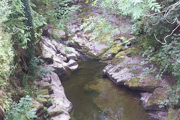 BML57.jpg At Garrigill Bridge; in a drought. (taken 29.7.2006) 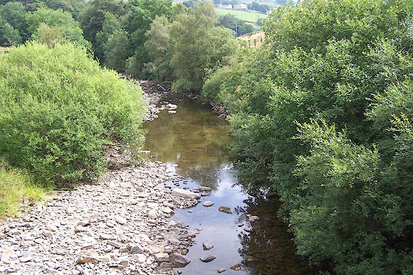 BML47.jpg At the footbridge below Garrigill; in a drought. (taken 29.7.2006) |
||||
|
|
||||
| evidence:- | old map:- OS County Series (Cmd 34 13) placename:- South Tyne |
|||
| source data:- | Maps, County Series maps of Great Britain, scales 6 and 25
inches to 1 mile, published by the Ordnance Survey, Southampton,
Hampshire, from about 1863 to 1948. OS County Series (Cmd 42 1) |
|||
|
|
||||
| evidence:- | old map:- Paris 1240s placename:- Thine |
|||
| source data:- | Map, version B, northern England, Scotland and part of Wales, by Matthew Paris, 1240s.
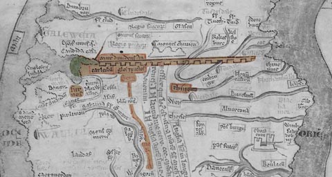 click to enlarge click to enlargePAR2Cm.jpg "Thine" derived from copyright image, courtesy of Corpus Christi College item:- Corpus Christi, Cambridge : MS16.f4.5 Image © see bottom of page |
|||
|
|
||||
| evidence:- | presumably descriptive text:- Froissart 1325-1400 placename:- Water of Tyne |
|||
| source data:- | Book, The Chronicles of Sir John Froissart, 1325-1400,
translated by Lord Berners, "... Northumberland, ... through which there runneth a river full of flint and great stones, called the Water of Tyne. And on this river standeth the town and castle of Carlisle, the which sometime was king Arthur's, and held his court there oftentimes. Also on that river is assised the town of Newcastle-upon-Tyne, ... the Scots could not enter into England, but they must pass this said river in one place or other. The Englishmen could hear no tidings of the Scots till they were come to the entry of the said country. The Scots were passed this river so privily, that they of Carlisle nor yet of Newcastle knew nothing thereof, for between the said towns it was twenty-four English mile [leagues in the original]." |
|||
|
|
||||
| evidence:- | old map:- Saxton 1579 placename:- South Tyne Flu. |
|||
| source data:- | Map, hand coloured engraving, Westmorlandiae et Cumberlandiae Comitatus ie Westmorland
and Cumberland, scale about 5 miles to 1 inch, by Christopher Saxton, London, engraved
by Augustinus Ryther, 1576, published 1579-1645.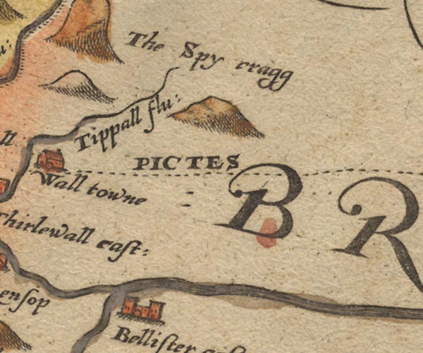 Sax9NY76.jpg 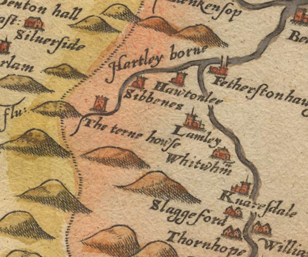 Sax9NY65.jpg 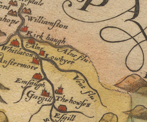 Sax9NY74.jpg 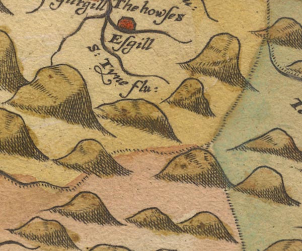 Sax9NY73.jpg "S: Tyne flu:" item:- private collection : 2 Image © see bottom of page |
|||
|
|
||||
| evidence:- | old map:- Burghley 1590 (facsimile) placename:- South Tyne flu. |
|||
| source data:- | Facsimile map, A Platt of the Opposete Border of Scotland to ye West Marches of England,
parts of Cumberland and Scotland including the Debateable Land, from a manuscript
drawn for William Cecil, Lord Burghley, about 1590, published by R B Armstrong, 1897. courtesy of the National Library of Scotland 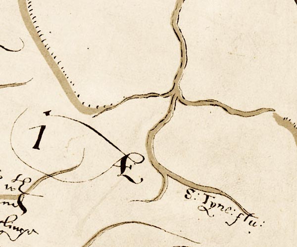 M048NY64.jpg "S. Tyne flu." river item:- National Library of Scotland : MS6113 f.267 Image © National Library of Scotland |
|||
|
|
||||
| evidence:- | old map:- Mercator 1595 (edn?) placename:- Sowth Tyne flu. |
|||
| source data:- | Map, hand coloured engraving, Northumbria, Cumberlandia, et
Dunelmensis Episcopatus, ie Northumberland, Cumberland and
Durham etc, scale about 6.5 miles to 1 inch, by Gerard Mercator,
Duisberg, Germany, about 1595. MER8CumD.jpg "Sowth Tyne flu." double line with stream lines; river, running into Northumberland item:- JandMN : 169 Image © see bottom of page |
|||
|
|
||||
| evidence:- | old map:- Keer 1605 |
|||
| source data:- | Map, hand coloured engraving, Westmorland and Cumberland, scale
about 16 miles to 1 inch, probably by Pieter van den Keere, or
Peter Keer, about 1605 edition perhaps 1676. click to enlarge click to enlargeKER8.jpg "" double wiggly line, tapering to single; river; flows into Durham item:- Dove Cottage : 2007.38.110 Image © see bottom of page |
|||
|
|
||||
| evidence:- | old map:- Speed 1611 (Cmd) placename:- South Tyne fl. |
|||
| source data:- | Map, hand coloured engraving, Cumberland and the Ancient Citie
Carlile Described, scale about 4 miles to 1 inch, by John Speed,
1610, published by J Sudbury and George Humble, Popes Head
Alley, London, 1611-12.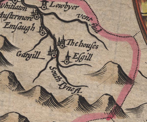 SP11NY74.jpg "South Tyne fl." double line with stream lines  SP11NY66.jpg "South Tyne" double line with stream lines; Northumberland item:- private collection : 16 Image © see bottom of page |
|||
|
|
||||
| evidence:- | poem:- Drayton 1612/1622 text placename:- Southern Tyne |
|||
| source data:- | Poem, Poly Olbion, by Michael Drayton, published by published by
John Marriott, John Grismand and Thomas Dewe, and others?
London, part 1 1612, part 2 1622. goto source goto sourcepage 168:- "... And in her [Cumberland's] praise bee't spoke, this soyle whose best is mine, That Fountaine bringeth forth, from which the Southern Tyne. (So nam'd for that of North, another hath that stile) This to the Easterne Sea, that makes forth many a mile, Her first beginning takes, and Vent, and Alne doth lend, To wait upon her foorth; ..." |
|||
|
|
||||
| evidence:- | old map:- Jansson 1646 |
|||
| source data:- | Map, hand coloured engraving, Cumbria and Westmoria, ie
Cumberland and Westmorland, scale about 3.5 miles to 1 inch, by
John Jansson, Amsterdam, Netherlands, 1646.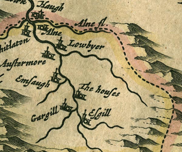 JAN3NY74.jpg  JAN3NY65.jpg  JAN3NY76.jpg Double wiggly line, tapering to single. item:- JandMN : 88 Image © see bottom of page |
|||
|
|
||||
| evidence:- | old map:- Sanson 1679 placename:- South Tyne fl. |
|||
| source data:- | Map, hand coloured engraving, Ancien Royaume de Northumberland
aujourdhuy Provinces de Nort, ie the Ancient Kingdom of
Northumberland or the Northern Provinces, scale about 9.5 miles
to 1 inch, by Nicholas Sanson, Paris, France, 1679. click to enlarge click to enlargeSAN2Cm.jpg "S Tyne fl." tapering wiggly line; river, county boundary item:- Dove Cottage : 2007.38.15 Image © see bottom of page |
|||
|
|
||||
| evidence:- | old map:- Seller 1694 (Cmd) |
|||
| source data:- | Map, uncoloured engraving, Cumberland, scale about 12 miles to 1
inch, by John Seller, 1694. click to enlarge click to enlargeSEL9.jpg tapering wiggly line; river item:- Dove Cottage : 2007.38.89 Image © see bottom of page |
|||
|
|
||||
| evidence:- | old map:- Morden 1695 (Cmd) placename:- South Tyne River |
|||
| source data:- | Map, uncoloured engraving, Cumberland, scale about 4 miles to 1
inch, by Robert Morden, 1695, published by Abel Swale, the
Unicorn, St Paul's Churchyard, Awnsham, and John Churchill, the
Black Swan, Paternoster Row, London, 1695-1715. MD12NY76.jpg "South Tyne River"  MD12NY75.jpg  MD12NY74.jpg 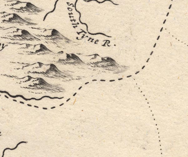 MD12NY73.jpg "South Tyne R." item:- JandMN : 90 Image © see bottom of page |
|||
|
|
||||
| evidence:- | old map:- Simpson 1746 map (Wmd) placename:- South Tyne River |
|||
| source data:- | Map, uncoloured engraving, Westmorland, scale about 8 miles to 1
inch, printed by R Walker, Fleet Lane, London, 1746.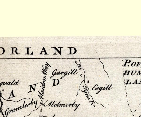 SMP2NYS.jpg "Sth. Tyne R." Wiggly line. item:- Dove Cottage : 2007.38.59 Image © see bottom of page |
|||
|
|
||||
| evidence:- | old map:- Bowen and Kitchin 1760 |
|||
| source data:- | Map, hand coloured engraving, A New Map of the Counties of
Cumberland and Westmoreland Divided into their Respective Wards,
scale about 4 miles to 1 inch, by Emanuel Bowen and Thomas
Kitchin et al, published by T Bowles, Robert Sayer, and John
Bowles, London, 1760. BO18NY74.jpg wiggly line, crosses county boundary Cumberland Northumberland  BO18NY73.jpg "South Tyne" wiggly line item:- Armitt Library : 2008.14.10 Image © see bottom of page |
|||
|
|
||||
| evidence:- | old map:- Donald 1774 (Cmd) placename:- Tyne River |
|||
| source data:- | Map, hand coloured engraving, 3x2 sheets, The County of Cumberland, scale about 1
inch to 1 mile, by Thomas Donald, engraved and published by Joseph Hodskinson, 29
Arundel Street, Strand, London, 1774. D4NY65SE.jpg "Tyne River"  D4NY74NW.jpg "Tyne River"  D4NY74SW.jpg "Tyne River"  D4NY73NE.jpg "Tyne River"  D4NY73SE.jpg "Tyne River" single or double wiggly line; a river item:- Carlisle Library : Map 2 Images © Carlisle Library |
|||
|
|
||||
| evidence:- | old map:- Bailey 1797 placename:- Tyne |
|||
| source data:- | Map, soil etc, uncoloured engraving, Cumberland, scale about 21
miles to 1 inch, by J Bailey, engraved by Neele, Strand,
published by Messrs Robinson, Paternoster Row and G Nicol, Pall
Mall, London, 1797. click to enlarge click to enlargeBY04.jpg "Tyne" river item:- Armitt Library : A680.2 Image © see bottom of page |
|||
|
|
||||
| evidence:- | road book:- Cary 1798 (2nd edn 1802) placename:- South Tyne, River |
|||
| source data:- | Road book, itineraries, Cary's New Itinerary, by John Cary, 181
Strand, London, 2nd edn 1802. goto source click to enlarge click to enlargeC38319.jpg page 319-320 "Cross the South Tyne River." twice item:- JandMN : 228.1 Image © see bottom of page |
|||
|
|
||||
| evidence:- | old map:- Cooke 1802 placename:- Tyne River |
|||
| source data:- | Map, Cumberland, scale about 15.5 miles to 1 inch, by George
Cooke, 1802, bound in Gray's New Book of Roads, 1824, published
by Sherwood, Jones and Co, Paternoster Road, London, 1824. click to enlarge click to enlargeGRA1Cd.jpg "Tyne R." tapering wiggly line; river item:- Hampshire Museums : FA2000.62.2 Image © see bottom of page |
|||
|
|
||||
| evidence:- | old map:- Cooper 1808 placename:- South Tyne River |
|||
| source data:- | Map, uncoloured engraving, Cumberland, scale about 10.5 miles to
1 inch, drawn and engraved by Cooper, published by R Phillips,
Bridge Street, Blackfriars, London, 1808. click to enlarge click to enlargeCOP3.jpg "S Tyne R." tapering wiggly line; river item:- JandMN : 86 Image © see bottom of page |
|||
|
|
||||
| evidence:- | old map:- Wallis 1810 (Cmd) placename:- Tyne River |
|||
| source data:- | Road map, hand coloured engraving, Cumberland, scale about 16
miles to 1 inch, by James Wallis, 77 Berwick Stree, Soho,
London, 1810. click to enlarge click to enlargeWL13.jpg "Tyne R." river item:- Dove Cottage : 2009.81.10 Image © see bottom of page |
|||
|
|
||||
| evidence:- | old map:- Ford 1839 map placename:- South River Tyne |
|||
| source data:- | Map, uncoloured engraving, Map of the Lake District of
Cumberland, Westmoreland and Lancashire, scale about 3.5 miles
to 1 inch, published by Charles Thurnam, Carlisle, and by R
Groombridge, 5 Paternoster Row, London, 3rd edn 1843. FD02NY74.jpg "So. R. Tyne" item:- JandMN : 100.1 Image © see bottom of page |
|||
|
|
||||
| evidence:- | old map:- Garnett 1850s-60s H placename:- South Tyne, River |
|||
| source data:- | Map of the English Lakes, in Cumberland, Westmorland and
Lancashire, scale about 3.5 miles to 1 inch, published by John
Garnett, Windermere, Westmorland, 1850s-60s. GAR2NY65.jpg "Sth. Tyne R." wiggly line, river item:- JandMN : 82.1 Image © see bottom of page |
|||
|
|
||||
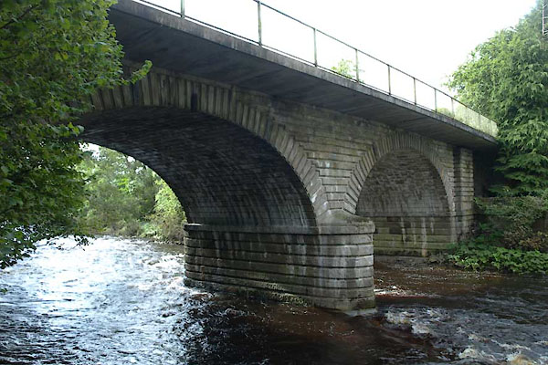
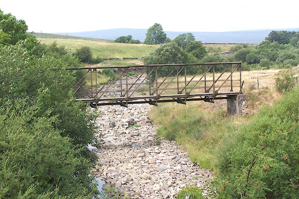
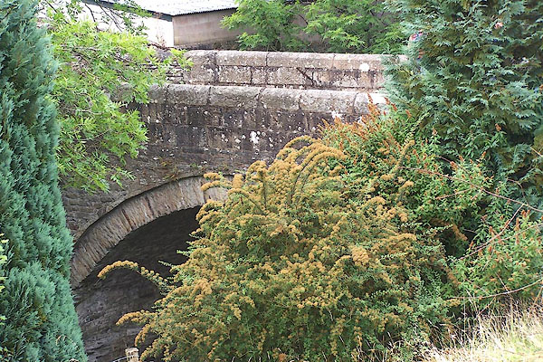
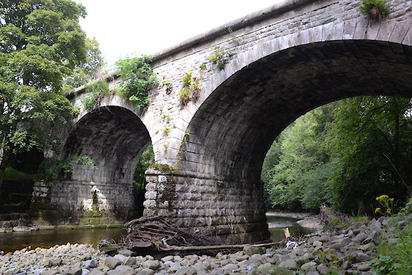
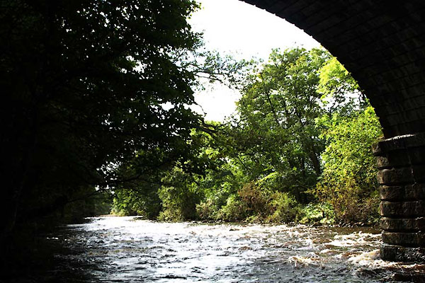 BXK62.jpg At Alston Bridge, (taken 28.9.2012) 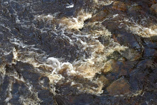 BXK63.jpg At Alston Bridge, (taken 28.9.2012) 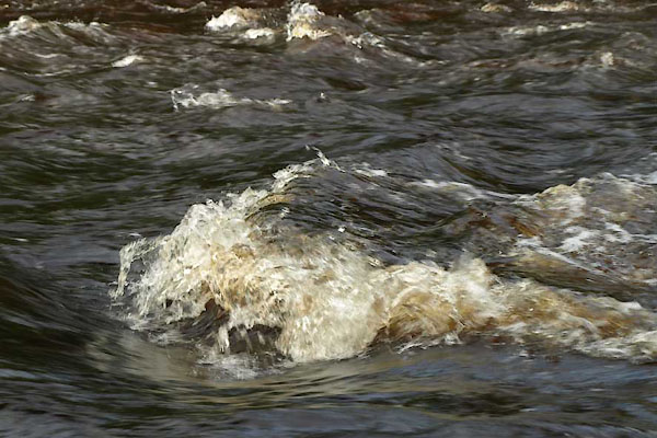 BXK64.jpg At Alston Bridge, (taken 28.9.2012) 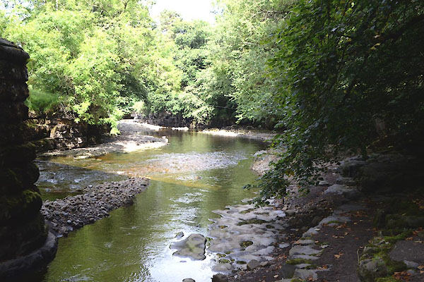 CGL30.jpg At Tyne Viaduct, (taken 1.9.2017) 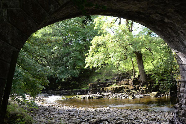 CGL31.jpg At Tyne Viaduct, (taken 1.9.2017) 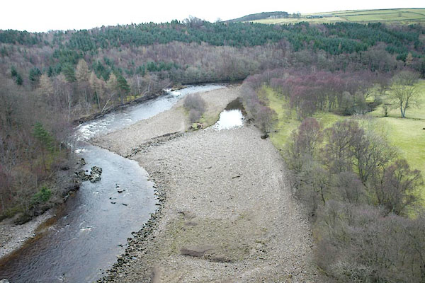 BPY06.jpg Upstream from Lambley Viaduct. (taken 16.1.2009) 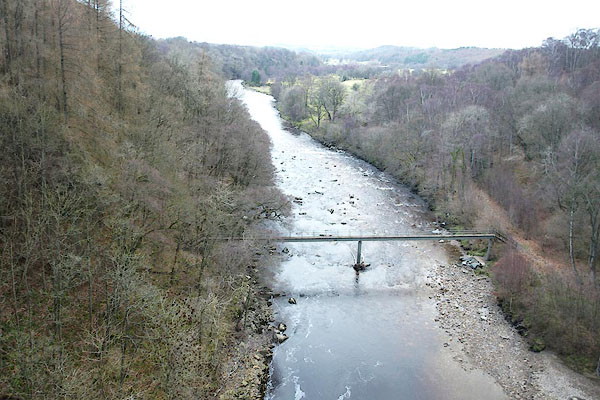 BPY07.jpg Downstream from Lambley Viaduct. (taken 16.1.2009) |
||||
|
|
||||
| places:- |
|
|||
|
||||
|
||||
|
||||
|
||||
|
||||
|
||||
|
||||
|
||||
Lakes Guides menu.