 Old Cumbria Gazetteer
 |
 |
|
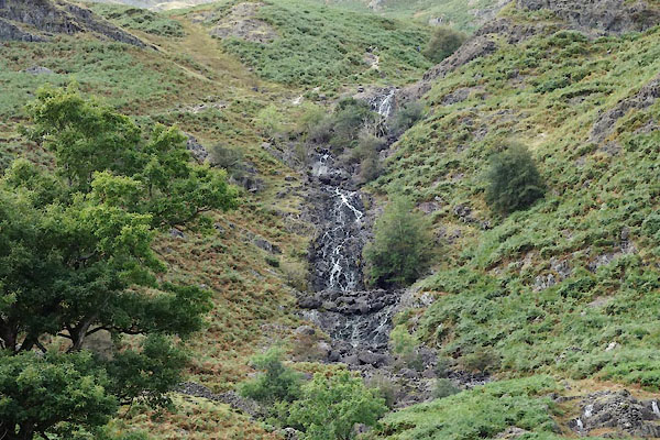
| Sour Milk Gill (3) | ||
| Sour Milk Gill | ||
| Sourmilk Gill | ||
| Churn Milk Force | ||
| site name:- | Easedale Beck | |
| locality:- | Easedale | |
| civil parish:- | Lakes (formerly Westmorland) | |
| county:- | Cumbria | |
| locality type:- | river | |
| locality type:- | waterfall | |
| 1Km square:- | NY3108 (etc) | |
| 10Km square:- | NY30 | |
|
|
||
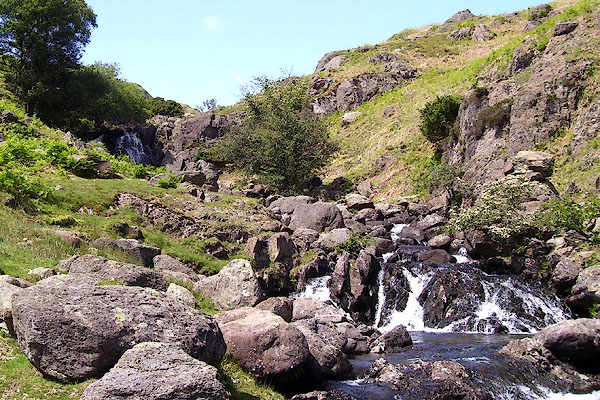 BNR38.jpg (taken 22.5.2007) 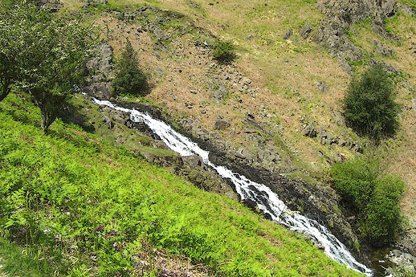 BNR40.jpg (taken 22.5.2007) |
||
|
|
||
| evidence:- | old map:- OS County Series (Wmd 18 16) placename:- Sourmilk Gill |
|
| source data:- | Maps, County Series maps of Great Britain, scales 6 and 25
inches to 1 mile, published by the Ordnance Survey, Southampton,
Hampshire, from about 1863 to 1948. |
|
|
|
||
| evidence:- | possibly old text:- Gents Mag placename:- White Churn Gill |
|
| source data:- | Magazine, The Gentleman's Magazine or Monthly Intelligencer or
Historical Chronicle, published by Edward Cave under the
pseudonym Sylvanus Urban, and by other publishers, London,
monthly from 1731 to 1922. goto source goto sourceGentleman's Magazine 1792 p.882 "..." "July 29. We went up a narrow lane about half a mile from the church, which gave us a new view of Grassmere valley, with a perpetual water-fall, justly, from its force, called White-Churn Gill; it seemed to rush from a crescent-heathed hill, and forms one of the most considerable brooks that supplies Grassmere." "..." |
|
|
|
||
| evidence:- | descriptive text:- Otley 1823 (5th edn 1834) placename:- Sourmilk Gill |
|
| source data:- | Guide book, A Concise Description of the English Lakes, the
mountains in their vicinity, and the roads by which they may be
visited, with remarks on the mineralogy and geology of the
district, by Jonathan Otley, published by the author, Keswick,
Cumberland now Cumbria, by J Richardson, London, and by Arthur
Foster, Kirkby Lonsdale, Cumbria, 1823; published 1823-49,
latterly as the Descriptive Guide to the English Lakes. goto source Page 34:- "... Easdale Tarn, ... Its stream - from its frothy whiteness called Sour-milk Gill - is a striking object from the road. ..." goto sourcePage 46:- "SOUR-MILK GILL is a name applied to some mountain torrents, on account of their frothy whiteness resembling Butter-milk from the churn. We have Sour-milk Gill near Buttermere, Sour-milk Gill in Grasmere, and Sour-milk Gill near the Black-lead Mine in Borrowdale." |
|
|
|
||
| evidence:- | old text:- Martineau 1855 placename:- Sour Milk Ghyll Force |
|
| source data:- | Guide book, A Complete Guide to the English Lakes, by Harriet
Martineau, published by John Garnett, Windermere, Westmorland,
and by Whittaker and Co, London, 1855; published 1855-76. goto source Page 51:- "... the waterfall,- the foaming cataract, which is seen all over the valley, and is called Sour Milk Ghyll Force. ..." |
|
|
|
||
| evidence:- | old text:- Martineau 1855 placename:- Sour Milk Force |
|
| source data:- | Guide book, A Complete Guide to the English Lakes, by Harriet
Martineau, published by John Garnett, Windermere, Westmorland,
and by Whittaker and Co, London, 1855; published 1855-76. goto source Page 180:- "WATERFALLS." "No. : Names and Situations of Falls. : Counties : Feet in Height." "11 : Sour Milk Force : Cumberland : 60" |
|
|
|
||
| evidence:- | old photograph:- Bell 1880s-1940s |
|
| source data:- | Photograph, sepia, Sour Milk Gill on Easedale Beck, Easedale, Westmorland, by Herbert
Bell, Ambleside, Westmorland, 1890s.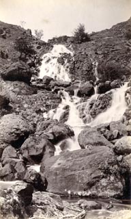 click to enlarge click to enlargeHB0518.jpg internegative at lower right:- "H. Bell" item:- Armitt Library : ALPS181 Image © see bottom of page |
|
|
|
||
 BNR39.jpg (taken 22.5.2007) 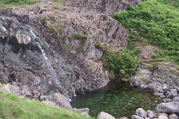 BSX41.jpg After a dry Spring. (taken 27.6.2010) 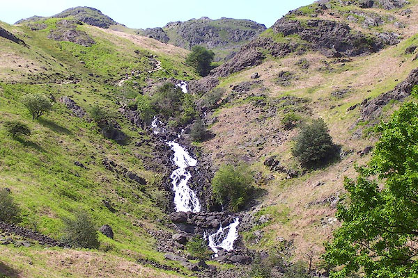 BNR41.jpg (taken 22.5.2007) 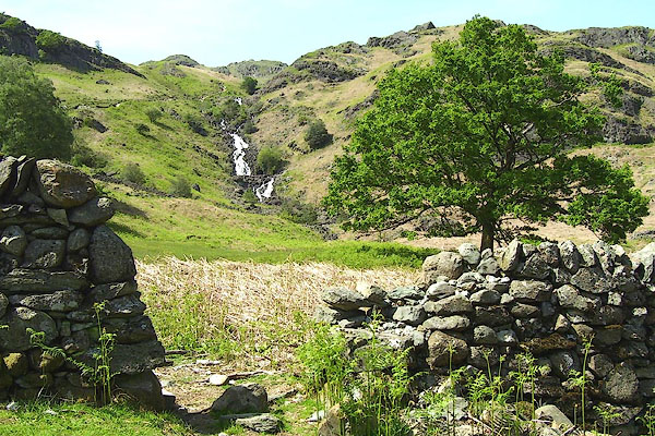 BNR42.jpg (taken 22.5.2007) 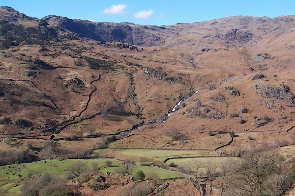 BUF61.jpg (taken 14.3.2011) |
||
|
|
||
| MN photo:- |
In a very dry month. |
|
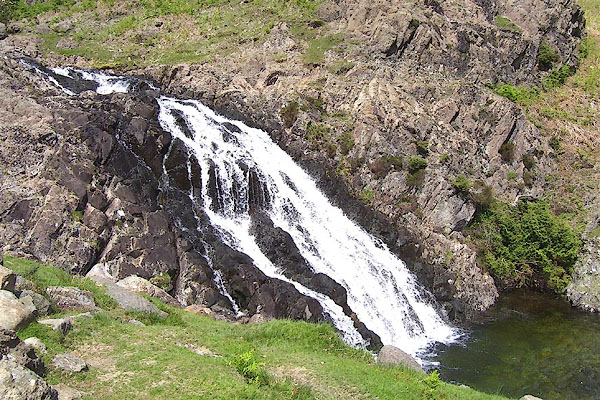
 CBU28.jpg (taken 24.9.2014) 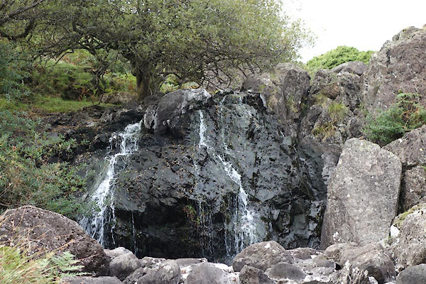 CBU29.jpg (taken 24.9.2014) 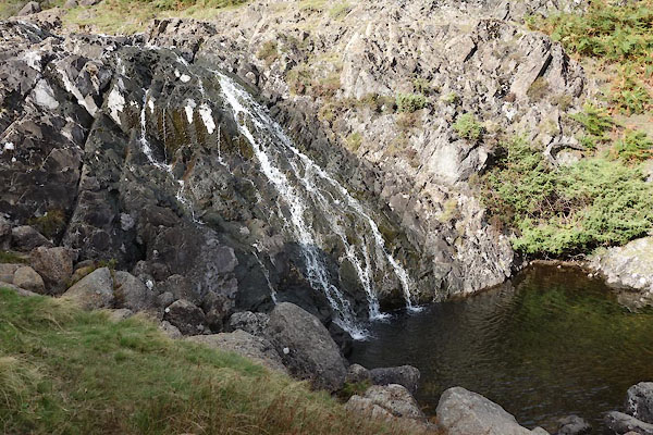 CBU30.jpg (taken 24.9.2014) |
||
|
|
||
Lakes Guides menu.