Old Cumbria Gazetteer
 |
 |
|
||
| Scarness, Bassenthwaite | ||||
| Scarness | ||||
| civil parish:- | Bassenthwaite (formerly Cumberland) | |||
| county:- | Cumbria | |||
| locality type:- | locality | |||
| locality type:- | buildings | |||
| coordinates:- | NY21993056 (etc) | |||
| 1Km square:- | NY2130 | |||
| 10Km square:- | NY23 | |||
|
|
||||
| evidence:- | old map:- OS County Series (Cmd 55 4) placename:- Scarness |
|||
| source data:- | Maps, County Series maps of Great Britain, scales 6 and 25
inches to 1 mile, published by the Ordnance Survey, Southampton,
Hampshire, from about 1863 to 1948. |
|||
|
|
||||
| evidence:- | old map:- Ogilby 1675 (plate 96) placename:- Scarwell |
|||
| source data:- | Road strip map, hand coloured engraving, the Road from Kendal to
Cockermouth, and the Road from Egremond to Carlisle, scale about
1 inch to 1 mile, by John Ogilby, London, 1675.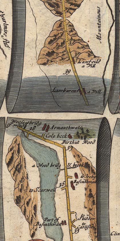 OG96m035.jpg In mile 35, Cumberland. Turning left:- "to Scarwell" item:- JandMN : 22 Image © see bottom of page |
|||
|
|
||||
| evidence:- | old map:- Donald 1774 (Cmd) placename:- Scarness |
|||
| source data:- | Map, hand coloured engraving, 3x2 sheets, The County of Cumberland, scale about 1
inch to 1 mile, by Thomas Donald, engraved and published by Joseph Hodskinson, 29
Arundel Street, Strand, London, 1774.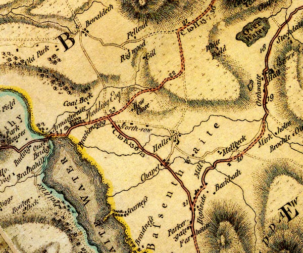 D4NY23SW.jpg "Scarness" block or blocks, labelled in lowercase; a hamlet or just a house item:- Carlisle Library : Map 2 Image © Carlisle Library |
|||
|
|
||||
| evidence:- | descriptive text:- West 1778 (11th edn 1821) placename:- Scareness |
|||
| source data:- | Guide book, A Guide to the Lakes, by Thomas West, published by
William Pennington, Kendal, Cumbria once Westmorland, and in
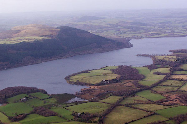
London, 1778 to 1821. goto source goto sourcePage 121:- "... On the eastern shore, the lake [Bassenthwaite] retires behind a peninsula, that rushes far into the water, and on its extreme point, a solitary oak, waving to every wind, is most picturesque. This is Scareness." |
|||
|
|
||||
| evidence:- | old map:- Crosthwaite 1783-94 (Bas) |
|||
| source data:- | Map, uncoloured engraving, An Accurate Map of Broadwater or
Bassenthwaite Lake, scale about 3 inches to 1 mile, by Peter
Crosthwaite, Keswick, Cumberland, 1783, version published 1800.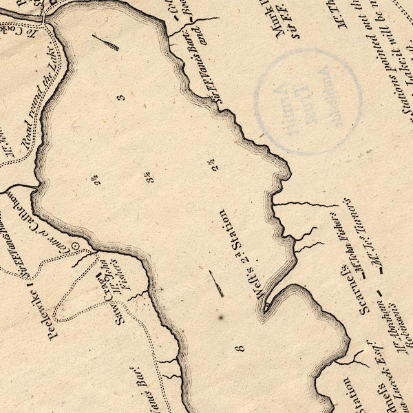 CT6NY23A.jpg "Scarness/Mr. Jos. Turner's" "Scarness/Mr. John Fishers" "Scarness/Mr. Abraham Robinson's" item:- Armitt Library : 1959.191.4 Image © see bottom of page |
|||
|
|
||||
| evidence:- | old map:- West 1784 map placename:- Scareness |
|||
| source data:- | Map, hand coloured engraving, A Map of the Lakes in Cumberland,
Westmorland and Lancashire, scale about 3.5 miles to 1 inch,
engraved by Paas, 53 Holborn, London, about 1784.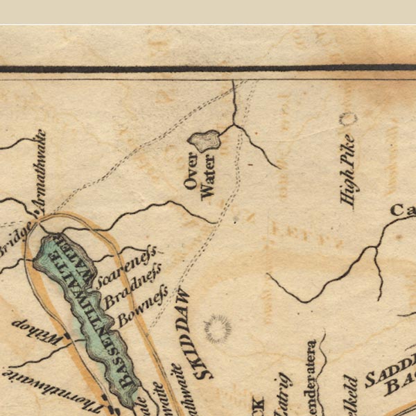 Ws02NY23.jpg item:- Armitt Library : A1221.1 Image © see bottom of page |
|||
|
|
||||
| evidence:- | old text:- Clarke 1787 placename:- Scarnhouse placename:- Scarn House item:- hunting; otter hound; cowherd; scarn; cow dung; placename, Scar Ness |
|||
| source data:- | Guide book, A Survey of the Lakes of Cumberland, Westmorland,
and Lancashire, written and published by James Clarke, Penrith,
Cumberland, and in London etc, 1787; published 1787-93. goto source Page 97:- "..." "A little below this is Scarnhouse, very beautiful promontory, whose end juts into the Lake; on it are two or three good houses, the principle of which belongs to Mr Wane, a gentleman who goes a hunting three times a week in that season, if the weather is favourable, and often on foot; he runs stoutly when the dogs are in full cry, though he is 87 years of age: he is one proof of the salutary air, and healthful diet, of this county; and was remarkable for his breed of otter hounds, one of which being sold to Salisbury found its way home again. ..." goto sourcePage 98:- "..." "We return now to Scarnhouse, by West called Scareness: in the parish register, &c. it is called Scarnhouse, and the inhabitants say it received its name thus: All the ground below the road to the Lake was stinted cow-pasture, and upon this hill the cows were always milked; the owners of them kept a person called a Cowherd, who collected them at this place twice-a-day, for which he had one shilling a head for the year; and in time the cows were taught to come by the sounding of a horn (a custom used in many places in this county to this day.) The herd built himself a little hut where he slept, and at a certain hour every morning and evening blew his horn, at which signal both the milk-maids and cows used to come." "Scarn, in the Cumberland dialect, is cow-dung, and is not applied to any other kind of excrement which is called muck: The cows, coming so much about the herd's house, covered the ground near it with scarn, that the milk-maids could not easily walk among it; hence, out of contempt, they called the house Scarn-House, a name it bears to this day. ..." |
|||
|
|
||||
| evidence:- | old map:- Clarke 1787 map (Bassenthwaite Lake) placename:- Scarnhouse |
|||
| source data:- | Map, A Map of Broadwater and its Environs, ie Bassenthwaite
Lake, scale about 6.5 ins to 1 mile, by James Clarke, engraved
by Neele, 352 Strand, published by James Clarke, Penrith,
Cumberland and in London etc, 1787. CL8NY23F.jpg "Scarnhouse" item:- private collection : 10.8 Image © see bottom of page |
|||
|
|
||||
| evidence:- | old map:- Ford 1839 map placename:- Scarness |
|||
| source data:- | Map, uncoloured engraving, Map of the Lake District of
Cumberland, Westmoreland and Lancashire, scale about 3.5 miles
to 1 inch, published by Charles Thurnam, Carlisle, and by R
Groombridge, 5 Paternoster Row, London, 3rd edn 1843. FD02NY23.jpg "Scarness" item:- JandMN : 100.1 Image © see bottom of page |
|||
|
|
||||
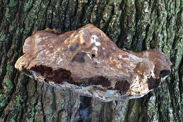 BPV72.jpg Fungus on oak tree by path to St Bega's Church. (taken 17.12.2008) 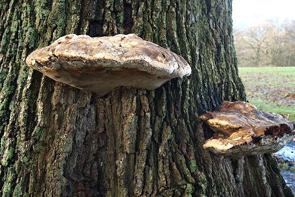 BPV73.jpg Fungus on oak tree by path to St Bega's Church. (taken 17.12.2008) |
||||
|
|
||||
| places:- |
|
|||
|
||||
|
||||
|
||||
|
||||
|
||||
Lakes Guides menu.