 Old Cumbria Gazetteer
 |
 |
|
| Scarness Bay, Bassenthwaite Lake | ||
| Scarness Bay | ||
| site name:- | Bassenthwaite Lake | |
| locality:- | Scarness | |
| civil parish:- | Bassenthwaite (formerly Cumberland) | |
| county:- | Cumbria | |
| locality type:- | bay | |
| coordinates:- | NY21703027 (etc) | |
| 1Km square:- | NY2130 | |
| 10Km square:- | NY23 | |
|
|
||
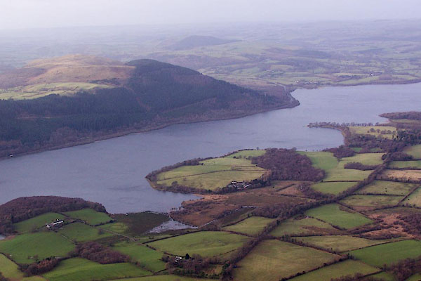 BPW07.jpg From about Ullock Pike. (taken 17.12.2008) |
||
|
|
||
| evidence:- | old map:- OS County Series (Cmd 55 4) placename:- Scarness Bay |
|
| source data:- | Maps, County Series maps of Great Britain, scales 6 and 25
inches to 1 mile, published by the Ordnance Survey, Southampton,
Hampshire, from about 1863 to 1948. |
|
|
|
||
| evidence:- | old map:- Crosthwaite 1783-94 (Bas) |
|
| source data:- | Map, uncoloured engraving, An Accurate Map of Broadwater or
Bassenthwaite Lake, scale about 3 inches to 1 mile, by Peter
Crosthwaite, Keswick, Cumberland, 1783, version published 1800.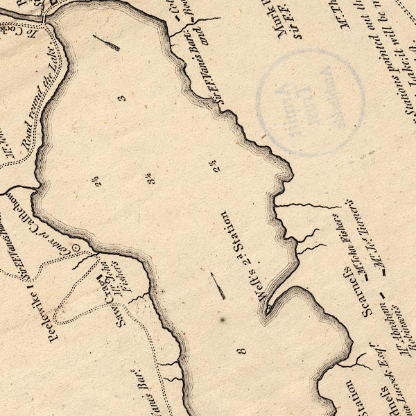 CT6NY23A.jpg item:- Armitt Library : 1959.191.4 Image © see bottom of page |
|
|
|
||
| evidence:- | old map:- Clarke 1787 map (Bassenthwaite Lake) |
|
| source data:- | Map, A Map of Broadwater and its Environs, ie Bassenthwaite
Lake, scale about 6.5 ins to 1 mile, by James Clarke, engraved
by Neele, 352 Strand, published by James Clarke, Penrith,
Cumberland and in London etc, 1787.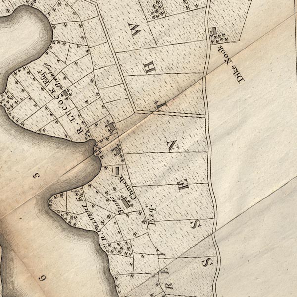 CL8NY22J.jpg item:- private collection : 10.8 Image © see bottom of page |
|
|
|
||
 Lakes Guides menu.