Old Cumbria Gazetteer
 |
 |
|
||
| Mosedale Beck | ||||
| runs into:- |  Glenderamackin, River Glenderamackin, River |
|||
|
|
||||
| locality:- | Mosedale | |||
| civil parish:- | Matterdale (formerly Cumberland) | |||
| civil parish:- | Threlkeld (formerly Cumberland) | |||
| civil parish:- | St John's Castlerigg and Wythburn (formerly Cumberland) | |||
| county:- | Cumbria | |||
| locality type:- | river | |||
| locality type:- | flood | |||
| locality type:- | boundary | |||
| locality type:- | parish boundary | |||
| 1Km square:- | NY3523 (etc) | |||
| 10Km square:- | NY32 | |||
|
|
||||
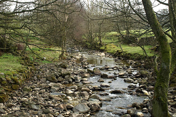
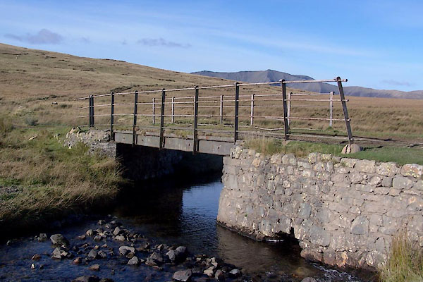
 BOV22.jpg (taken 17.3.2008) 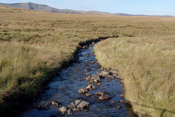 BXP15.jpg (taken 27.10.2012) |
||||
|
|
||||
| evidence:- | old map:- OS County Series (Cmd 65 6) placename:- Mosedale Beck |
|||
| source data:- | Maps, County Series maps of Great Britain, scales 6 and 25
inches to 1 mile, published by the Ordnance Survey, Southampton,
Hampshire, from about 1863 to 1948. OS County Series (Cmd 65 9) |
|||
|
|
||||
| evidence:- | old map:- Saxton 1579 |
|||
| source data:- | Map, hand coloured engraving, Westmorlandiae et Cumberlandiae Comitatus ie Westmorland
and Cumberland, scale about 5 miles to 1 inch, by Christopher Saxton, London, engraved
by Augustinus Ryther, 1576, published 1579-1645.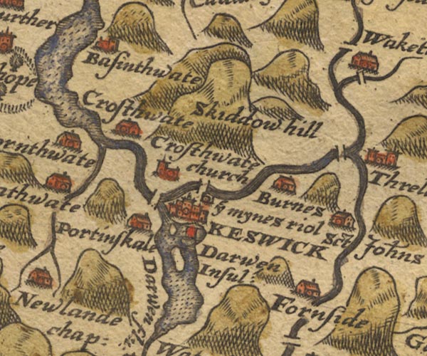 Sax9NY22.jpg item:- private collection : 2 Image © see bottom of page |
|||
|
|
||||
| evidence:- | old map:- Speed 1611 (Cmd) |
|||
| source data:- | Map, hand coloured engraving, Cumberland and the Ancient Citie
Carlile Described, scale about 4 miles to 1 inch, by John Speed,
1610, published by J Sudbury and George Humble, Popes Head
Alley, London, 1611-12.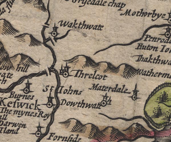 SP11NY32.jpg wiggly line, runs into the Glenderamackin item:- private collection : 16 Image © see bottom of page |
|||
|
|
||||
| evidence:- | old map:- Jansson 1646 |
|||
| source data:- | Map, hand coloured engraving, Cumbria and Westmoria, ie
Cumberland and Westmorland, scale about 3.5 miles to 1 inch, by
John Jansson, Amsterdam, Netherlands, 1646.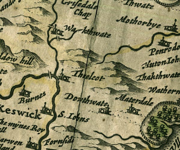 JAN3NY32.jpg Single wiggly line. item:- JandMN : 88 Image © see bottom of page |
|||
|
|
||||
| evidence:- | old map:- Morden 1695 (Cmd) |
|||
| source data:- | Map, uncoloured engraving, Cumberland, scale about 4 miles to 1
inch, by Robert Morden, 1695, published by Abel Swale, the
Unicorn, St Paul's Churchyard, Awnsham, and John Churchill, the
Black Swan, Paternoster Row, London, 1695-1715.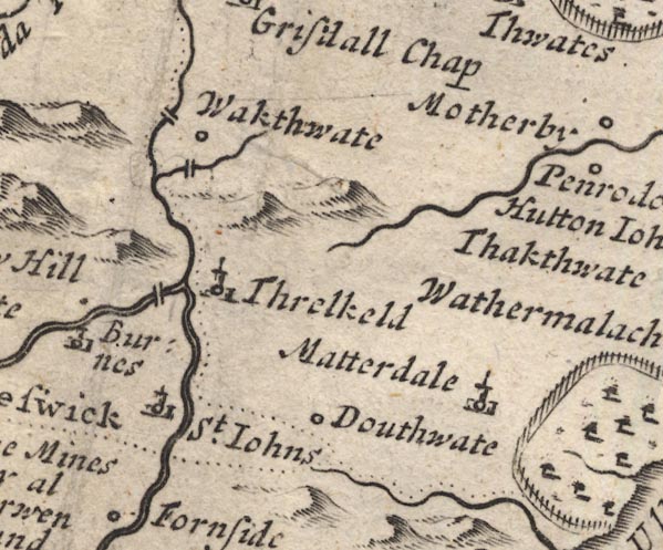 MD12NY32.jpg Running into the Greta south of Wakthwate. item:- JandMN : 90 Image © see bottom of page |
|||
|
|
||||
| evidence:- | old text:- Gents Mag placename:- Mose Beck placename:- Mosedale Beck item:- flood, 1749 |
|||
| source data:- | Magazine, The Gentleman's Magazine or Monthly Intelligencer or
Historical Chronicle, published by Edward Cave under the
pseudonym Sylvanus Urban, and by other publishers, London,
monthly from 1731 to 1922. goto source Gentleman's Magazine 1751 p.200 "... One of the said brooks, called Mose or Mosedale Beck, which rises near the source of the others, but runs North from the other side of Legburthet Fells, continues still foul and muddy, probably from having worked its channel into some mineral substance, which gives it the colour of water gushed from lead mines, and is so strong as to tinge the river Derwent, even at the sea, near twenty miles form their meeting." "..." |
|||
|
|
||||
| evidence:- | old map:- Bowen and Kitchin 1760 |
|||
| source data:- | Map, hand coloured engraving, A New Map of the Counties of
Cumberland and Westmoreland Divided into their Respective Wards,
scale about 4 miles to 1 inch, by Emanuel Bowen and Thomas
Kitchin et al, published by T Bowles, Robert Sayer, and John
Bowles, London, 1760. BO18NY22.jpg wiggly line, into the Glenderamackin item:- Armitt Library : 2008.14.10 Image © see bottom of page |
|||
|
|
||||
| evidence:- | old map:- Donald 1774 (Cmd) |
|||
| source data:- | Map, hand coloured engraving, 3x2 sheets, The County of Cumberland, scale about 1
inch to 1 mile, by Thomas Donald, engraved and published by Joseph Hodskinson, 29
Arundel Street, Strand, London, 1774. D4NY32NE.jpg single or double wiggly line; a river into the Glendermacken item:- Carlisle Library : Map 2 Image © Carlisle Library |
|||
|
|
||||
| evidence:- | perhaps old map:- West 1784 map |
|||
| source data:- | Map, hand coloured engraving, A Map of the Lakes in Cumberland,
Westmorland and Lancashire, scale about 3.5 miles to 1 inch,
engraved by Paas, 53 Holborn, London, about 1784.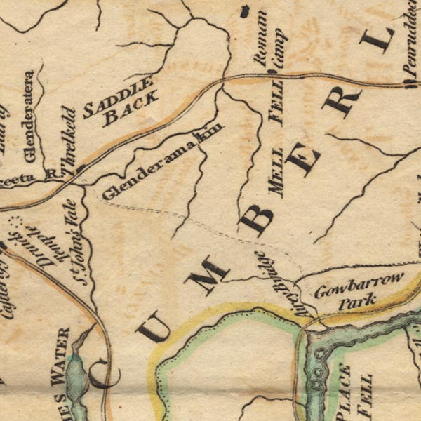 Ws02NY32.jpg item:- Armitt Library : A1221.1 Image © see bottom of page |
|||
|
|
||||
| evidence:- | old text:- Clarke 1787 placename:- Mosedale Beck item:- storm, 1749; rain; flood, 1749 |
|||
| source data:- | Guide book, A Survey of the Lakes of Cumberland, Westmorland,
and Lancashire, written and published by James Clarke, Penrith,
Cumberland, and in London etc, 1787; published 1787-93. goto source Page 56:- "... About 100 yards beyond the eleventh-mile post [from Penrith], ... observe the rivulet called Mosedale-Beck; its source may be pretty plainly traced between the two mountains on the left, the roughest of which is called Wolf-Cragg, and the smoothest Dodd." goto sourcePage 57:- "This rivulet (with another hereafter to be described,) is remarkable for having been the scene of the most dreadful and destructive inundation ever remembered in this country, and of which may awful vestiges may to this hour be traced; this happened on the 22d of August 1749. All the evening of that day, horrid, tumultuous noises were heard in the air; sometimes a puff of wind would blow with great violence, then in a moment all was calm again. The inhabitants, used to bosom-winds, whirlwinds, and the howling of distant tempests among the rocks, went to bed as usual, and from the fatigues of the day were in a sound sleep when the inundation awoke them. About one in the morning the rain began to fall, and before four such a quantity fell as covered the whole face of the country below with a sheet of water many feet deep: several houses were filled with sand to the first storey, many more driven down; ... Several persons were obliged to climb to the tops of the houses, to escape instantaneous death; and there many (particularly those who were either worn out with age, or too weak to attempt remove) were obliged to remain, in a situation of the most dreadful suspense, till the waters abated. Mr Mounsey of Wallthwaite says, that when he came down stairs in the morning, the first sight he saw was a gander belonging to one of his neighbours, and several planks and kitchen-utensils, which were floating about his lower apartments, the violence of the waters having forced open the doors on both sides of the house. The most dreadful vestiges of this inundation, or water-spout, are at a place called Lob-wath, a little above Wallthwaite: ..." "The quantity of water which had fallen here is truly astonishing, more particularly considering the small space it had to collect in. ..." |
|||
|
|
||||
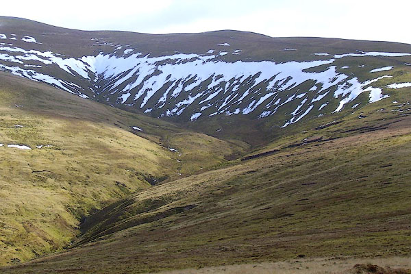
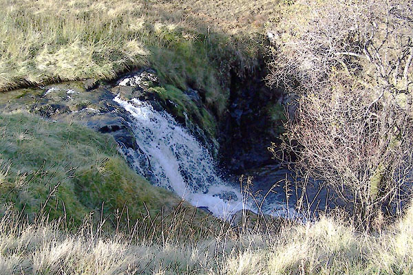 BXP16.jpg Waterfall, (taken 27.10.2012) |
||||
|
|
||||
| places:- |
|
|||
|
||||
|
||||
|
||||
|
||||
Lakes Guides menu.