 Old Cumbria Gazetteer
 |
 |
|
| ford, Wallthwaite | ||
| site name:- | Mosedale Beck | |
| locality:- | Wallthwaite | |
| civil parish:- | Matterdale (formerly Cumberland) | |
| county:- | Cumbria | |
| locality type:- | ford | |
| coordinates:- | NY35322620 (?) | |
| 1Km square:- | NY3526 | |
| 10Km square:- | NY32 | |
|
|
||
| MN photo:- |
It is hard to see where the ford was. |
|
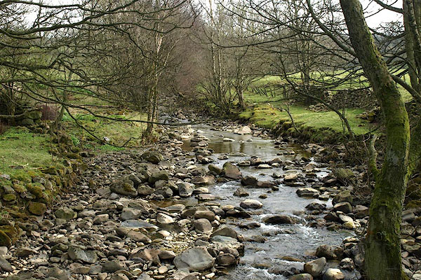 BPC03.jpg (taken 22.4.2008) 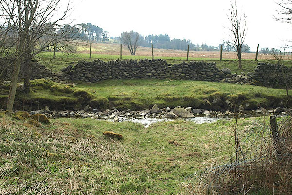 BPC04.jpg (taken 22.4.2008) |
||
|
|
||
| evidence:- | possibly old map:- Saxton 1579 |
|
| source data:- | Map, hand coloured engraving, Westmorlandiae et Cumberlandiae Comitatus ie Westmorland
and Cumberland, scale about 5 miles to 1 inch, by Christopher Saxton, London, engraved
by Augustinus Ryther, 1576, published 1579-1645.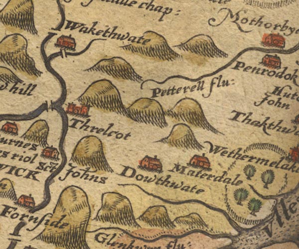 Sax9NY32.jpg South of Wakethate. item:- private collection : 2 Image © see bottom of page |
|
|
|
||
| evidence:- | possibly old map:- Speed 1611 (Cmd) |
|
| source data:- | Map, hand coloured engraving, Cumberland and the Ancient Citie
Carlile Described, scale about 4 miles to 1 inch, by John Speed,
1610, published by J Sudbury and George Humble, Popes Head
Alley, London, 1611-12.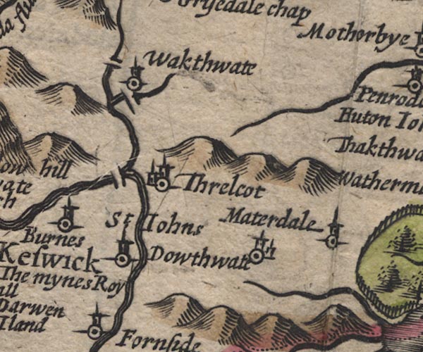 SP11NY32.jpg double line across Mosedale Beck item:- private collection : 16 Image © see bottom of page |
|
|
|
||
| evidence:- | probably old map:- Jansson 1646 |
|
| source data:- | Map, hand coloured engraving, Cumbria and Westmoria, ie
Cumberland and Westmorland, scale about 3.5 miles to 1 inch, by
John Jansson, Amsterdam, Netherlands, 1646.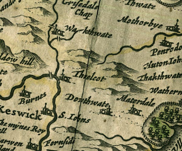 JAN3NY32.jpg Double line crossing the stream. item:- JandMN : 88 Image © see bottom of page |
|
|
|
||
| evidence:- | possibly old map:- Morden 1695 (Cmd) |
|
| source data:- | Map, uncoloured engraving, Cumberland, scale about 4 miles to 1
inch, by Robert Morden, 1695, published by Abel Swale, the
Unicorn, St Paul's Churchyard, Awnsham, and John Churchill, the
Black Swan, Paternoster Row, London, 1695-1715.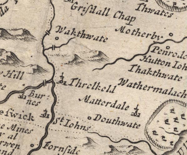 MD12NY32.jpg Double line over the Mosedale Beck, near Wakthwate (Wallthwaite). item:- JandMN : 90 Image © see bottom of page |
|
|
|
||
 Lakes Guides menu.