Old Cumbria Gazetteer
 |
 |
|
||
| Mill Beck (3) | ||||
| runs into:- |  Windermere lake Windermere lake |
|||
|
|
||||
| Mill Beck | ||||
| civil parish:- | Windermere (formerly Westmorland) | |||
| county:- | Cumbria | |||
| locality type:- | river | |||
| 1Km square:- | SD4097 (etc) | |||
| 10Km square:- | SD49 | |||
|
|
||||
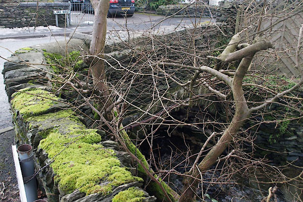
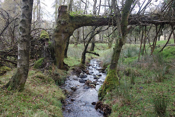 CGR78.jpg Near its head, about (taken 9.10.2017) |
||||
|
|
||||
| evidence:- | old map:- OS County Series (Wmd 32 8) placename:- Mill Beck |
|||
| source data:- | Maps, County Series maps of Great Britain, scales 6 and 25
inches to 1 mile, published by the Ordnance Survey, Southampton,
Hampshire, from about 1863 to 1948. OS County Series (Wmd 32 12) |
|||
|
|
||||
| evidence:- | old map:- Jefferys 1770 (Wmd) |
|||
| source data:- | Map, 4 sheets, The County of Westmoreland, scale 1 inch to 1
mile, surveyed 1768, and engraved and published by Thomas
Jefferys, London, 1770.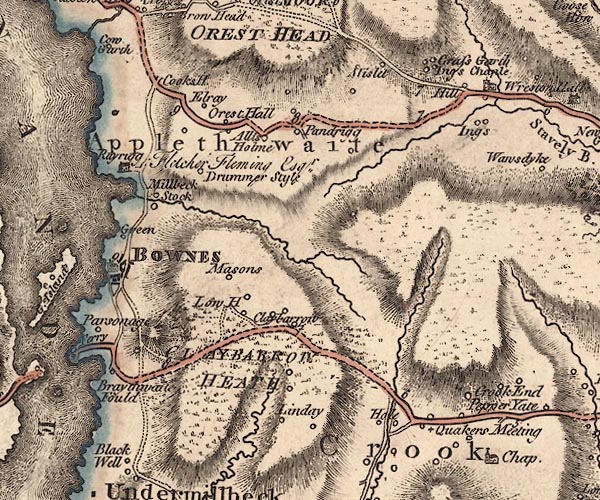 J5SD49NW.jpg single or double wiggly line; river item:- National Library of Scotland : EME.s.47 Image © National Library of Scotland |
|||
|
|
||||
| evidence:- | old map:- Clarke 1787 map (Windermere N) |
|||
| source data:- | Map, A Map of the Northern Part of the Lake Winandermere and its
Environs, scale about 6.5 ins to 1 mile, by James Clarke,
engraved by Samuel John Neele, 352 Strand, published by James
Clarke, Penrith, Cumberland and in London etc, 1787.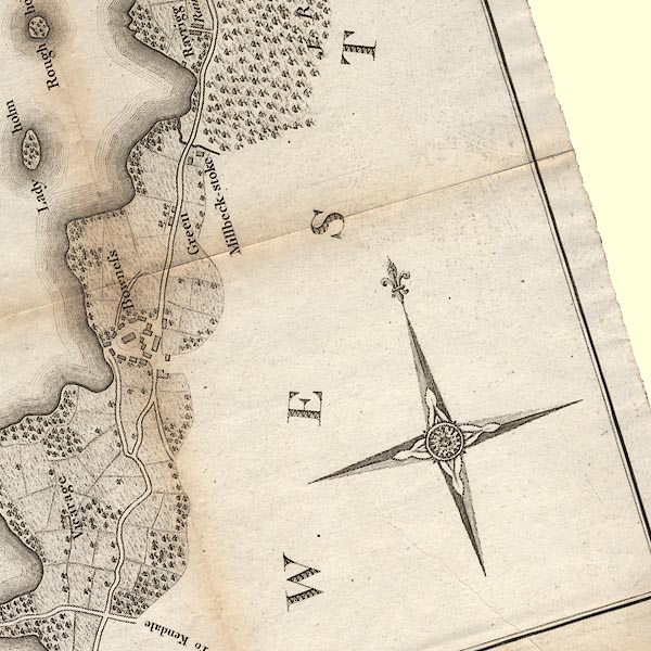 CLASD49D.jpg item:- private collection : 10.10 Image © see bottom of page |
|||
|
|
||||
| evidence:- | old map:- Prior 1874 map 1 |
|||
| source data:- | Map, uncoloured engraving or lithograph? Winander Mere, scale
about 2.5 miles to 1 inch, published by John Garnett,
Windermere, Westmorland, 1874. click to enlarge click to enlargePI03M1.jpg tapering wiggly line item:- private collection : 133.1 Image © see bottom of page |
|||
|
|
||||
| places:- |
|
|||
|
||||
Lakes Guides menu.