 Old Cumbria Gazetteer
 |
 |
|
| Lindal Station, Lindal in Furness | ||
| Lindal Station | ||
| site name:- | Furness Railway | |
| locality:- | Lindal in Furness | |
| civil parish:- | Lindal and Marton (formerly Lancashire) | |
| county:- | Cumbria | |
| locality type:- | railway station | |
| coordinates:- | SD25067542 (?) | |
| 1Km square:- | SD2575 | |
| 10Km square:- | SD27 | |
| SummaryText:- | Opened 1851; closed 1951. | |
|
|
||
| evidence:- | old map:- OS County Series (Lan 16 10) placename:- Lindal Station item:- weighing machine; railway signal; goods shed; railway bridge |
|
| source data:- | Maps, County Series maps of Great Britain, scales 6 and 25
inches to 1 mile, published by the Ordnance Survey, Southampton,
Hampshire, from about 1863 to 1948.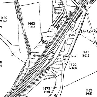 click to enlarge click to enlargeCSRY0146.jpg "Lindal Station / Goods Shed / Coal Yard / W.M. / S.P." |
|
|
|
||
| evidence:- | old map:- OS County Series (Lan 16) placename:- Lindale Station |
|
| source data:- | Maps, County Series maps of Great Britain, scales 6 and 25
inches to 1 mile, published by the Ordnance Survey, Southampton,
Hampshire, from about 1863 to 1948. "Lindale Station" |
|
|
|
||
| evidence:- | old map:- Garnett 1850s-60s H |
|
| source data:- | Map of the English Lakes, in Cumberland, Westmorland and
Lancashire, scale about 3.5 miles to 1 inch, published by John
Garnett, Windermere, Westmorland, 1850s-60s.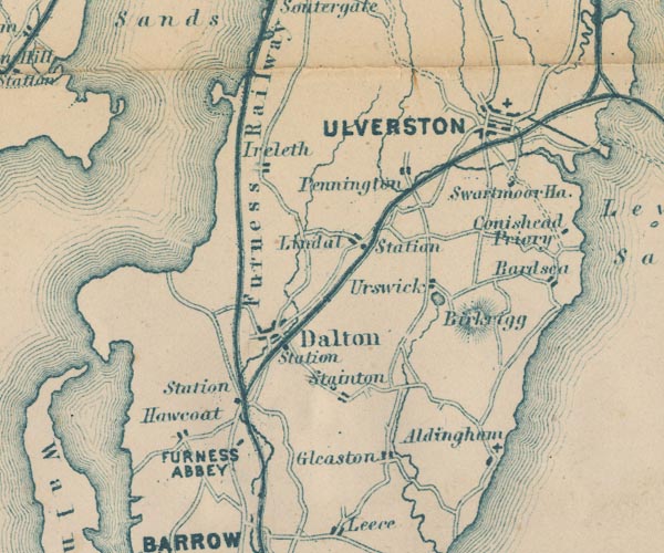 GAR2SD27.jpg "Station" dot by railway item:- JandMN : 82.1 Image © see bottom of page |
|
|
|
||
| evidence:- | old map:- Postlethwaite 1877 (3rd edn 1913) |
|
| source data:- | Map, uncoloured engraving, Map of the Lake District Mining Field, Westmorland, Cumberland,
Lancashire, scale about 5 miles to 1 inch, by John Postlethwaite, published by W H
Moss and Sons, 13 Lowther Street, Whitehaven, Cumberland, 1877 edn 1913.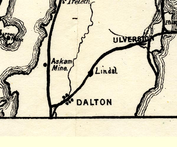 PST2SD27.jpg "Lindal" station on railway item:- JandMN : 162.2 Image © see bottom of page |
|
|
|
||
| hearsay:- |
At the end of the 19th century a locomotive disappeared into a hole 200 foot deep
in the railway sidings and was never seen again. The area is subject to mining subsidence. |
|
|
|
||
 Lakes Guides menu.