 Old Cumbria Gazetteer
 |
 |
|
| Kirkstone Pass, Patterdale | ||
| Kirkstone Pass | ||
| civil parish:- | Patterdale (formerly Westmorland) | |
| civil parish:- | Lakes (formerly Westmorland) | |
| county:- | Cumbria | |
| locality type:- | pass | |
| locality type:- | locality | |
| coordinates:- | NY40150825 (etc) | |
| 1Km square:- | NY4008 | |
| 10Km square:- | NY40 | |
|
|
||
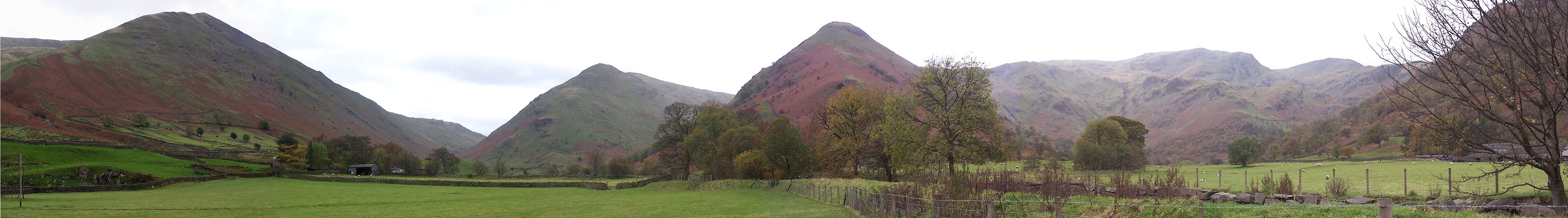
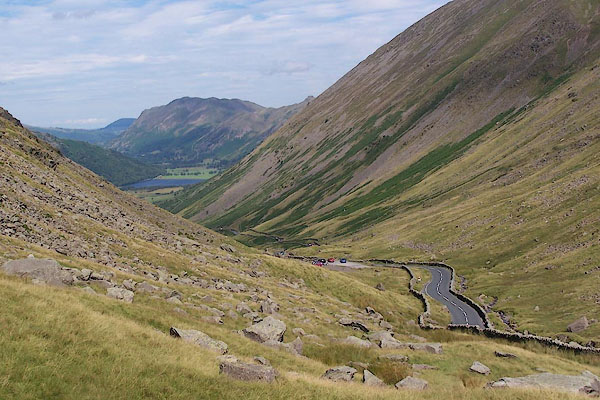 BJS79.jpg Looking down to Brothers Water and Patterdale. (taken 17.8.2005) 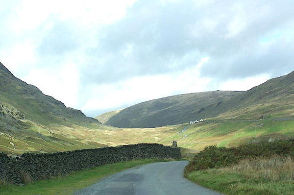 BMR40.jpg From the Struggle. (taken 19.9.2006) |
||
|
|
||
| evidence:- | old map:- OS County Series (Wmd 26 3) placename:- Kirkstone Pass |
|
| source data:- | Maps, County Series maps of Great Britain, scales 6 and 25
inches to 1 mile, published by the Ordnance Survey, Southampton,
Hampshire, from about 1863 to 1948. labelling the route up The Struggle |
|
|
|
||
| evidence:- | descriptive text:- Fiennes 1698 item:- peat; marble (?) |
|
| source data:- | Travel book, manuscript record of Journeys through England
including parts of the Lake District, by Celia Fiennes, 1698. "Thence [Bowness] I rode almost all the waye in sight of this great water [Windermere]; some tymes I lost it by reason of the great hills interposeing and so a continu'd up hill and down hill and that pretty steep even when I was in what they called bottoms, which are very rich good grounds, and so I gained by degrees from lower to higher hills which I allwayes went up and down before I came to another hill; at last I attained to the side of one of these hills or fells of rocks which I passed on the side much about the middle; for looking down to the bottom it was at least a mile all full of those lesser hills and inclosures, so looking upward I was as farre from the top which was all rocks and something more barren tho' there was some trees and woods growing in the rocks and hanging over all down the brow of some of the hills; from these great fells there are severall springs out of the rock that trickle down their sides, and as they meete with stones and rocks in the way when something obstructs their passage and so they come with more violence that gives a pleaseing sound and murmuring noise; these descend by degress, at last fall into the low grounds and fructifye it which makes the land soe fruit full in the valleys; and upon those very high fells or rocky hills its (tho') soe high and yet a moorish sort off ground whence they digg abundance of peat which they use for their fewell, being in many places a barren ground yielding noe wood, etc.; I rode in sight of this Winander Water as I was saying up and down above 7 mile; afterwards as I was ascending another of those barren fells - which tho' I at last was not halfe way up, yet was an hour going it up and down, on the other side going only on the side of it about the middle of it, but it was of such a height as to shew one a great deale of the Country when it happens to be between those hills, else those interposeing hinders any sight but of the clouds - I see a good way behind me another of those waters or mers but not very bigge; these great hills are so full of loose stones and shelves of rocks that its very unsafe to ride them down." "There is good marble amongst those rocks: as I walked down at this place I was walled on both sides by those inaccessible high rocky barren hills which hangs over ones head in some places and appear very terrible; and from them springs many little currents of water from the sides and clefts which trickle down to some lower part where it runs swiftly over the stones and shelves in the way, which makes a pleasant rush and murmuring noise and like a snow ball is encreased by each spring trickling down on either side of those hills, and so descends into the bottoms which are a moorish ground in which in many places the waters stand, and so forme some of those Lakes as it did here, ..." |
|
|
|
||
| evidence:- | old map:- Jefferys 1770 (Wmd) placename:- Kirkstone |
|
| source data:- | Map, 4 sheets, The County of Westmoreland, scale 1 inch to 1
mile, surveyed 1768, and engraved and published by Thomas
Jefferys, London, 1770.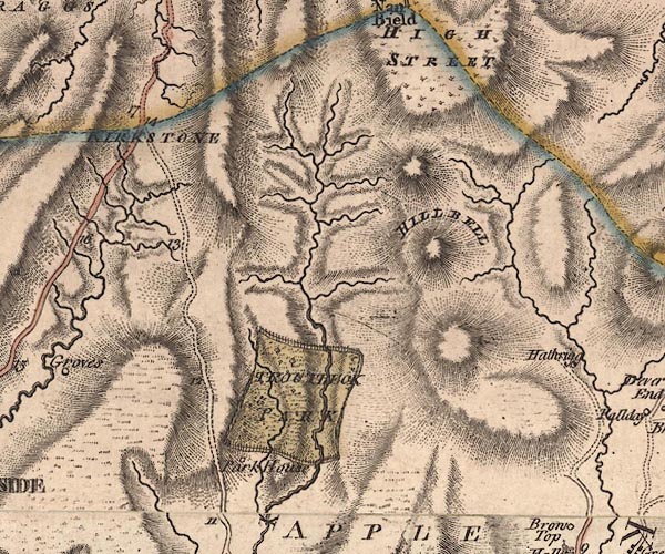 J5NY40NW.jpg "KIRKSTONE" hill hachuring and streams; pass item:- National Library of Scotland : EME.s.47 Image © National Library of Scotland |
|
|
|
||
| evidence:- | descriptive text:- West 1778 (11th edn 1821) placename:- Kirkston |
|
| source data:- | Guide book, A Guide to the Lakes, by Thomas West, published by
William Pennington, Kendal, Cumbria once Westmorland, and in
London, 1778 to 1821. goto source goto sourcePage 148:- "... [invasion of Caledonians] ... the pass at the head of Patterdale, called Kirkston, which is so steep, narrow, and crowded with rocks, that a few veteran troops would easily stop the career of a tumultuous crowd. If they made good the pass, and turned to the east before the Romans arrived, they would, in that case, be harrassed (sic) in the rear, till they arrived at Kendal, where the watchmen from Watercrook would be ready to receive them," goto sourcePage 149:- "and then they would be attacked in front and rear. That the Romans have had engagements at Kirkston-pass is evident, from the Roman arms that were lately found in the adjoining moss, and the many heaps of stones collected thereabouts, which have the appearance of barrows." "These are the only passes amongst the mountains, that a body of Caledonians could attempt in their way to the south, ..." |
|
|
|
||
| evidence:- | old map:- West 1784 map placename:- Kirkstone |
|
| source data:- | Map, hand coloured engraving, A Map of the Lakes in Cumberland,
Westmorland and Lancashire, scale about 3.5 miles to 1 inch,
engraved by Paas, 53 Holborn, London, about 1784.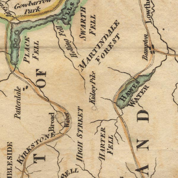 Ws02NY41.jpg 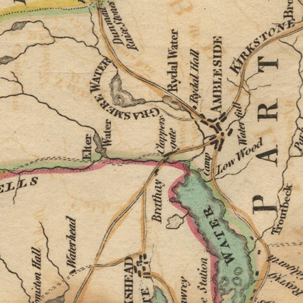 Ws02NY30.jpg "KIRKSTONE" item:- Armitt Library : A1221.1 Image © see bottom of page |
|
|
|
||
| evidence:- | old map:- Cary 1789 (edn 1805) placename:- Kirkstone |
|
| source data:- | Map, uncoloured engraving, Westmoreland, scale about 2.5 miles
to 1 inch, by John Cary, London, 1789; edition 1805.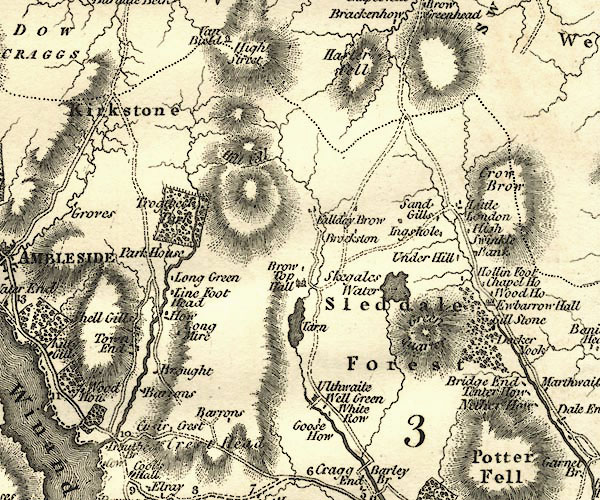 CY24NY40.jpg "Kirkstone" area item:- JandMN : 129 Image © see bottom of page |
|
|
|
||
| evidence:- | old map:- Laurie and Whittle 1806 placename:- Kirkstone |
|
| source data:- | Road map, Completion of the Roads to the Lakes, scale about 10
miles to 1 inch, by Nathaniel Coltman? 1806, published by Robert
H Laurie, 53 Fleet Street, London, 1834. click to enlarge click to enlargeLw18.jpg "Kirkstone" place item:- private collection : 18.18 Image © see bottom of page |
|
|
|
||
| evidence:- | old text:- Green 1810 placename:- Kirkstone item:- placename, Kirkstone |
|
| source data:- | Set of prints, soft ground etchings, Sixty Studies from Nature,
by William Green, Ambleside, Westmorland, drawn 1808-10,
published 1810. goto source page 111:- "..." "The road to Ulls Water, from Ambleside, is wild and mountainous; the ascent from Ambleside is steep, with little variation, to the top of Kirkstone. This place takes its name from a sort of cubical stone on the left, called Kirkstone; ..." |
|
|
|
||
| evidence:- | old print:- Wilkinson 1810 (plate 46) placename:- Kirkstone item:- bridge |
|
| source data:- | Print, uncoloured soft ground etching, View on Kirkstone, between Ambleside and Patterdale,
Westmorland, by Joseph Wilkinson, engraved by William Frederick Wells, published by
R Ackermann, Repository of Arts, 101 Strand, London, 1810.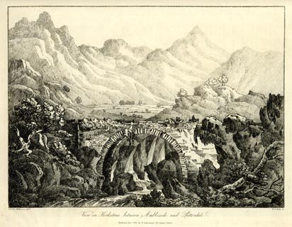 click to enlarge click to enlargeWKN146.jpg Plate 46 in Select Views in Cumberland, Westmoreland, and Lancashire. printed at bottom left, right, centre:- "Revd. Jos: Wilkenson delt. / W. F. Wells Sc. / View on Kirkstone, between Ambleside and Patterdale. / Published Dec. 1. 1810. by R. Ackermann. 101. Strand. London." item:- Fell and Rock Climbing Club : MN4.46 Image © see bottom of page |
|
|
|
||
| evidence:- | old text:- Wordsworth 1810 |
|
| source data:- | Guide book, A Description of the Scenery of the Lakes, later A
Guide through the District of The Lakes, by William Wordsworth,
1810-35. goto source page 132 "..." "Reached home a little before midnight. The following verses (from the Author's Miscellaneous Poems,) after what has just been read may be acceptable to the reader, by way of conclusion to this little Volume." "ODE." "THE PASS OF KIRKSTONE." "1." "WITHIN the mind strong fancies work, A deep delight the bosom thrills, Oft as I pass along the fork Of these fraternal hills: Where, save the rugged road, we find No appanage of human kind; Nor hint of man, if stone or rock Seem not his handy-work to mock By something cognizably shaped; Mockery - or model roughly hewn, And left as if by earthquake strewn, Or from the Flood escaped: Altars for Druid service fit;" goto sourcepage 133 "(But where no fire was ever lit, Unless the glow-worm to the skies Thence offer nightly sacrifice;) Wrinkled Egyptian monument; Green moss-grown tower; or hoary tent; Tents of a camp that never shall be raised; On which four thousand years have gazed!" "2." "Ye plough-shares sparkling on the slopes! Ye snow-white lambs that trip Imprisoned 'mid the formal props Of restless ownership! Ye trees, that may to-morrow fall To feed the insatiate Prodigal! Lawns, houses, chattels, groves, and fields, All that the fertile valley shields; Wages of folly - baits of crime, - Of life's uneasy game the stake, Playthings that keep the eyes awake Of drowsy, dotard Time; O care! O guilt! - O vales and plains, Here 'mid his own unvexed domains, A Genius dwells, that can subdue At once all memory of You, - Most potent when mists veil the sky, Mists that distort and magnify; While the course rushes, to the sweeping breeze, Sigh forth their ancient melodies!" "3." "List to those shriller notes! - that march Perchance was on the blast, When through this Height's inverted arch, Rome's earliest legion passed! - They saw, adventurously impelled, And older eyes than theirs beheld, This block - and yon, whose Church-like frame Gives to the savage Pass its name." goto sourcepage 134 "Aspiring Road! that lov'st to hide Thy daring in a vapoury bourn, Not seldom may the hour return When thou shalt be my Guide; And I (as often we find cause, When life is at a weary pause, And we have panted up the hill Of duty with reluctant will) Be thankful, even though tired and faint, For the rich bounties of Constraint; Whence oft invigorating transports flow That Choice lacked courage to bestow!" "4." "My Soul was grateful for delight That wore a threatening brow; A veil is lifted - can she slight The scene that opens now? Though habitation none appear, The greenness tells, man must be there; The shelter - that the perspective Is of the clime in which we live; Where Toil pursues his daily round; Where Pity sheds sweet tears, and Love, In woodbine bower or birchen grove, Inflicts his tender wound. - Who comes not hither ne'er shall know How beautiful the world below; Nor can he guess how lightly leaps The brook adown the rocky steeps. Farewell, thou desolate Domain! Hope, pointing to the cultured Plain, Carols like a shepherd boy; And who is she? - Can that be Joy! Who, with a sun-beam for her guide, Smoothly skims the meadow wide; While Faith, from yonder opening cloud, To hill and vale proclaims aloud, "Whate'er the weak may dread, the wicked dare, Thy lot, O man, is good, thy portion fair!"" |
|
|
|
||
| evidence:- | old text:- Wordsworth 1810 placename:- Kirkstone |
|
| source data:- | Guide book, A Description of the Scenery of the Lakes, later A
Guide through the District of The Lakes, by William Wordsworth,
1810-35. goto source page 120 "[7.11.1805] ... The mists gathered as we went along: but, when we reached the top of Kirkstone, we were glad we had not been discouraged by the apprehension of bad weather. Though not able to see a hundred yards before us, we were more than contented. At such a time, and in such a place, every scattered stone the size of one's head becomes a companion. Near the top of the Pass is the remnant of an old wall, which (magnified, though obscured, by the vapour) might have been taken for a fragment of some monument of ancient grandeur, - yet that same pile of stones we had never before even observed. This situation, it must be allowed, is not favourable to gaiety; but a pleasing hurry of spirits accompanies the surprise occasioned by objects transformed, dilated, or distorted, as they are when seen through such a medium. Many of the fragments of rock on" goto sourcepage 121 "the top and slopes of Kirkstone, and of similar places, are fantastic enough in themselves; but the full effect of such impressions can only be had in a state of weather when they are not likely to be sought for. ..." |
|
|
|
||
| evidence:- | old map:- Otley 1818 placename:- Kirkstone |
|
| source data:- | Map, uncoloured engraving, The District of the Lakes,
Cumberland, Westmorland, and Lancashire, scale about 4 miles to
1 inch, by Jonathan Otley, 1818, engraved by J and G Menzies,
Edinburgh, Scotland, published by Jonathan Otley, Keswick,
Cumberland, et al, 1833.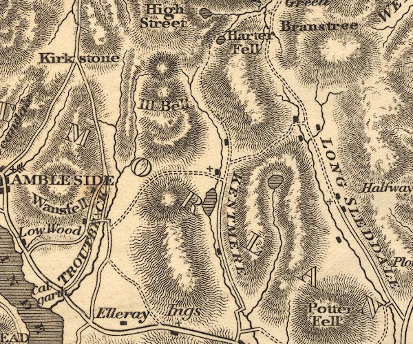 OT02NY40.jpg item:- JandMN : 48.1 Image © see bottom of page |
|
|
|
||
| evidence:- | old print:- Fielding and Walton 1821 (plate 47) |
|
| source data:- | Print, coloured aquatint, Broader Water, ie Brothers Water, Patterdale, Westmorland,
drawn by John Walton, published by R Ackermann, 101 Strand, London, 1821.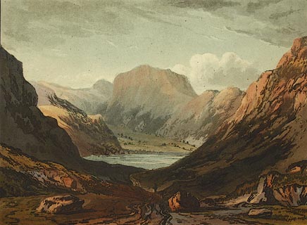 click to enlarge click to enlargeFW0147.jpg Viewed from Kirkstone Pass. Tipped in opposite p.280 in A Picturesque Tour of the English Lakes. item:- Dove Cottage : 1993.R566.47 Image © see bottom of page |
|
|
|
||
| evidence:- | old print:- Fielding and Walton 1821 (plate 49) placename:- Kirkstone Pass |
|
| source data:- | Print, coloured aquatint, Kirkstone Pass, Patterdale, Westmorland, drawn by Theodore
H A Fielding, published by R Ackermann, 101 Strand, London, 1821.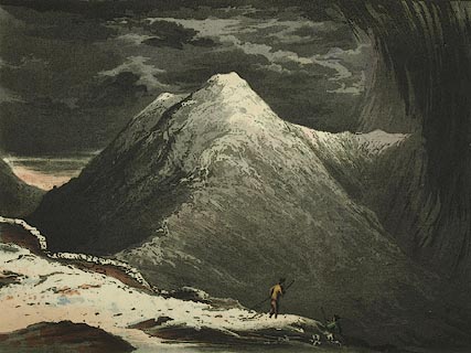 click to enlarge click to enlargeFW0149.jpg What are the ?shepherds doing clambering on the steep roadside? Tipped in opposite p.284 in A Picturesque Tour of the English Lakes. item:- Dove Cottage : 1993.R566.49 Image © see bottom of page |
|
|
|
||
| evidence:- | outline view:- Otley 1823 (4th edn 1830) placename:- Kirkstone Pass |
|
| source data:- | Print, engraving, outline view, Mountains of Patterdale as seen from the Slate Quarry
on Place Fell, published by Jonathan Otley, Keswick, Cumberland et al, 1830.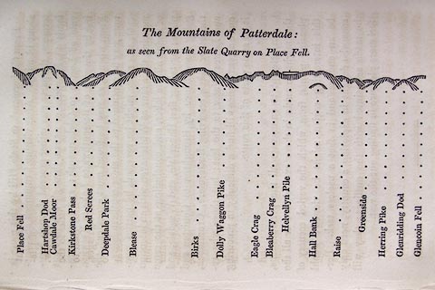 click to enlarge click to enlargeO75E10.jpg p.137 in A Concise Description of the English Lakes, by Jonathan Otley, 4th edition, 1830. "The Mountains of Patterdale: / as seen from the Slate Quarry on Place Fell." "Place Fell / Hartshop Dod / Cawdale Moor / Kirkstone Pass / Red Screes / Deepdale Park / Blease / Birks / Dolly Waggon Pike / Eagle Crag / Bleaberry Pike / Helvellyn Pile / Hall Bank / Raise / Greenside / Herring Pike / Glenridding Dod / Glencoin Fell" item:- Armitt Library : A1175.10 Image © see bottom of page |
|
|
|
||
| evidence:- | outline view:- Otley 1823 (5th edn 1834) |
|
| source data:- | Print, woodcut outline view, The Mountains of Patterdale, by
Jonathan Otley, Keswick, Cumberland, 1830.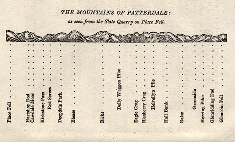 click to enlarge click to enlargeOT2E02.jpg Printed on p.11 of A Concise Description of the English Lakes, by Jonathan Otley, 5th edition, 1834. "THE MOUNTAINS OF PATTERDALE: as seen from the Slate Quarry on Place Fell." "Place Fell / Hartsop Dod / Cawdale Moor / Kirkstone Pass / Red Screes / Deepdale Park / Blease / Birks / Dolly Waggon Pike / Eagle Crag / Bleaberry Crag / Helvellyn Pile / Hall Bank / Raise / Greenside / Herring Pike / Glenridding Dod / Glencoin Fell" item:- JandMN : 48.3 Image © see bottom of page |
|
|
|
||
| evidence:- | descriptive text:- Otley 1823 (5th edn 1834) |
|
| source data:- | Print, woodcut outline view, The Mountains of Patterdale, by
Jonathan Otley, Keswick, Cumberland, 1830. goto source "This is a very steep carriage road, rising 1300 feet above Ambleside, and falling 900 feet on the other side. This hill has taken its name of Kirkstone from a detached mass of rock, standing at a" goto sourcePage 107:- "little distance from the road, and bearing some resemblance to the form of a house. ..." item:- JandMN : 48.3 Image © see bottom of page |
|
|
|
||
| evidence:- | old drawing:- Aspland 1840s-60s |
|
| source data:- | Drawing, pencil, Kirkstone Pass and Brothers Water, Patterdale, Westmorland, by Theophilus
Lindsey Aspland, 29 August 1845.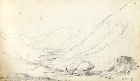 click to enlarge click to enlargeAS0213.jpg "Brothers Water / Aug 29 1845" page number "10" item:- Armitt Library : 1958.488.13 Image © see bottom of page |
|
|
|
||
| evidence:- | old drawing:- Aspland 1840s-60s |
|
| source data:- | Drawing, pencil, view south from Kirkstone Pass, Westmorland, by Theophilus Lindsey
Aspland, 30 August 1852.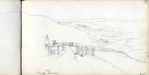 click to enlarge click to enlargeAS0330.jpg "Aug 30. from Kirkstone" page number "23" item:- Armitt Library : 1958.390.30 Image © see bottom of page |
|
|
|
||
| evidence:- | old drawing:- Aspland 1840s-60s |
|
| source data:- | Drawing, pencil? and ink wash, Kirkstone Pass, Patterdale, Westmorland, by Theophilus
Lindsey Aspland, 1852.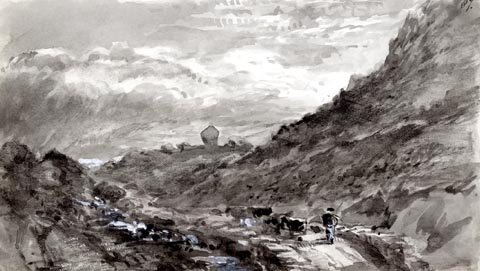 click to enlarge click to enlargeAS0331.jpg "87." item:- Armitt Library : 1958.390.31 Image © see bottom of page |
|
|
|
||
| evidence:- | old map:- Garnett 1850s-60s H placename:- Kirkstone Pass |
|
| source data:- | Map of the English Lakes, in Cumberland, Westmorland and
Lancashire, scale about 3.5 miles to 1 inch, published by John
Garnett, Windermere, Westmorland, 1850s-60s. GAR2NY30.jpg "Kirkstone Pass" pass, partly indicated by hachuires, and roads item:- JandMN : 82.1 Image © see bottom of page |
|
|
|
||
| evidence:- | old text:- Martineau 1855 placename:- Kirkstone item:- altitude, Kirkstone Pass |
|
| source data:- | Guide book, A Complete Guide to the English Lakes, by Harriet
Martineau, published by John Garnett, Windermere, Westmorland,
and by Whittaker and Co, London, 1855; published 1855-76. goto source Page 179:- "PASSES." ": : Height above the Level of the Sea" "Kirkstone : Westmorland : 1200" |
|
|
|
||
| evidence:- | old print:- Payn 1867 placename:- Kirkstone Pass item:- cart |
|
| source data:- | Print, uncoloured engraving, Kirkstone Pass and Brothers' Water, Patterdale, Westmorland,
by T L Aspland, published by J Garnett, Windermere, Westmorland, 1867.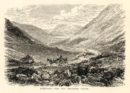 click to enlarge click to enlargePN0329.jpg On p.60 of The Lakes in Sunshine, text by James Payn. printed at bottom:- "KIRKSTONE PASS AND BROTHERS' WATER." item:- Fell and Rock Climbing Club : 184.29 Image © see bottom of page |
|
|
|
||
| evidence:- | old photograph:- Bell 1880s-1940s |
|
| source data:- | Photograph, black and white, Kirkstone Pass, Patterdale, Westmorland, by Herbert Bell,
photographer, Ambleside, Westmorland, 1890s.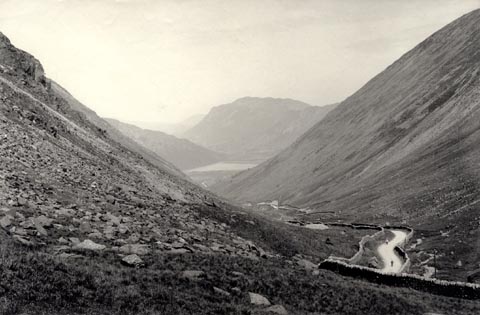 click to enlarge click to enlargeHB0927.jpg item:- Armitt Library : ALPS604 Image © see bottom of page |
|
|
|
||
| evidence:- | old photograph:- Bell 1880s-1940s |
|
| source data:- | Photograph, black and white, Kirkstone Pass, Patterdale, Westmorland, by Herbert Bell,
photographer, Ambleside, Westmorland, 1890s.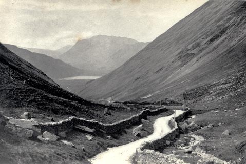 click to enlarge click to enlargeHB0625.jpg stamped on reverse:- "HERBERT BELL / Photographer / AMBLESIDE" item:- Armitt Library : ALPS286 Image © see bottom of page |
|
|
|
||
| evidence:- | old photograph:- Bell 1880s-1940s |
|
| source data:- | Photograph, the Kaiser touring in Kirkstone Pass, Patterdale, by Herbert Bell, Ambleside,
Westmorland, 1900s?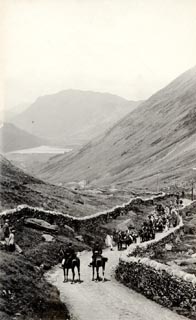 click to enlarge click to enlargeHB0247.jpg item:- Armitt Library : ALPS289 Image © see bottom of page |
|
|
|
||
| evidence:- | old print:- Bradley 1901 placename:- Kirkstone Pass |
|
| source data:- | Print, uncoloured lithograph, Brotherwater and Kirkstone Pass, Patterdale, Westmorland,
by Joseph Pennell, published by Macmillan and Co, London, 1901.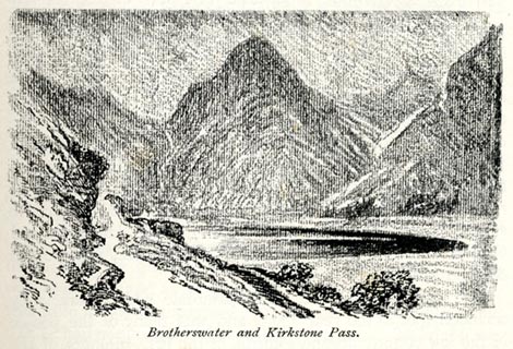 click to enlarge click to enlargeBRL110.jpg On page 51 of Highways and Byways in the Lake District, by A G Bradley. printed at bottom:- "Brotherwater and Kirkstone Pass." item:- JandMN : 464.10 Image © see bottom of page |
|
|
|
||
| evidence:- | old print:- Heaton Cooper 1905 (edn 1908) placename:- Kirkstone Pass |
|
| source data:- | Print, colour halftone, Kirkstone Pass and Brothers' Water, Patterdale, Westmorland,
from a watercolour painting by Alfred Heaton Cooper, published by Adam and Charles
Black, London, 2nd edn 1908.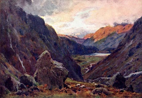 click to enlarge click to enlargeHC0171.jpg The rock does not look like the Kirk Stone. Opposite p.214 of The English Lakes, painted by Alfred Heaton Cooper, described by William T Palmer. printed at tissue opposite the print:- "KIRKSTONE PASS AND BROTHERS' WATER" printed at signed lower right:- "[A HEATON COOPER]" item:- JandMN : 468.71 Image © see bottom of page |
|
|
|
||
| evidence:- | old photograph:- Photochrom 1930s placename:- Kirkstone Pass |
|
| source data:- | Photograph, black and white halftone print, Kirkstone Pass and Brothers Water, Patterdale,
Westmorland, published by Photochrom Co, Tunbridge Wells, Kent, 1930s?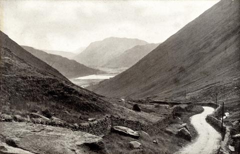 click to enlarge click to enlargePCH115.jpg printed, "Kirkstone Pass and Brothers / Water. / "He surely is an arrant ass / Who pays to drive up Kirkstone Pass; / You'll find in spite of all their talking, / You've got to walk and pay for walking." / ..." item:- JandMN : 1015.15 Image © see bottom of page |
|
|
|
||
| evidence:- | old print:- Robertson 1911 placename:- Kirkstone Pass |
|
| source data:- | Print, lithograph? Kirkstone Pass, from a watercolour by Arthur Tucker, published
by Chatto and Windus, London, 1911.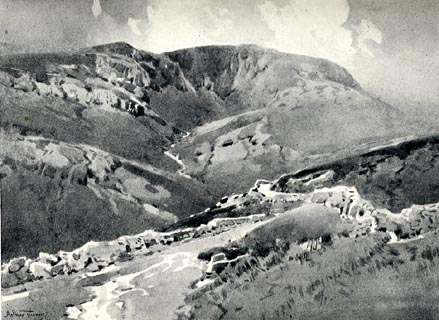 click to enlarge click to enlargeRSN137.jpg Tipped in opposite p.248 of Wordsworthshire by Eric Robertson. printed at bottom:- "KIRKSTONE PASS / (Between Windermere and Ullswater)" signed at painting lower left:- "Arthur Tucker" item:- JandMN : 197.41 Image © see bottom of page |
|
|
|
||
| evidence:- | old print:- Pearson 1900s placename:- Kirkstone Pass |
|
| source data:- | Print, halftone photograph, Brothers Water, from the Kirkstone Pass, Westmorland,
published by C Arthur Pearson, Henrietta Street, London, 1900s.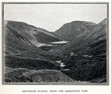 click to enlarge click to enlargePS1E32.jpg On p.85 of Pearson's Gossipy Guide to the English Lakes and Neighbouring Districts. printed at bottom:- "BROTHERS WATER, FROM THE KIRKSTONE PASS." item:- Armitt Library : A1188.39 Image © see bottom of page |
|
|
|
||
| evidence:- | old print:- Gresham Publishing 1900s placename:- Kirkstone Pass |
|
| source data:- | Print, colour halftone, Kirkstone Pass and Brothers Water, Westmorland, by Ernest
W Haslehurst, published by The Gresham Publishing Co, 66 Chandos Street, London, 1900s?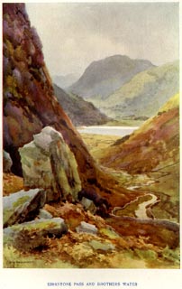 click to enlarge click to enlargePR1564.jpg Tipped in opposite p.26 of The English Lakes section of a volume of Our Beautiful Homeland. printed at bottom:- "KIRKSTONE PASS AND BROTHERS WATER" printed at lower left:- "E. W. HASLEHURST" item:- JandMN : 381.6 Image © see bottom of page |
|
|
|
||
| evidence:- | old print:- Bogg 1898 item:- stage coach; horse |
|
| source data:- | Print, engraving, A Mountain Road, Kirkstone, Patterdale, Westmorland, by Gilbert
Foster, published by Edmund Bogg, 3 Woodhouse Lane, and James Miles, Guildford Street,
Leeds, Yorkshire, 1898.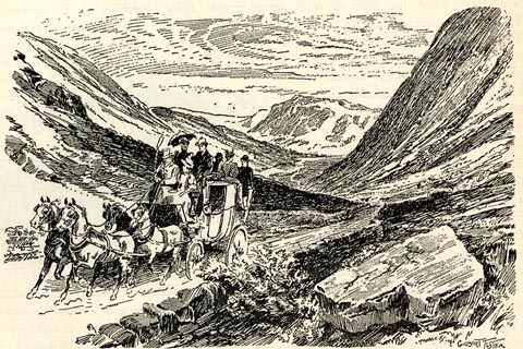 click to enlarge click to enlargeBGG132.jpg Included on p.126 of Lakeland and Ribblesdale, by Edmund Bogg. item:- JandMN : 231.32 Image © see bottom of page |
|
|
|
||
| evidence:- | old print:- Payn 1860s-70s placename:- Kirkstone Pass |
|
| source data:- | Print, colour printed, Kirkstone Pass, Patterdale, Westmorland, published by John
Garnett, Windermere, Westmorland, and by Simpkin, Marshall and Co, London, 1860s-70s?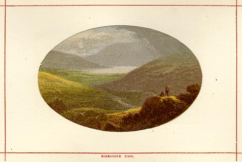 click to enlarge click to enlargePN0109.jpg Tipped in opposite p.38 of England's Lakeland, a Tour Therein, by James Payn. printed at bottom:- "KIRKSTONE PASS." item:- Armitt Library : A1183.9 Image © see bottom of page |
|
|
|
||
| evidence:- | old print:- placename:- Kirkstone Pass |
|
| source data:- | Print, engraving with lithograph colour? Brothers Water from Kirkstone Pass, Westmorland,
1860s-70s?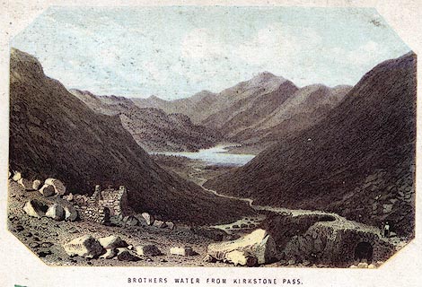 click to enlarge click to enlargePR0383.jpg printed at bottom:- "BROTHERS WATER FROM KIRKSTONE PASS." item:- Dove Cottage : 2008.107.383 Image © see bottom of page |
|
|
|
||
| evidence:- | outline view:- Black 1856 (23rd edn 1900) placename:- Kirkstone Pass |
|
| source data:- | Print, lithograph, Outline Views, Ullswater - Mountains as seen a little on the Matterdale
Road near Lyulph's Tower on Ullswater, and Mountains as seen at the Slate Quarry at
Blowick on Ullswater, by J Flintoft, Keswick, Cumberland, engraved by R Mason, Edinburgh,
Lothian, about 1900.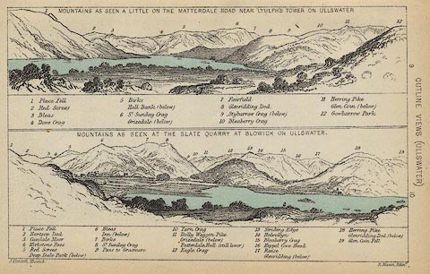 click to enlarge click to enlargeBC08E2.jpg "... 4 Kirkstone Pass ..." item:- JandMN : 37.8 Image © see bottom of page |
|
|
|
||
| evidence:- | old print:- Garnett 1850s-60s F |
|
| source data:- | Print, uncoloured engraving, Brothers' Water from near Kirkstone Pass, Westmorland,
drawn and engraved by William Banks and Son, Edinburgh, published by John Garnett,
Windermere, Westmorland, 1850s-60s?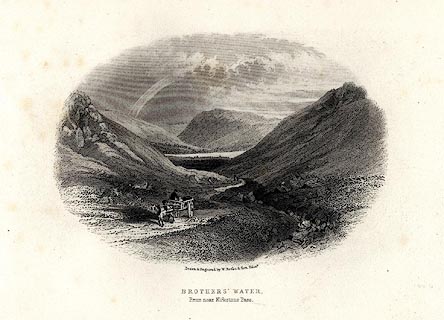 click to enlarge click to enlargeGAR703.jpg Included in Views of the English Lakes. printed at bottom:- "Drawn & Engraved. by W. Banks &Son, Edinr. / BROTHERS' WATER. / From near Kirkstone Pass." item:- JandMN : 165.3 Image © see bottom of page |
|
|
|
||
| evidence:- | outline view:- Black 1841 (3rd edn 1846) placename:- Kirkstone Pass |
|
| source data:- | Print, engraving, outline view, Mountains as seen a little on the Matterdale Road
near Lyulph's Tower on Ulleswater, and Mountains as seen at the Slate Quarry at Blowick
on Ulleswater, by J Flintoft, Keswick, Cumberland, engraved by R Mason, Edinburgh,
Lothian, about 1846.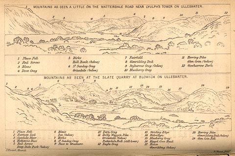 click to enlarge click to enlargeBC02E9.jpg "... 4 Kirkstone Pass ..." item:- JandMN : 32.15 Image © see bottom of page |
|
|
|
||
| evidence:- | outline view:- placename:- Kirkstone |
|
| source data:- | Print, hand coloured engraving, Lower Reach, Ullswater from Pooley Bridge, Westmorland
and Cumberland, published by Sherwood and Co, London, 1836?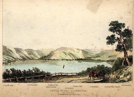 click to enlarge click to enlargePR0371.jpg Objects in the view are identified by a caption at the bottom - Swarth Fell, Martindale, High Street, Hallen Fell, Kirkstone, Place Fell, Fairfield, Gowbarrow Parks, Dumallet. printed at bottom:- "LOWER REACH, ULLSWATER. / from Pooley Bridge. / Pubd. April 15th 1836 by Sherwood &Co London." item:- Dove Cottage : 2008.107.371 Image © see bottom of page |
|
|
|
||
| evidence:- | old postcard:- placename:- Kirkstone Pass item:- charabanc |
|
| source data:- | Postcard, coloured photograph, Kirkstone Pass and Brotherswater, Patterdale, Westmorland,
published 1920s?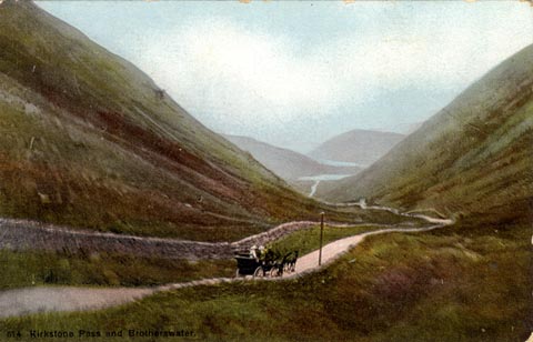 click to enlarge click to enlargePR1769.jpg printed at lower left:- "" printed at reverse:- "Affix ½d. Stamp Inland / 1d. Stamp Foreign" item:- private collection : 338 Image © see bottom of page |
|
|
|
||
| evidence:- | old print:- Goodwin 1887 (edn 1890) |
|
| source data:- | Print, etching? Brothers Water, from the Kirkstone Pass, Patterdale, Westmorland,
by Harry Goodwin, published by Swan Sonnenschein and Co, Paternoster Square, London,
1890.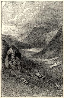 click to enlarge click to enlargePR1600.jpg Tipped in opposite p.154 of Through the Wordsworth Country, by William Knight. item:- JandMN : 382.30 Image © see bottom of page |
|
|
|
||
| evidence:- | old print:- Goodwin 1887 (edn 1890) placename:- Kirkstone Pass |
|
| source data:- | Print, etching? Kirkstone Pass, looking up The Struggle, Westmorland, by Harry Goodwin,
published by Swan Sonnenschein and Co, Paternoster Square, London, 1890.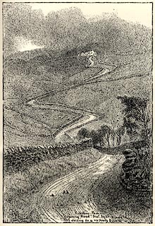 click to enlarge click to enlargePR1601.jpg Tipped in opposite p.160 of Through the Wordsworth Country, by William Knight. printed at lower centre:- "Kirkstone Pass / Aspiring road! that lov'st to hide / Thy daring in a vapoury bourn" item:- JandMN : 382.31 Image © see bottom of page |
|
|
|
||
 Click to enlarge BMY53.jpg Panorama from the track to Hartsop Hall; Caudale Moor, Kirkstone Pass, Middle Dodd, High Hartsop Dodd, Stand Crags and Dove Crag in Dovedale. (taken 5.11.2006) 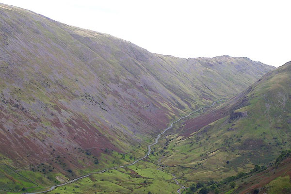 BOE64.jpg N side. (taken 11.9.2007) 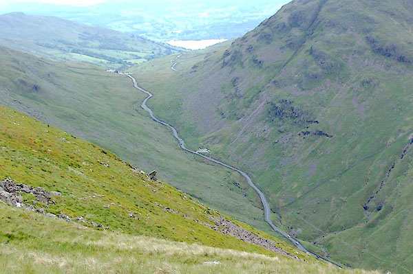 BQT10.jpg Looking southish; Windermere in the distance, beyond which is Blelham Tarn. (taken 9.6.2009) |
||
|
|
||
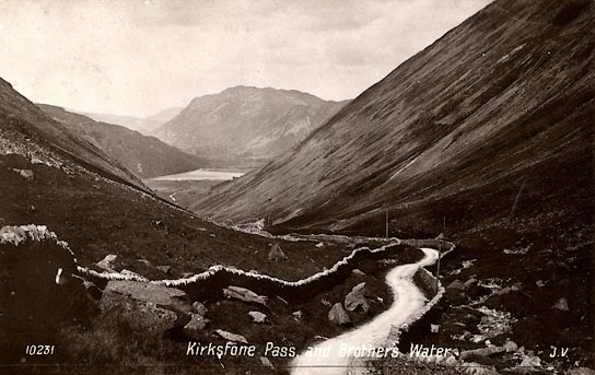 BVN55.jpg "Kirkstone Pass, and Brothers Water / J.V." courtesy of John Bennet |
||
| Sent to Miss Blenkinship, Wads Howe, Long Sleddale; postmark March 1915. |
||
|
|
||
Lakes Guides menu.