 Old Cumbria Gazetteer
 |
 |
|
| Gatescarth Pass, Longsleddale | ||
| Gatescarth Pass | ||
| site name:- | Adam Seat | |
| site name:- | Selside Brow | |
| civil parish:- | Shap Rural (formerly Westmorland) | |
| civil parish:- | Longsleddale (formerly Westmorland) | |
| county:- | Cumbria | |
| locality type:- | pass | |
| locality type:- | cirque (at head) | |
| coordinates:- | NY47390927 | |
| coordinates:- | NY47420920 (track summit) | |
| 1Km square:- | NY4709 | |
| 10Km square:- | NY40 | |
| altitude:- | 1920 feet | |
| altitude:- | 585m | |
| SummaryText:- | The track is not the lowest part of the pass between the hills, it runs a little up the side of Adam Seat. | |
|
|
||
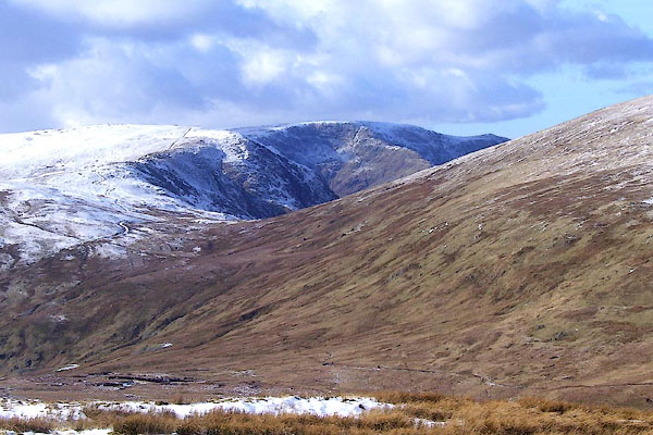 BOT60.jpg (taken 4.3.2008) |
||
|
|
||
| evidence:- | descriptive text:- West 1778 (11th edn 1821) placename:- Goatscar |
|
| source data:- | Guide book, A Guide to the Lakes, by Thomas West, published by
William Pennington, Kendal, Cumbria once Westmorland, and in
London, 1778 to 1821. goto source goto sourcePage 190:- "A TABLE OF THE Height of Mountains and Lakes SEEN IN THIS TOUR, ... TAKEN FROM THE LEVEL OF THE SEA. ... by Mr. John Dalton." "Goatscar, summit of the road from Hawes-water to Kendal ... 663 [yards]" |
|
|
|
||
| evidence:- | old text:- Housman 1800 item:- clouds |
|
| source data:- | Guide book, Descriptive Tour, and Guide to the Lakes, Caves, Mountains ..., by John
Housman, published by F Jollie, Carlisle, Cumberland and C Law, Ave Maria Lane, London,
1800; published
1800-21. Page 72:- "..." "The road now contracts into a rugged path, and winds curiously half way up the side of a steep mountain, whence a more easy ascent is had to its summit. It then descends, in a like serpentine manner, down to the vale of Mardale. Notwithstanding the difficulty of this road, the stranger enjoys the satisfaction of being assured that he cannot possibly deviate from the right path. - When we traversed this Alpine pass, the broken scattered clouds were hurried along before a brisk wind, just touching the tops of the mountains, while the sun shone bright through among them. The dark coloured and well defined shadows of these dense vapours, sweeping rapidly over the heathy surface in a variety of figures, like immense carpets, occasioned a very singular appearance in this elevated region." |
|
|
|
||
| evidence:- | descriptive text:- Otley 1823 (5th edn 1834) item:- viewpoint; horse |
|
| source data:- | Guide book, A Concise Description of the English Lakes, the
mountains in their vicinity, and the roads by which they may be
visited, with remarks on the mineralogy and geology of the
district, by Jonathan Otley, published by the author, Keswick,
Cumberland now Cumbria, by J Richardson, London, and by Arthur
Foster, Kirkby Lonsdale, Cumbria, 1823; published 1823-49,
latterly as the Descriptive Guide to the English Lakes. goto source Page 115:- "The road over Gatescarth, between Branstree and Harter Fell, is steep on both sides, yet such as a horse may be ridden, or rather led; and from the highest part there is an extensive view towards the sea. ..." |
|
|
|
||
| evidence:- | old map:- Hodgson 1828 placename:- Gate Scarth |
|
| source data:- | Map, hand coloured engraving, 4 sheets mounted together on linen and rolled, Plan
of the County of Westmorland, scale about 1.25 inches to 1 mile, by Thomas Hodgson,
engraved by W R Gardner, Harpur Street, London, published by Thomas Hodgson, Lancaster,
and perhaps by C Smith, 172 Strand, London,1828.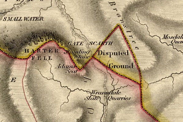 HDG6lsl5.jpg map courtesy of Mark Cropper "GATE SCARTH" item:- private collection : 371 Image © see bottom of page |
|
|
|
||
| evidence:- | old map:- Garnett 1850s-60s H placename:- Gatescarth Pass |
|
| source data:- | Map of the English Lakes, in Cumberland, Westmorland and
Lancashire, scale about 3.5 miles to 1 inch, published by John
Garnett, Windermere, Westmorland, 1850s-60s.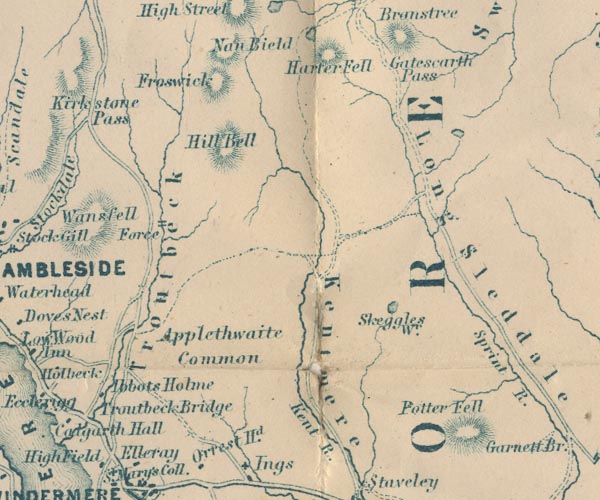 GAR2NY40.jpg "Gatescarth Pass" pass between hachures item:- JandMN : 82.1 Image © see bottom of page |
|
|
|
||
| evidence:- | old map:- OS 1881-82 New Series (outline edition) placename:- Gate Scarth |
|
| source data:- | Map, engraving, area north of Kendal, Westmorland, New Series
one inch map, outline edition, sheet 39, scale 1 inch to 1 mile,
published by the Ordnance Survey, Southampton, Hampshire,
1881-82.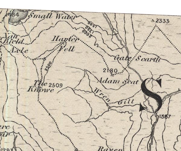 O21NY40U.jpg "Gate Scarth" item:- JandMN : 61 Image © see bottom of page |
|
|
|
||
| evidence:- | descriptive text:- Wilson 1912 |
|
| source data:- | Guide book, Longsleddale, by F M Wilson, published by T Wilson,
Kendal, Westmorland, 1912. WILSON1.txt "The pathway up to the elevated plateau of Gatescarth is very steep and rough, but when you reach the top, the view is indescribably grand. On one side is the beautiful Mardale valley, and on looking back you see the range of Kentmere hills in all their beauty of form and colour; the Yorkshire hills - Ingleborough; a little further on Morecambe Bay; and nearer, the town of Kendal." |
|
|
|
||
| evidence:- | map:- OS Six Inch (1956) |
|
| source data:- | Map series, various editions with the national grid, scale about
6 inches to 1 mile, published by the Ordnance Survey,
Southampton, Hampshire, scale 1 to 10560 from 1950s to 1960s,
then 1 to 10000 from 1960s to 2000s, superseded by print on
demand from digital data.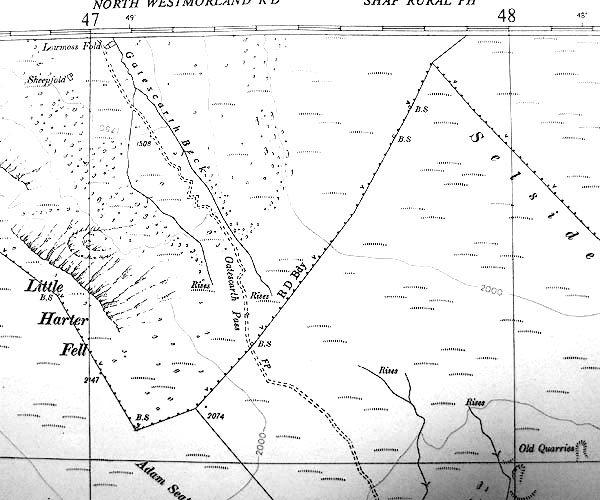 SINY4709.jpg |
|
|
|
||
| evidence:- | old print:- Prior 1865 placename:- Gatescarth Pass |
|
| source data:- | Print, uncoloured engraving, Gatescarth Pass and Longsleddale, Westmorland, published
by John Garnett, Windermere, Westmorland, and by Simpkin, Marshall and Co, London,
1865.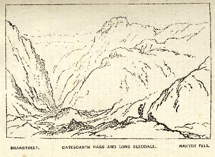 click to enlarge click to enlargePI0107.jpg Included on page 51 of the guide book, Ascents and Passes in the Lake District of England, by Herman Prior. printed at bottom:- "BRANSTREET. / GATESCARTH PASS AND LONG SLEDDALE. / HARTER FELL." item:- JandMN : 235.9 Image © see bottom of page |
|
|
|
||
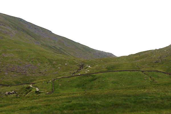 BUY27.jpg From Mardale Head (taken 15.7.2011) |
||
|
|
||
Lakes Guides menu.