 |
 |
   |
|
|
|
Friar's Crag |
| locality:- |
Keswick |
| civil parish:- |
Keswick (formerly Cumberland) |
| county:- |
Cumbria |
| locality type:- |
rocks |
| coordinates:- |
NY26372227 (etc) |
| 1Km square:- |
NY2622 |
| 10Km square:- |
NY22 |
| altitude:- |
280 feet |
| altitude:- |
85m |
|
|
| evidence:- |
old map:- OS County Series (Cmd 64 6)
placename:- Friar's Crag
|
| source data:- |
Maps, County Series maps of Great Britain, scales 6 and 25
inches to 1 mile, published by the Ordnance Survey, Southampton,
Hampshire, from about 1863 to 1948.
|
|
|
| evidence:- |
old map:- Crosthwaite 1783-94 (Der)
|
| source data:- |
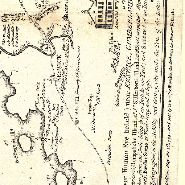
Map, uncoloured engraving, An Accurate Map of the Matchless Lake
of Derwent, ie Derwent Water, scale about 3 inches to 1 mile, by
Peter Crosthwaite, Keswick, Cumberland, 1783, version published
1800.
CT2NY22Q.jpg
With rocks offshore in the lake.
item:- Armitt Library : 1959.191.3
Image © see bottom of page
|
|
|
| evidence:- |
old map:- Clarke 1787 map (Der)
placename:- Fryer Crag
|
| source data:- |
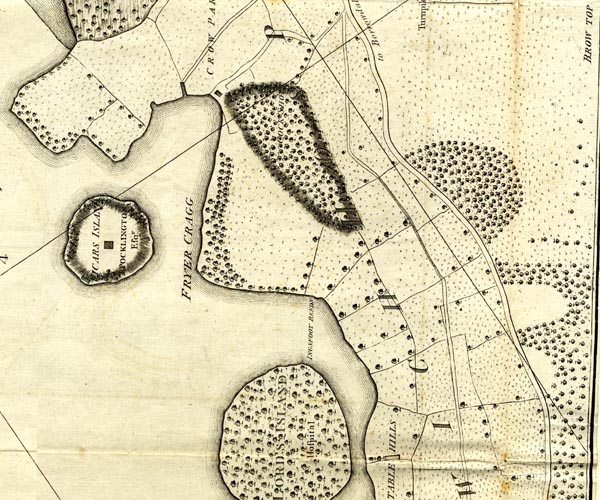
Map, uncoloured engraving, Map of Derwentwater and its Environs,
scale about 13 ins to 1 mile, by James Clarke, engraved by S J
Neele, published by James Clarke, Penrith, Cumberland and in
London etc, 1787.
CL152622.jpg
"FRYER CRAG"
headland and trees
item:- private collection : 169
Image © see bottom of page
|
|
|
| evidence:- |
descriptive text:- Otley 1823 (5th edn 1834)
placename:- Friar Crag
|
| source data:- |
Guide book, A Concise Description of the English Lakes, the
mountains in their vicinity, and the roads by which they may be
visited, with remarks on the mineralogy and geology of the
district, by Jonathan Otley, published by the author, Keswick,
Cumberland now Cumbria, by J Richardson, London, and by Arthur
Foster, Kirkby Lonsdale, Cumbria, 1823; published 1823-49,
latterly as the Descriptive Guide to the English Lakes.
 goto source goto source
Page 119:- "A walk by the water side, to Friar Crag, at the distance of three quarters of a mile,
is the favourite promenade of the inhabitants of the town, and affords much gratification
to strangers. ..."
|
|
|
| evidence:- |
old print:- Westall 1830s
placename:- Friar's Crag
|
| source data:- |
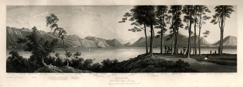
Print, aquatint panorama, Keswick Lake, from Friar's Crag, Evening, Cumberland, drawn
and engraved by William Westall, published by Ackermann and Co, 96 Strand, London,
1835.
 click to enlarge click to enlarge
WTL313.jpg
"Waller Crag. High scat. Ashness Gill head. Ashness. Falcon Crag. Lords Island, the
residence of the last Lord Derwentwater, the Ruins of the House are still remaining.
Barrow House, Mr. Pocklington's, Cat Crags. Whatenlath fells. Lowdore Waterfall. St.
Herbert's Isle. Gowder Crag. Brunt fell. Grange fell. Rosthwaite Comb. Castle Crag.
Great End. Scawfell Pike. Raven Crag. St. Cuthbert's Isle. Bull Crag. High Cat Bell.
Low Cat Bell. Red Pike. Buttermere Haws. Bowling End. / Drawn & Engraved by W. Westall
A.R.A. / Keswick Lake, / from Friar's Crag. Evening. / Published by Ackermann and
Co, 96 Strand. 1835. Price 3s. 6d."
item:- Armitt Library : A6658.13
Image © see bottom of page
|
|
|
| evidence:- |
old print:- Nelson 1853 (edn 1880s)
placename:- Friar's Crag
|
| source data:- |
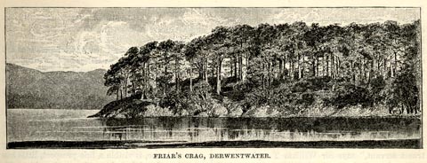
Print, uncoloured, Friar's Crag, Derwentwater, Keswick, Cumberland, published by Thomas
Nelson and Sons, London, 1853 edn 1880s?
 click to enlarge click to enlarge
NS0302.jpg
On p.7 of Views of the English Lakes, and Tourists Guide to the English Lakes.
printed at bottom:- "FRIAR'S CRAG, DERWENTWATER."
item:- JandMN : 474.3
Image © see bottom of page
|
|
|
| evidence:- |
old photograph:- Bell 1880s-1940s
|
| source data:- |
Photograph, sepia, Friar's Crag Derwentwater, Keswick, Cumberland, by Herbert Bell,
photographer, Ambleside, Westmorland, 1890s?
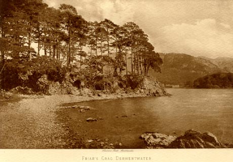 click to enlarge click to enlarge
HB0952.jpg
printed at bottom:- "Herbert Bell, Ambleside / FRIAR'S CRAG AND DERWENTWATER"
item:- Armitt Library : 1958.4257
Image © see bottom of page
|
|
|
| evidence:- |
old photograph:- Bell 1880s-1940s
|
| source data:- |
Photograph, black and white, Friar's Crag, Keswick, Cumberland, by Herbert Bell, photographer,
Ambleside, Westmorland, 1890s.
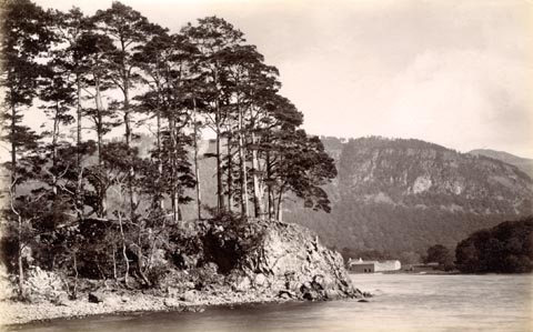 click to enlarge click to enlarge
HB0858.jpg
item:- Armitt Library : ALPS529
Image © see bottom of page
|
|
|
| evidence:- |
old photograph:- Bell 1880s-1940s
|
| source data:- |
Photograph, black and white, Friar's Crag and Causey Pike, Derwent Water, Cumberland,
by Herbert Bell, Ambleside, Westmorland, 1890s.
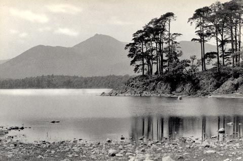 click to enlarge click to enlarge
HB0482.jpg
stamped at reverse:- "HERBERT BELL / Photographer / AMBLESIDE"
item:- Armitt Library : ALPS141
Image © see bottom of page
|
|
|
| evidence:- |
old photograph:- Bell 1880s-1940s
|
| source data:- |
Photograph, black and white, Friar's Crag, Derwent Water, Cumberland, by Herbert Bell,
Ambleside, Westmorland, 1890s.
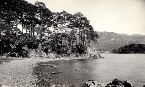 click to enlarge click to enlarge
HB0483.jpg
internegative at lower left:- "H. Bell"
stamped at reverse:- "HERBERT BELL / Photographer / AMBLESIDE"
item:- Armitt Library : ALPS142
Image © see bottom of page
|
|
|
| evidence:- |
old print:- Philip/Wilson 1890s
|
| source data:- |
Print, engraving, Friar's Crag, Derwentwater, published by
George Philip and Son, London, Philip, Son and Nephew,
Liverpool, Lancashire, and Titus Wilson, Kendal, Westmorland,
about 1895.
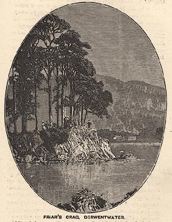 click to enlarge click to enlarge
PW1E27.jpg
"FRIAR'S CRAG, DERWENTWATER."
item:- JandMN : 58.28
Image © see bottom of page
|
|
|
| evidence:- |
illustration:- LNWR 1910
|
| source data:- |
Print, colour lithograph? Head of Friar's Crag, Derwentwater,
from a painting by R T Roussel, published by the London and
North Western Railway, LNWR, about 1910.
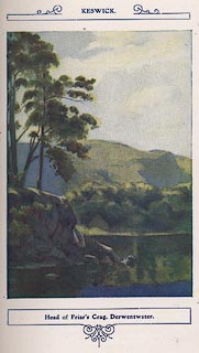 click to enlarge click to enlarge
NW01E5.jpg
Included in the guide book, The English Lakes, published by the London and North Western
Railway about 1910.
Roussel, R T, 1910item:- JandMN : 49.6
Image © see bottom of page
|
|
|
| evidence:- |
old photograph:- Photochrom 1930s
placename:- Friars Crag
|
| source data:- |
Photograph, black and white halftone print, Friars Crag, Derwentwater, Keswick, Cumberland,
published by Photochrom Co, Tunbridge Wells, Kent, 1930s?
 click to enlarge click to enlarge
PCH116.jpg
printed, "Friars Crag, Derwentwater. / ..."
item:- JandMN : 1015.16
Image © see bottom of page
|
|
|
| evidence:- |
old postcard:-
placename:- Friars Crag
|
| source data:- |
Postcard, colour printed photograph, Friar's Crag and Walla Crag, Keswick area, Cumberland,
published mid 20th century?
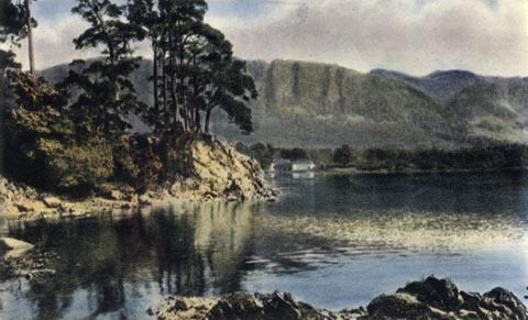 click to enlarge click to enlarge
PH0088.jpg
printed at bottom:- "FRIARS CRAG AND WALLA CRAG, DERWENTWATER"
item:- JandMN : 956
Image © see bottom of page
|
|
|
| evidence:- |
old postcard:-
placename:- Friars Crag
|
| source data:- |
Postcard, colour printed photograph, Friars Crag and Grisedale Pike, Keswick area,
Cumberland, published mid 20th century?
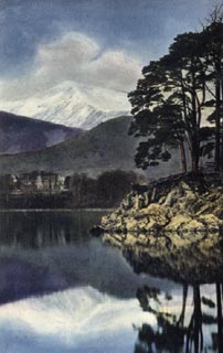 click to enlarge click to enlarge
PH0087.jpg
printed at bottom:- "FRIARS CRAG AND GRISEDALE PIKE, DERWENTWATER"
item:- JandMN : 955
Image © see bottom of page
|
|
|
| evidence:- |
old print:- Heywood 1906
placename:- Friar's Crag
|
| source data:- |
Print, halftone, Friar's Crag, Keswick, Cumberland, from a photograph by H Bell, Ambleside,
published by Abel Heywood and Son, 56-58 Oldham Street, Manchester, and by Simpkin,
Marshall, Hamilton, Kent and Co, Ave Maria Lane, Paternoster Row, London, 1906.
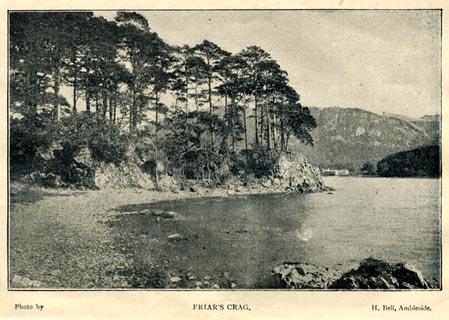 click to enlarge click to enlarge
HW1E02.jpg
In a Guide to Keswick and its Vicinity in the Penny Guide Books series.
printed at bottom:- "Photo by / FRIAR'S CRAG. / H. Bell, Ambleside"
inter neg at lower left:- "[H. BELL]"
item:- JandMN : 348.2
Image © see bottom of page
|
|
|
| evidence:- |
old print:-
placename:- Friar's Crag
|
| source data:- |
Print, uncoloured engraving, Friar's Crag, Keswick, Cumberland, by EMW, published
late 19th century?
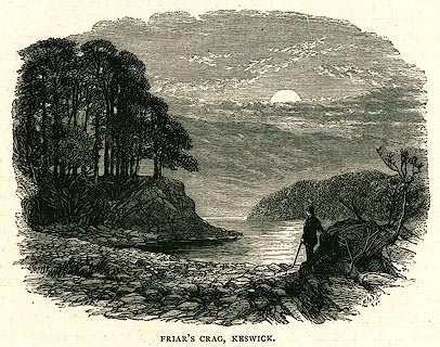 click to enlarge click to enlarge
PR0329.jpg
On page 148 of The English Lakes.
printed at lower right:- "EMW"
printed at bottom:- "FRIAR'S CRAG, KESWICK."
item:- Dove Cottage : 2008.107.329
Image © see bottom of page
|
|
|
| evidence:- |
old print:-
placename:- Friar's Crag
|
| source data:- |
Print, uncoloured engraving, Derwentwater from Friar's Crag, Keswick, Cumberland,
by ?B Foster, engraved by E Evans, 1850s-60s?
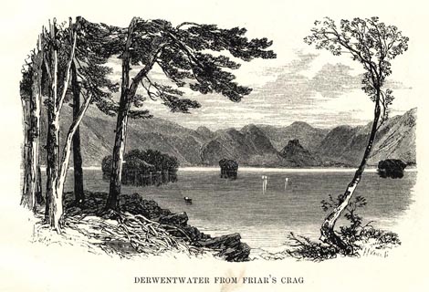 click to enlarge click to enlarge
PR0486.jpg
printed at bottom left, right, centre:- "[B] Foster / E. EVANS SC. / DERWENTWATER FROM FRIAR'S CRAG"
item:- Dove Cottage : 2008.107.435
Image © see bottom of page
|
|
|


 goto source
 click to enlarge
 click to enlarge
 click to enlarge
 click to enlarge
 click to enlarge
 click to enlarge
 click to enlarge
 click to enlarge
 click to enlarge
 click to enlarge
 click to enlarge
 click to enlarge
 click to enlarge
 click to enlarge