 Old Cumbria Gazetteer
 |
 |
|
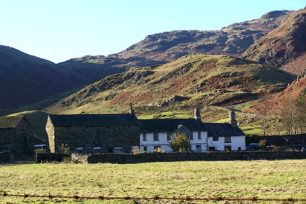
| Fell Foot, Little Langdale | ||
| Fell Foot | ||
| civil parish:- | Lakes (formerly Westmorland) | |
| locality:- | Little Langdale | |
| county:- | Cumbria | |
| locality type:- | buildings | |
| locality type:- | inn (ex) | |
| coordinates:- | NY29890319 | |
| 1Km square:- | NY2903 | |
| 10Km square:- | NY20 | |
|
|
||
 BLK27.jpg (taken 17.11.2005) |
||
|
|
||
| evidence:- | old map:- OS County Series (Wmd 25 11) placename:- Fell Foot |
|
| source data:- | Maps, County Series maps of Great Britain, scales 6 and 25
inches to 1 mile, published by the Ordnance Survey, Southampton,
Hampshire, from about 1863 to 1948. |
|
|
|
||
| evidence:- | old map:- OS County Series (Lan 1 8) placename:- Fell Foot |
|
| source data:- | Maps, County Series maps of Great Britain, scales 6 and 25
inches to 1 mile, published by the Ordnance Survey, Southampton,
Hampshire, from about 1863 to 1948. |
|
|
|
||
| evidence:- | old map:- Jefferys 1770 (Wmd) placename:- Fell Foot |
|
| source data:- | Map, 4 sheets, The County of Westmoreland, scale 1 inch to 1
mile, surveyed 1768, and engraved and published by Thomas
Jefferys, London, 1770.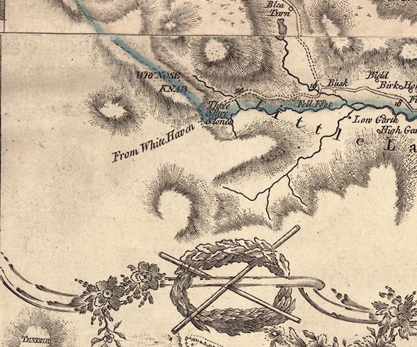 J5NY20SE.jpg "Fell Foot" circle, labelled in italic lowercase text; settlement, farm, house, or hamlet? item:- National Library of Scotland : EME.s.47 Image © National Library of Scotland |
|
|
|
||
| evidence:- | old map:- Otley 1818 placename:- Fellfoot |
|
| source data:- | Map, uncoloured engraving, The District of the Lakes,
Cumberland, Westmorland, and Lancashire, scale about 4 miles to
1 inch, by Jonathan Otley, 1818, engraved by J and G Menzies,
Edinburgh, Scotland, published by Jonathan Otley, Keswick,
Cumberland, et al, 1833.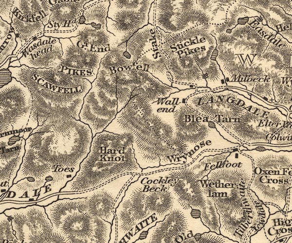 OT02NY20.jpg item:- JandMN : 48.1 Image © see bottom of page |
|
|
|
||
| evidence:- | descriptive text:- Ford 1839 (3rd edn 1843) placename:- Fell Foot |
|
| source data:- | Guide book, A Description of Scenery in the Lake District, by
Rev William Ford, published by Charles Thurnam, Carlisle, by W
Edwards, 12 Ave Maria Lane, Charles Tilt, Fleet Street, William
Smith, 113 Fleet Street, London, by Currie and Bowman,
Newcastle, by Bancks and Co, Manchester, by Oliver and Boyd,
Edinburgh, and by Sinclair, Dumfries, 1839. goto source goto sourcePage 37:- "..." "... Further on to the left is Fell Foot, an ancient inn, on the Old Bell road which led from Kendal to Whitehaven over Hard Knot and Wry Nose." |
|
|
|
||
| evidence:- | old map:- Ford 1839 map placename:- Fell Foot |
|
| source data:- | Map, uncoloured engraving, Map of the Lake District of
Cumberland, Westmoreland and Lancashire, scale about 3.5 miles
to 1 inch, published by Charles Thurnam, Carlisle, and by R
Groombridge, 5 Paternoster Row, London, 3rd edn 1843.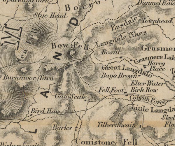 FD02NY20.jpg "Fell Foot" item:- JandMN : 100.1 Image © see bottom of page |
|
|
|
||
| evidence:- | old drawing:- Aspland 1840s-60s placename:- Fell Foot |
|
| source data:- | Drawing, pencil and ink wash, Fell Foot, Little Langdale, Westmorland, by Theophilus
Lindsey Aspland, 1849.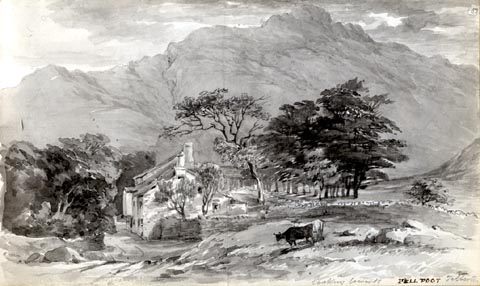 click to enlarge click to enlargeAS0160.jpg "looking towards FELL FOOT Tilberth" item:- Armitt Library : 1958.487.60 Image © see bottom of page |
|
|
|
||
| evidence:- | old map:- Garnett 1850s-60s H placename:- Fellfoot |
|
| source data:- | Map of the English Lakes, in Cumberland, Westmorland and
Lancashire, scale about 3.5 miles to 1 inch, published by John
Garnett, Windermere, Westmorland, 1850s-60s. GAR2NY20.jpg "Fellfoot" block, building item:- JandMN : 82.1 Image © see bottom of page |
|
|
|
||
| evidence:- | old text:- Martineau 1855 placename:- Fellfoot item:- packhorse |
|
| source data:- | Guide book, A Complete Guide to the English Lakes, by Harriet
Martineau, published by John Garnett, Windermere, Westmorland,
and by Whittaker and Co, London, 1855; published 1855-76. goto source Page 115:- "... to Fellfoot, and the old road from Kendal to Whitehaven, which was the only route before carriers' carts found their way into the region. Fellfoot was the house of entertainment whence the pack-horse cavalcade began the ascent, or where they stopped to congratulate themselves on having accomplished the descent. ..." |
|
|
|
||
| evidence:- | database:- Listed Buildings 2010 placename:- Fell Foot |
|
| source data:- | courtesy of English Heritage "FELL FOOT / / / LAKES / SOUTH LAKELAND / CUMBRIA / II / 452300 / NY2989203198" |
|
| source data:- | courtesy of English Heritage "At the foot of Wrynose Pass. C16 north wing, the main block C17. A long, low house, white-washed stone rubble, flag roof, 2 storeys. The door is under the overhang of a slate-bung upper storey, gabled, and without windows, the timber beam ends showing in the gable. Otherwise 4 small modern casements on ground floor and 5 above, with a slate dripstone over ground floor. Round chimney on north end. Lower one-time cottage (now part of house) to right has a door, 2 windows on ground floor and one above, also a loft door, and a large round chimney on the end. Higher stables adjoin on the end at the left, stone and slate, with 4 doors on roadside. The rear rises up hill, with barn door on upper level, above stables, with huge quoins." |
|
|
|
||
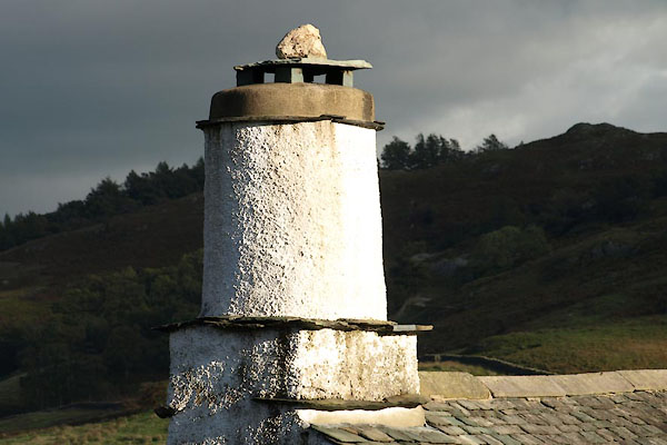 BTO26.jpg Chimney. (taken 24.9.2010) 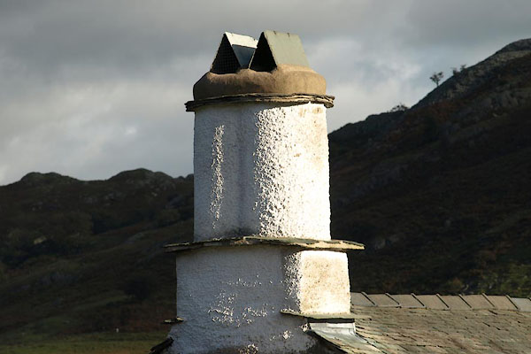 BTO27.jpg Chimney. (taken 24.9.2010) |
||
|
|
||
| hearsay:- |
Coat of arms of Fletcher Fleming under a gable, he lived here 1707-16. |
|
| Lanty Slee is said to have had an illicit whisky still here. |
||
|
|
||
Lakes Guides menu.