


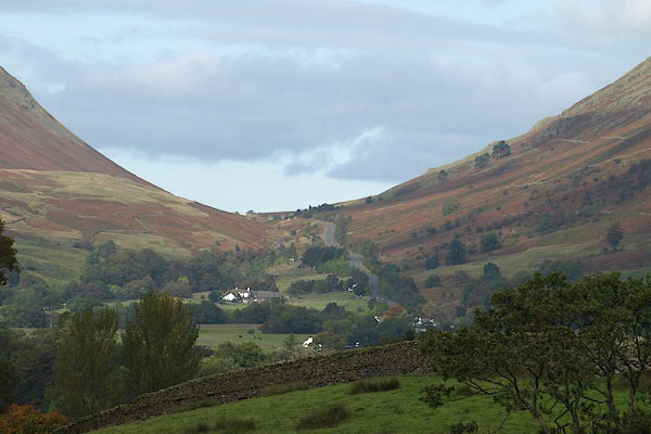
BRR53.jpg (taken 7.10.2009)
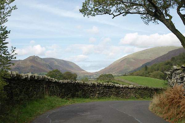
BRR54.jpg (taken 7.10.2009)
placename:- Raise Gap
placename:- Dunmail Raise
placename:- Pass of Dunmail Raise
placename:- Raise Gap
placename:-
item:- Dunmail Raise Stones
 goto source
page 164:- "... Dunbalrase ...
From whose stone-trophied head, ..."
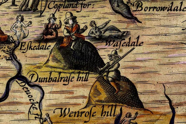
placename:- Dunbalrase Hill
DRY520.jpg
"Dunbalrase hill"
Hillock, gentelman sitting on top.
item:- JandMN : 168
Image © see bottom of page
OG96m015.jpg
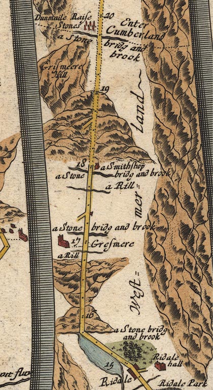
In mile 18, Westmerland.
Road ascends a great hill.
item:- JandMN : 22
Image © see bottom of page
 goto source
Addendum; Mr Gray's Journal, 1769
Page 210:- "..."
"Oct. 8. I left Keswick, and took the Ambleside road, ..."
"... soon after a beck near Dunmail-raise, where I entered Westmorland a second time: ..."
placename:- Rays Gap
placename:- Dunmail Rays
 goto source
Page 118:- "..."
"It is a pleasant enough road thro' these openings of the mountains, not being steep or troublesome, to Rays-Gap, or Dunmail-Rays, as it is called in all the old boundary rolls. Some will tell you that it had its name from Dunmail King of Cumberland, who in conjunction with Llewellyn King of South Wales, fought a battle with Edmund our Saxon King, and Malcolm King of Scots at this place; ..."
placename:- Dunmail Rays
placename:- Ray's Gap
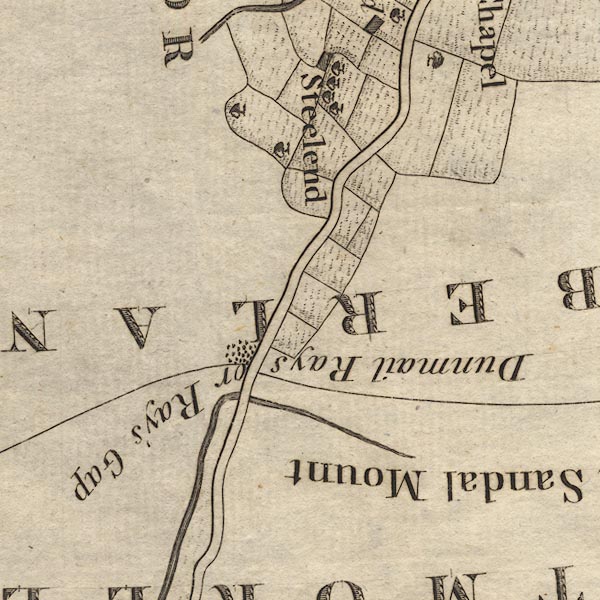
CL9NY31A.jpg
"Dunmail Rays or Ray's Gap"
item:- private collection : 10.9
Image © see bottom of page
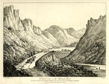
placename:- Dulmail Raise
item:- cart
 click to enlarge
WKN116.jpg
Plate 16 in Select Views in Cumberland, Westmoreland, and Lancashire.
printed at bottom left, right, centre:- "Revd. Jos: Wilkenson delt. / W: F: Wells sc. / Dulmail Raise, on the Ambleside Road. / ... / Published Octr. 1. 1810. by R. Ackermann. 101. Strand. London."
item:- Fell and Rock Climbing Club : MN4.16
Image © see bottom of page
placename:- Dunmail Raise
 goto source
page 12:- "... at the intersection of the sweeping lines, is Dunmail Raise, a considerable heap of stones, dividing Westmorland and Cumberland; under which see the zig-zag road from Ambleside to Keswick: ..."
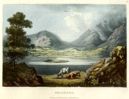
item:- cattle
 click to enlarge
GN0528.jpg
Dunmail Raise behind.
Plate 30 in Lake Scenery.
printed at upper right:- "30"
printed at bottom:- "GRASMERE. / Published at Ambleside, June 1, 1815, by Wm. Green."
item:- Armitt Library : A6646.28
Image © see bottom of page
placename:- Raise
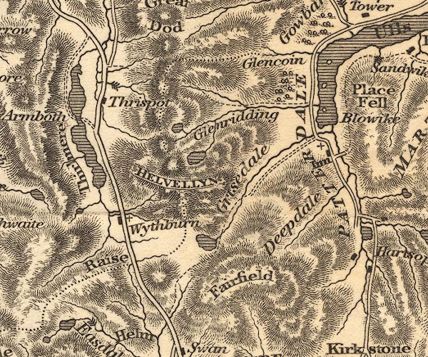
OT02NY31.jpg
item:- JandMN : 48.1
Image © see bottom of page
placename:- Raise Gap
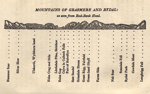 click to enlarge
OT2E03.jpg
Printed on p.15 of A Concise Description of the English Lakes, by Jonathan Otley, 5th edition, 1834. "MOUNTAINS OF GRASMERE AND RYDAL: as seen from Red-Bank Head."
"Hammer Scar / Silver How / Ullskarth, Wythburn head / Helm Crag and Stile / Littledale Pike, Skiddaw / Raise Gap / Calva in Caldbeck Fells / Part of Helvellyn / Seat Sandal / Grisedale Hause / Great Rigg, Fairfield / Green-head Ghyll / Forest Side / Nab Scar / Scandale Fell / Rydal Park / Cawdale Moor / Loughrigg Fell"
item:- JandMN : 48.4
Image © see bottom of page
placename:- Raise Gap
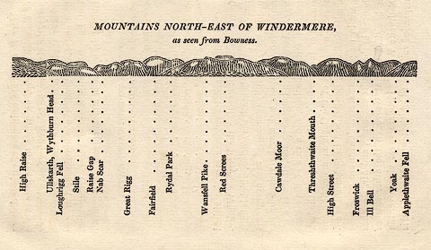 click to enlarge
OT2E11.jpg
Printed on p.99 of A Concise Description of the English Lakes, by Jonathan Otley, 5th edition, 1834. "MOUNTAINS NORTH-EAST OF WINDERMERE, as seen from Bowness."
Mountains are listed:- "High Raise / Ullskarth, Wythburn Head / Loughrigg Fell / Stile / Raise Gap / Nab Scar / Great Rigg / Fairfield / Rydal Park / Wansfell Pike / Red Screes / Cawdale Moor / Threshthwaite Mouth / High Street / Froswick / Ill Bell / Yoak / Applethwaite Fell"
item:- JandMN : 48.12
Image © see bottom of page
 goto source
Page 110:- "The long hill of Dunmail Raise is next to be ascended. It rises to the height of 750 feet above the level of the sea; and yet it is the lowest pass through a chain of mountains which extends from Black Combe on the southern verge of Cumberland, into the county of Durham. Having overcome the steepest part of the road, Skiddaw begins to shew his venerable head in the distance; and here is a retrospect over Grasmere vale, and through a vista of mountains, extending as far as Hampsfield Fell, near the sands of Lancaster. At the highest part of the road, a wall separates the counties of Westmorland and Cumberland;"
placename:- Raise Gap
 click to enlarge
WTL310.jpg
"Ambleside Road. Coniston Old Man. Dale end. The Wyke. Silver how. Kilbarrow, Mr. Barker's. Cordale Pike. farm, Pavement End. Easedale. Grasmere Church & Village. Helm crag. Steel fell. The Raise gap. Seat Sandel, the Southern extremeity of Helvellin. / Drawn & Engraved by W. Westall A.R.A. / The Vale of Grasmere, from White Moss. / [outline sketch showing the position of the next two items in the caption] Allen Bank, many years the residence of Mr. Wordsworth. Butterlip how. [outline sketch locating the next four items] Raven crag. Skiddaw. Dunmail Raise. Keswick Road. / Published by R. Ackermann, 96 Strand. 1832."
item:- Armitt Library : A6658.10
Image © see bottom of page
placename:- Raise Gap
 goto source
Page 44:- "..."
"... From hence [Swan Inn] the road is a long and gradual ascent, mounting in mazy serpentines to the Raise Gap; the steepest part of the road is from Highbroad Rain, through the turnpike, to a long dreary pass, through which the wind sweeps in piercing blasts. On the left brawls along the Rothay or Raise Beck, over which towers the naked Helm Crag. On the right of the Raise Gap, is a stream that divides the counties of Cumberland and Westmorland, and in wet weather presents a number of fine falls."
 goto source
Page 45:- "..."
"On the left are Steel Fell, the green cove of Wythburn Head, and Nab Scar, and on the right are the bulwarks and buttresses of Helvellyn. ..."
placename:- Dunmail Raise
 click to enlarge
AS0510.jpg
"Looking up Dunmail raise / rock on the N. side of Helm crag."
page number "8"
item:- Armitt Library : 1958.389.10
Image © see bottom of page
placename:- Dunmail Raise
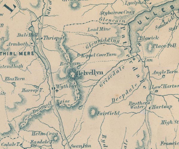
GAR2NY31.jpg
"Dunmail Raise"
pass between hachures
item:- JandMN : 82.1
Image © see bottom of page
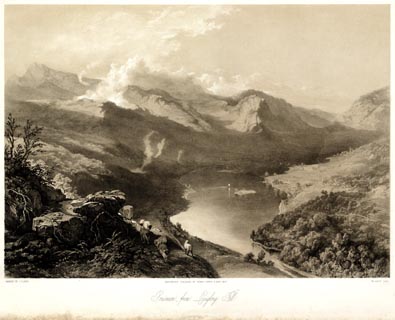 click to enlarge
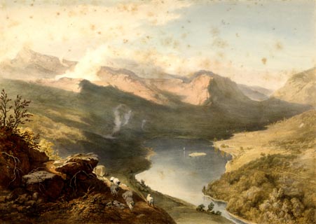
PYN217.jpg
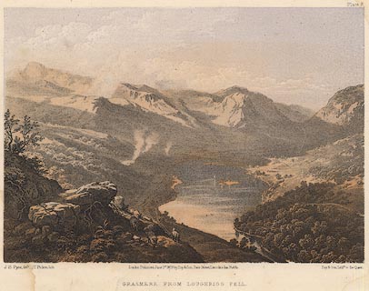
"PAINTED BY J. B. PYNE. / W. GAUCI LITH. / MANCHESTER, PUBLISHED BY THOMAS AGNEW & SONS, 1853. / Grasmere, from Loughrigg Fell. / M & N HANHART IMPT."
item:- Armitt Library : A6678.18
Image © see bottom of page
 click to enlarge
PYN417.jpg
item:- Armitt Library : A6677.18
Image © see bottom of page
item:- altitude, Dunmail Raise
 goto source
Page 68:- "From the Swan, the road to Keswick ascends Dunmail Raise;- a steep pitch of road, though its highest point is only 720 feet above the sea. On the right there is a stream which divides the counties of Cumberland and Westmorland; and on either hand rise the mountains of Steel Fell and Seat Sandal."
item:- altitude, Dunmail Raise
 goto source
Page 179:- "PASSES."
": : Height above the Level of the Sea"
"Dunmail Raise : West. &Cumb. : 720"
 click to enlarge
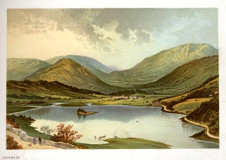
NS0326.jpg
At the end of Views of the English Lakes, and Tourists Guide to the English Lakes.
printed at bottom:- "GRASMERE"
item:- JandMN : 474.27
Image © see bottom of page
 click to enlarge
HB0281.jpg
item:- Armitt Library : ALPS638
Image © see bottom of page
 click to enlarge
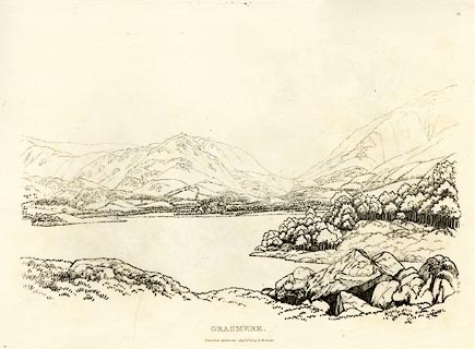
GN0351.jpg
Plate 51 in Seventy Eight Studies from Nature.
printed in introductory pages to set of prints:- "Number 51. This view of the lake and vale of Grasmere is from the side of Loughrigg Fell, below the road to Langdale Chapel from Ambleside. ... at the intersection of the sweeping lines of Steel Fell and Seat Sandal is Dunmail Raise [Stones], ... the zigzag line below the raise is part of the road between Keswick and Ambleside."
printed at bottom:- "GRASMERE. / Published Ambleside, Augst. 1st. 1809, by W. Green."
item:- Armitt Library : A6637.51
Image © see bottom of page
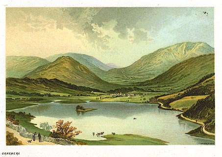 click to enlarge
PR0162.jpg
From a set of prints, The Scenery of the English Lakes
printed at lower right:- "T. NELSON &SONS"
printed at bottom left:- "GRASMERE"
item:- Dove Cottage : 2008.107.162
Image © see bottom of page
placename:- Dunmail Raise
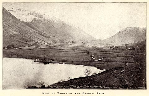 click to enlarge
HRW302.jpg
Tipped in opposite p.36 of the History and Description of the Thirlmere Water Scheme, by Sir John James Harwood.
printed at bottom:- "HEAD OF THIRLMERE AND DUNMAIL RAISE"
printed at lower right:- "Meisenbach"
item:- Armitt Library : A660.4
Image © see bottom of page
placename:- Dunmail Raise
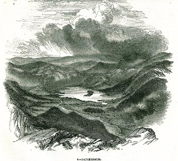 click to enlarge
PR0346.jpg
On a page of The Land We Live In.
printed at lower left:- "[ D]ASTIN"
printed at bottom:- "9.- GRASMERE, FROM DUNMAIL RAISE. DERWENT WATER AND CONISTON IN THE DISTANCE."
item:- Dove Cottage : 2008.107.346
Image © see bottom of page
placename:- Raise Gap
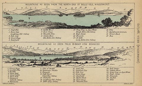 click to enlarge
BC08E1.jpg
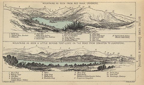
"... 2 Raise Gap ..."
item:- JandMN : 37.4
Image © see bottom of page
placename:- Raise Gap
 click to enlarge
BC08E3.jpg
"... 6 Raise Gap ..."
item:- JandMN : 37.12
Image © see bottom of page
 click to enlarge
PY08.jpg
"Grasmere from Loughrigg Fell"
item:- JandMN : 97.9
Image © see bottom of page
placename:- Dunmaile Raise
item:- shooting
 click to enlarge
SYL137.jpg
On p.151 of Sylvan's Pictorial Guide to the English Lakes.
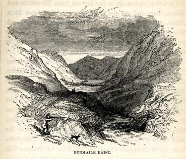
printed at bottom:- "DUNMAILE RAISE."
item:- Armitt Library : A1201.37
Image © see bottom of page
 click to enlarge
HRW210.jpg
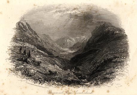
printed at bottom left, centre:- "London, J &F. Harwood, 26, Fenchurch Street. / Dunmail Raise, Cumberland."
item:- JandMN : 166.10
Image © see bottom of page
placename:- Raise Gap
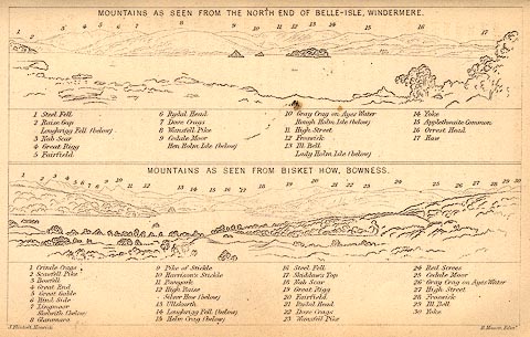 click to enlarge
BC02E1.jpg
"... 2 Raise Gap ..."
item:- JandMN : 32.3
Image © see bottom of page
placename:- Raise Gap
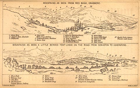 click to enlarge
BC02E3.jpg
"... 6 Raise Gap ..."
item:- JandMN : 32.5
Image © see bottom of page
placename:- Raise Gap
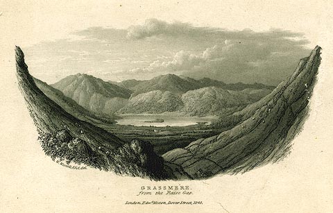 click to enlarge
PR0158.jpg
printed at bottom left, centre:- "W. Westall, ARA. delt. / GRASSMERE, / from the Raise Gap. / London. Edwd. Moxon, Dover Street, 1840."
item:- Dove Cottage : 2008.107.158
Image © see bottom of page
placename:- Dunmail Hause
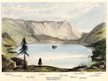 click to enlarge
TAT205.jpg
Included in The Lakes of England, by W F Topham.
printed at bottom:- "GRASMERE, / from Loughrigg Fell."
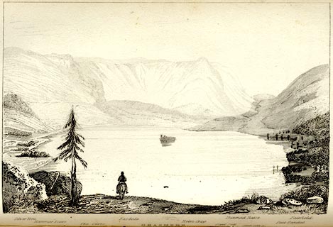
printed at bottom:- "Silver How. / Hammar Scarr. / The Carrs. / Easdale. / Helm Crag. / Steel Fell. / Dunmail Hause. / Helvellyn. / Seat Sandal. / Fairfield."
item:- Armitt Library : A1067.5
Image © see bottom of page
placename:- Dunmail Hause
 click to enlarge
TAT110.jpg
The print is captioned with mountain names and acts as an outline view.
Tipped in opposite p.43 of The Lakes of England, by George Tattersall.
printed at bottom:- "GRASMERE."
printed at bottom left to right:- "Silver How. / Hammar Scarr. / The Carrs. / Easdale. / Helm Crag. / Steel Fell. / Dunmail Hause. / Helvellyn. / Seat Sandal. / Fairfield."
item:- Armitt Library : A1204.11
Image © see bottom of page
Click to enlarge
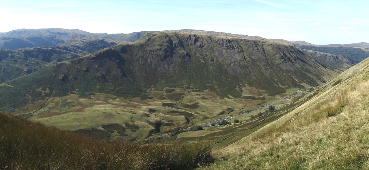
CEA05.jpg From Seat Sandal.
(taken 28.9.2015)
