Old Cumbria Gazetteer
 |
 |
|
||
| Drumburgh, Bowness | ||||
| Drumburgh | ||||
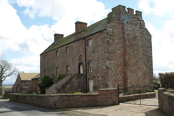
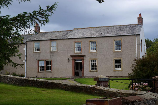
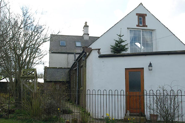
| locality:- | Hadrian's Wall | |||
| civil parish:- | Bowness (formerly Cumberland) | |||
| county:- | Cumbria | |||
| locality type:- | locality | |||
| locality type:- | buildings | |||
| coordinates:- | NY26495978 (etc) | |||
| 1Km square:- | NY2659 | |||
| 10Km square:- | NY25 | |||
|
|
||||
| evidence:- | old map:- OS County Series (Cmd 15 10) placename:- Drumburgh |
|||
| source data:- | Maps, County Series maps of Great Britain, scales 6 and 25
inches to 1 mile, published by the Ordnance Survey, Southampton,
Hampshire, from about 1863 to 1948. |
|||
|
|
||||
| evidence:- | old text:- Gents Mag item:- base line; surveying |
|||
| source data:- | Magazine, The Gentleman's Magazine or Monthly Intelligencer or
Historical Chronicle, published by Edward Cave under the
pseudonym Sylvanus Urban, and by other publishers, London,
monthly from 1731 to 1922. goto source goto sourceGentleman's Magazine 1748 p.4 "..." "I measured a base line on Burgh Marsh, after correcting the magnetical meridian; this was directed to a tree on an eminence near Drumbugh, as judging it the longest course in a plain. I carefully examined every angle from each of these stations, and fix'd the several places as specified in my draught. ..." |
|||
|
|
||||
| evidence:- | old map:- Donald 1774 (Cmd) placename:- Drumburgh |
|||
| source data:- | Map, hand coloured engraving, 3x2 sheets, The County of Cumberland, scale about 1
inch to 1 mile, by Thomas Donald, engraved and published by Joseph Hodskinson, 29
Arundel Street, Strand, London, 1774.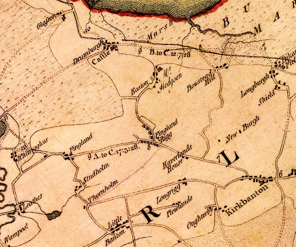 D4NY25NE.jpg "Drumburgh" block or blocks, labelled in lowercase; a hamlet or just a house item:- Carlisle Library : Map 2 Image © Carlisle Library |
|||
|
|
||||
| evidence:- | road book:- Cary 1798 (2nd edn 1802) placename:- Drumburgh |
|||
| source data:- | Road book, itineraries, Cary's New Itinerary, by John Cary, 181
Strand, London, 2nd edn 1802. goto source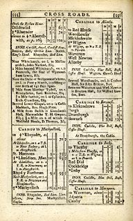 click to enlarge click to enlargeC38555.jpg page 555-556 "Drumburgh" item:- JandMN : 228.2 Image © see bottom of page |
|||
|
|
||||
| evidence:- | old map:- Cooper 1808 placename:- Drumburgh |
|||
| source data:- | Map, uncoloured engraving, Cumberland, scale about 10.5 miles to
1 inch, drawn and engraved by Cooper, published by R Phillips,
Bridge Street, Blackfriars, London, 1808. click to enlarge click to enlargeCOP3.jpg "Drumburgh" item:- JandMN : 86 Image © see bottom of page |
|||
|
|
||||
| evidence:- | old map:- Garnett 1850s-60s H placename:- Drumburgh |
|||
| source data:- | Map of the English Lakes, in Cumberland, Westmorland and
Lancashire, scale about 3.5 miles to 1 inch, published by John
Garnett, Windermere, Westmorland, 1850s-60s.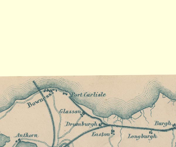 GAR2NY26.jpg "Drumburgh" blocks, settlement item:- JandMN : 82.1 Image © see bottom of page |
|||
|
|
||||
| places:- |
|
|||
|
||||
|
||||
|
||||
|
||||
|
||||
|
||||
|
||||
|
||||
Lakes Guides menu.