 Old Cumbria Gazetteer
 |
 |
|
| Dale End, Grasmere | ||
| Dale End | ||
| locality:- | Grasmere | |
| civil parish:- | Lakes (formerly Westmorland) | |
| county:- | Cumbria | |
| locality type:- | buildings | |
| coordinates:- | NY33610618 | |
| 1Km square:- | NY3306 | |
| 10Km square:- | NY30 | |
| SummaryText:- | Earlier names resolve the problem that this is not at the end of the dale. | |
|
|
||
| evidence:- | old map:- OS County Series (Wmd 25 4) placename:- Dale End |
|
| source data:- | Maps, County Series maps of Great Britain, scales 6 and 25
inches to 1 mile, published by the Ordnance Survey, Southampton,
Hampshire, from about 1863 to 1948. |
|
|
|
||
| evidence:- | old map:- Jefferys 1770 (Wmd) placename:- Tail End |
|
| source data:- | Map, 4 sheets, The County of Westmoreland, scale 1 inch to 1
mile, surveyed 1768, and engraved and published by Thomas
Jefferys, London, 1770.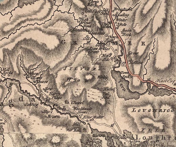 J5NY30NW.jpg "Tail End" circle, labelled in italic lowercase text; settlement, farm, house, or hamlet? item:- National Library of Scotland : EME.s.47 Image © National Library of Scotland |
|
|
|
||
| evidence:- | old map:- Clarke 1787 map (Ambleside to Keswick) placename:- Tailend |
|
| source data:- | Map, A Map of the Roads Lakes etc between Keswick and Ambleside,
scale about 2.5 ins to 1 mile, by James Clarke, engraved by S J
Neele, 352 Strand, published by James Clarke, Penrith,
Cumberland and in London etc, 1787.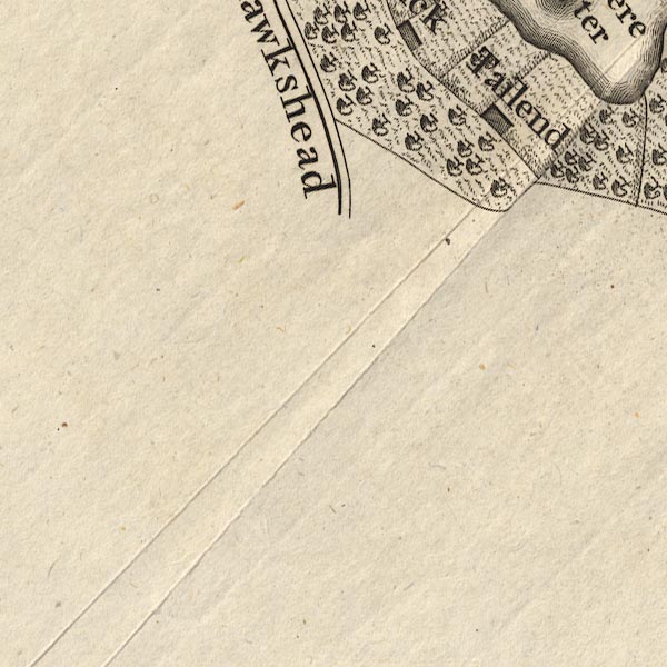 CL9NY30H.jpg "Tailend" item:- private collection : 10.9 Image © see bottom of page |
|
|
|
||
| evidence:- | old map:- Cary 1789 (edn 1805) placename:- Tail End |
|
| source data:- | Map, uncoloured engraving, Westmoreland, scale about 2.5 miles
to 1 inch, by John Cary, London, 1789; edition 1805.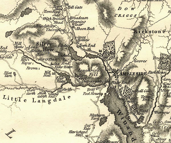 CY24NY30.jpg "Tail End" block/s, labelled in italic lowercase; house, or hamlet item:- JandMN : 129 Image © see bottom of page |
|
|
|
||
| evidence:- | probably old text:- Green 1814 placename:- Tail End |
|
| source data:- | Set of prints, soft ground etchings, Sixty Small Prints, with
text, A Description of a Series of Sixty Small Prints, by
William Green, Ambleside, Westmorland, 1814. goto source goto sourcepage 12:- "..." "It has been before observed that there is a horse road from Pelter Bridge to Grasmere Church, by passing, on the right, Rydal and Grasmere Waters. On this road, Tail End is about three miles and three quarters from Ambleside, and one mile from Grasmere Church." "This interesting view [plate 22] of the lake and vale of Grasmere is from the room built by Francis Dukinfield Astley, Esq. in addition to the farm-house," |
|
|
|
||
| evidence:- | old map:- Ford 1839 map placename:- Tail End |
|
| source data:- | Map, uncoloured engraving, Map of the Lake District of
Cumberland, Westmoreland and Lancashire, scale about 3.5 miles
to 1 inch, published by Charles Thurnam, Carlisle, and by R
Groombridge, 5 Paternoster Row, London, 3rd edn 1843.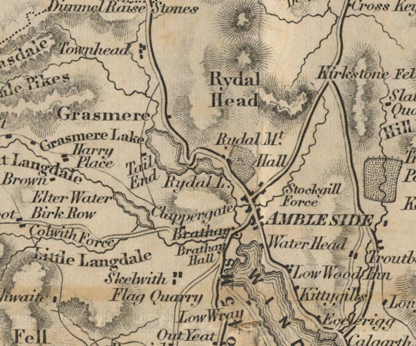 FD02NY30.jpg "Tail End" item:- JandMN : 100.1 Image © see bottom of page |
|
|
|
||
Lakes Guides menu.