Old Cumbria Gazetteer
 |
 |
|
||
| Cunsey Beck | ||||
| runs into:- |  Windermere lake Windermere lake |
|||
|
|
||||
| civil parish:- | Satterthwaite (formerly Lancashire) (etc) | |||
| civil parish:- | Claife (formerly Lancashire) | |||
| county:- | Cumbria | |||
| locality type:- | river | |||
| locality type:- | boundary | |||
| locality type:- | parish boundary | |||
| 1Km square:- | SD3694 | |||
| 10Km square:- | SD39 | |||
|
|
||||
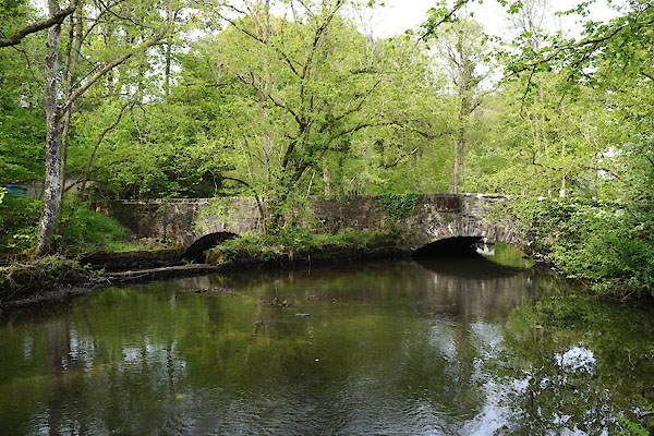
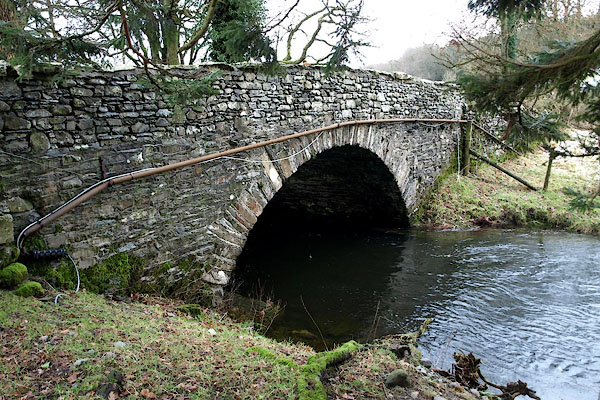
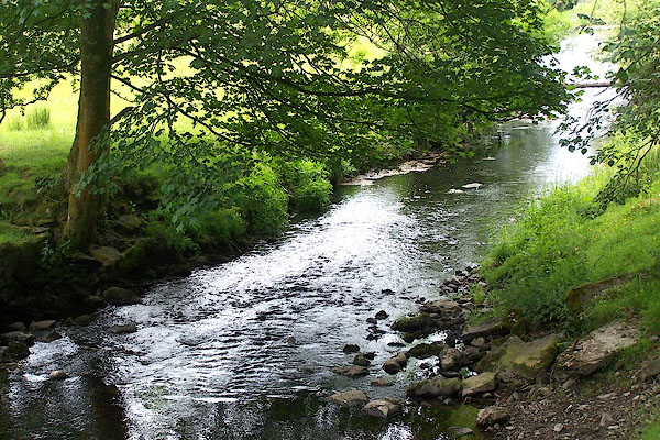 BMF91.jpg South from Ees Bridge. (taken 12.6.2006) 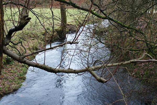 BPY46.jpg South from Eel Bridge. (taken 23.1.2009) |
||||
|
|
||||
| evidence:- | old map:- OS County Series (Lan 5 10) placename:- Cunsey Beck |
|||
| source data:- | Maps, County Series maps of Great Britain, scales 6 and 25
inches to 1 mile, published by the Ordnance Survey, Southampton,
Hampshire, from about 1863 to 1948. OS County Series (Lan 5 11) |
|||
|
|
||||
| evidence:- | old map:- Saxton 1579 |
|||
| source data:- | Map, hand coloured engraving, Westmorlandiae et Cumberlandiae Comitatus ie Westmorland
and Cumberland, scale about 5 miles to 1 inch, by Christopher Saxton, London, engraved
by Augustinus Ryther, 1576, published 1579-1645.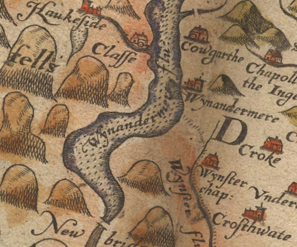 Sax9SD39.jpg item:- private collection : 2 Image © see bottom of page |
|||
|
|
||||
| evidence:- | old map:- Speed 1611 (Wmd) |
|||
| source data:- | Map, hand coloured engraving, The Countie Westmorland and
Kendale the Cheif Towne, scale about 2.5 miles to 1 inch, by
John Speed, 1610, published by George Humble, Popes Head Alley,
London, 1611-12. SP14SD39.jpg double line, north from Esthwaite Water, into Windermere item:- Armitt Library : 2008.14.5 Image © see bottom of page |
|||
|
|
||||
| evidence:- | old map:- Jefferys 1770 (Wmd) |
|||
| source data:- | Map, 4 sheets, The County of Westmoreland, scale 1 inch to 1
mile, surveyed 1768, and engraved and published by Thomas
Jefferys, London, 1770.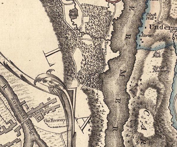 J5SD39SE.jpg single or double wiggly line; river item:- National Library of Scotland : EME.s.47 Image © National Library of Scotland |
|||
|
|
||||
| evidence:- | old map:- West 1784 map |
|||
| source data:- | Map, hand coloured engraving, A Map of the Lakes in Cumberland,
Westmorland and Lancashire, scale about 3.5 miles to 1 inch,
engraved by Paas, 53 Holborn, London, about 1784.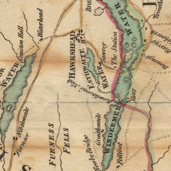 Ws02SD39.jpg item:- Armitt Library : A1221.1 Image © see bottom of page |
|||
|
|
||||
| evidence:- | old map:- Clarke 1787 map (Windermere S) |
|||
| source data:- | Map, A Map of the Southern Part of the Lake Winandermere and its
Environs, scale about 6.5 ins to 1 mile, by James Clarke,
engraved by Samuel John Neele, 352 Strand, published by James
Clarke, Penrith, Cumberland and in London etc, 1787.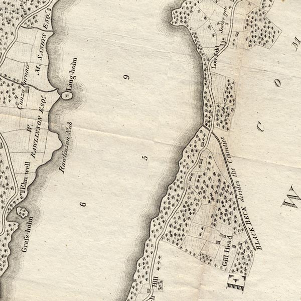 CLBSD39W.jpg item:- private collection : 10.11 Image © see bottom of page |
|||
|
|
||||
| evidence:- | old map:- Cary 1789 (edn 1805) |
|||
| source data:- | Map, uncoloured engraving, Westmoreland, scale about 2.5 miles
to 1 inch, by John Cary, London, 1789; edition 1805.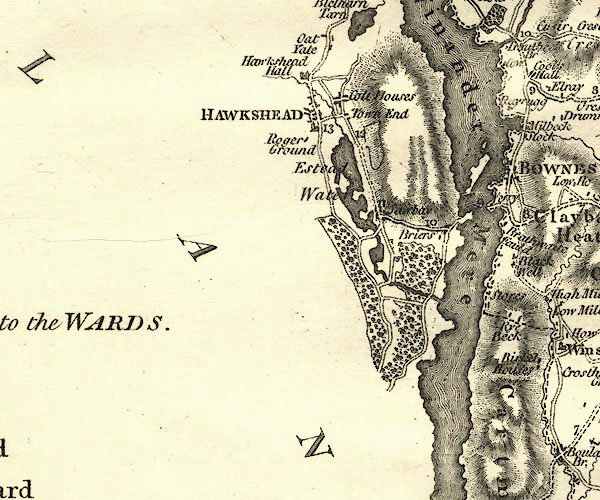 CY24SD39.jpg river from Out Dubs Tarn running into Windermere item:- JandMN : 129 Image © see bottom of page |
|||
|
|
||||
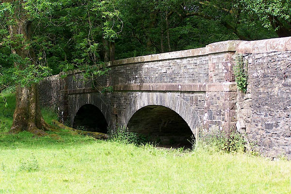
| evidence:- | old drawing:- Aspland 1840s-60s placename:- Cunsey Beck |
|||
| source data:- | Drawing, pencil, bridge on Cunsey Beck, Satterthwaite and Claife, Lancashire, by Theophilus
Lindsey Aspland, 23 June 1847.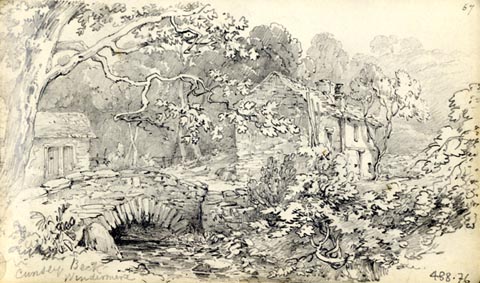 click to enlarge click to enlargeAS0276.jpg "June 23. / Cunsey Beck / Windermere" page number "67" item:- Armitt Library : 1958.488.76 Image © see bottom of page |
|||
|
|
||||
| evidence:- | old map:- Garnett 1850s-60s H placename:- Cunsey Beck |
|||
| source data:- | Map of the English Lakes, in Cumberland, Westmorland and
Lancashire, scale about 3.5 miles to 1 inch, published by John
Garnett, Windermere, Westmorland, 1850s-60s.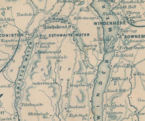 GAR2SD39.jpg "Cunsey Beck" wiggly line, river item:- JandMN : 82.1 Image © see bottom of page |
|||
|
|
||||
| evidence:- | old map:- Prior 1874 map 1 placename:- Cunsey Beck |
|||
| source data:- | Map, uncoloured engraving or lithograph? Winander Mere, scale
about 2.5 miles to 1 inch, published by John Garnett,
Windermere, Westmorland, 1874. click to enlarge click to enlargePI03M1.jpg "Cunsey Beck" double line with stream lines; river item:- private collection : 133.1 Image © see bottom of page |
|||
|
|
||||
| places:- |
|
|||
|
||||
|
||||
|
||||
|
||||
|
||||
|
||||
Lakes Guides menu.