 Old Cumbria Gazetteer
 |
 |
|
| Ees Bridge, Hawkshead | ||
| Ees Bridge | ||
| site name:- | Cunsey Beck | |
| civil parish:- | Hawkshead (formerly Lancashire) | |
| civil parish:- | Claife (formerly Lancashire) | |
| county:- | Cumbria | |
| locality type:- | bridge | |
| coordinates:- | SD36589521 | |
| 1Km square:- | SD3695 | |
| 10Km square:- | SD39 | |
|
|
||
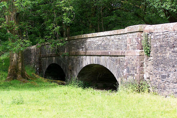 BMF88.jpg (taken 12.6.2006) 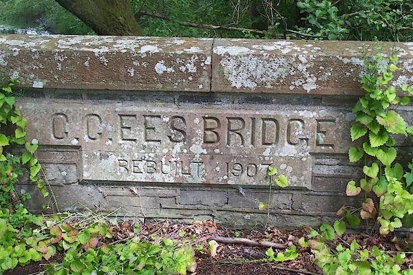 BMF89.jpg Plaque:- "C.C. EES BRIDGE / REBUILT 1907" (taken 12.6.2006) |
||
|
|
||
| evidence:- | old map:- OS County Series (Lan 5 10) placename:- Ees Bridge |
|
| source data:- | Maps, County Series maps of Great Britain, scales 6 and 25
inches to 1 mile, published by the Ordnance Survey, Southampton,
Hampshire, from about 1863 to 1948. |
|
|
|
||
| evidence:- | old map:- Jefferys 1770 (Wmd) |
|
| source data:- | Map, 4 sheets, The County of Westmoreland, scale 1 inch to 1
mile, surveyed 1768, and engraved and published by Thomas
Jefferys, London, 1770.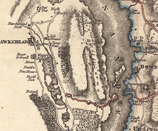 J5SD39NE.jpg single or double wiggly line; river item:- National Library of Scotland : EME.s.47 Image © National Library of Scotland |
|
|
|
||
| evidence:- | descriptive text:- West 1778 (11th edn 1821) |
|
| source data:- | Guide book, A Guide to the Lakes, by Thomas West, published by
William Pennington, Kendal, Cumbria once Westmorland, and in
London, 1778 to 1821. goto source goto sourcePage 55:- "ESTHWAITE-WATER," "... The lake is encompassed with a good carriage road, and over its outlet is a narrow stone bridge. ..." |
|
|
|
||
Lakes Guides menu.