 Old Cumbria Gazetteer
 |
 |
|
| Church Brough, Brough | ||
| Church Brough | ||
| locality:- | Brough | |
| civil parish:- | Brough (formerly Westmorland) | |
| county:- | Cumbria | |
| locality type:- | buildings | |
| coordinates:- | NY79371406 (etc) | |
| 1Km square:- | NY7914 | |
| 10Km square:- | NY71 | |
|
|
||
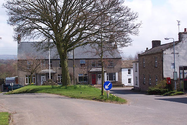 BLX17.jpg (taken 21.4.2006) |
||
|
|
||
| evidence:- | old map:- OS County Series (Wmd 16 15) placename:- Church Brough |
|
| source data:- | Maps, County Series maps of Great Britain, scales 6 and 25
inches to 1 mile, published by the Ordnance Survey, Southampton,
Hampshire, from about 1863 to 1948. |
|
|
|
||
| evidence:- | hearth tax returns:- Hearth Tax 1675 placename:- Church Brough |
|
| source data:- | Records, hearth tax survey returns, Westmorland, 1674/75. "Church Brough" |
|
|
|
||
| evidence:- | hearth tax returns:- Hearth Tax 1670 placename:- Kirkebrough |
|
| source data:- | Records, hearth tax returns, exchequer duplicates, Westmorland,
1670. "Kirkebrough" |
|
|
|
||
| evidence:- | descriptive text:- Simpson 1746 placename:- Upper Brough placename:- Church Brough |
|
| source data:- | Atlas, three volumes of maps and descriptive text published as
'The Agreeable Historian, or the Compleat English Traveller
...', by Samuel Simpson, 1746. goto source goto sourcePage 1024:- "..." "Brough, ... is divided into [two]" goto sourcePage 1025:- "two Towns, viz. the Upper alias Church Brough, where the Church stands, with a Castle and a small Fort called Caesar's Tower, ... Near the Bridge a Spaw-well was lately discovered. ..." |
|
|
|
||
| evidence:- | old map:- Jefferys 1770 (Wmd) placename:- Church Brough |
|
| source data:- | Map, 4 sheets, The County of Westmoreland, scale 1 inch to 1
mile, surveyed 1768, and engraved and published by Thomas
Jefferys, London, 1770. J5NY71SE.jpg "Church Brough" blocks, labelled in upright lowercase text; settlement; town? item:- National Library of Scotland : EME.s.47 Image © National Library of Scotland |
|
|
|
||
| evidence:- | descriptive text:- Lowther 1780s-90s placename:- Brough under Stainmore placename:- Burgh under Stanmore placename:- Burgh |
|
| source data:- | Scrapbook, 4 volumes, of descriptive texts, maps, and prints of
views and coats of arms, for Westmorland and Cumberland,
assembled by a member of the Lowther Family, late 18th early
19th century. Text with a print, engraving, Brough Castle, drawn by Samuel Hooper, engraved by Sparrow, 1775:- "BROUGH CASTLE, WESTMORELAND." "..." "'THIS castle of Brough under Stainmore, ..." "THE present proprietor of these ruins is the Earl of Thanet. Of late years they have been much demolished for the sake of the materials, which have been used in building stables, garden walls, and other conveniences; ..." "CAMDEN describing this country says, '... The town itself is dwindled into a village, which is defended with a small fort, and its name is now Burgh; for it is called Burgh under Stanmore, i. e. a Brough under a Stony Mountain. It is divided into two. The Upper, otherwise Church-Brough, where the Church standeth, of which Robert Eglesfield, Founder of Queen College in Oxford, was Rector, and procured the appropriation thereof from King Edward III. to the said College.' ..." |
|
|
|
||
| evidence:- | old text:- Camden 1789 (Gough Additions) placename:- Upper Brough placename:- Church Brough placename:- Western Brough |
|
| source data:- | Book, Britannia, or A Chorographical Description of the Flourishing Kingdoms of England,
Scotland, and Ireland, by William Camden, 1586, translated from the 1607 Latin edition
by Richard Gough, published London, 1789. goto source Page 157:- "..." "The town is divided into two, upper or church Brough (or Western), where stands the church, ... Here also stands the castle ... and the fort mentioned by Camden called Caesar's tower. ..." |
|
|
|
||
| evidence:- | old map:- Cary 1789 (edn 1805) placename:- Church Brough |
|
| source data:- | Map, uncoloured engraving, Westmoreland, scale about 2.5 miles
to 1 inch, by John Cary, London, 1789; edition 1805. CY24NY71.jpg "Church Brough" block/s, with a church, labelled in italic lowercase; house, or hamlet item:- JandMN : 129 Image © see bottom of page |
|
|
|
||
| evidence:- | old map:- Cooke 1802 placename:- Church Brough |
|
| source data:- | Map, Westmoreland ie Westmorland, scale about 12 miles to 1
inch, by George Cooke, 1802, published by Sherwood, Jones and
Co, Paternoster Road, London, 1824. click to enlarge click to enlargeGRA1Wd.jpg "Church Brough" blocks, italic lowercase text, village, hamlet, locality item:- Hampshire Museums : FA2000.62.4 Image © see bottom of page |
|
|
|
||
| evidence:- | old map:- Wallis 1810 (Wmd) placename:- Church Brough |
|
| source data:- | Road map, Westmoreland, scale about 19 miles to 1 inch, by James
Wallis, 77 Berwick Street, Soho, 1810, published by W Lewis,
Finch Lane, London, 1835? click to enlarge click to enlargeWAL5.jpg "Church Brough" village, hamlet, house, ... item:- JandMN : 63 Image © see bottom of page |
|
|
|
||
| evidence:- | market notes:- placename:- Brugys placename:- Burgo item:- market |
|
| source data:- | www.history.ac.uk/cmh/gaz/gazweb2.htmPalmer's Index No.93:: Public Record Office | |
|
|
||
Lakes Guides menu.