 Old Cumbria Gazetteer
 |
 |
|
| Church Bridge, Grasmere | ||
| Church Bridge | ||
| Street:- | Church Stile | |
| locality:- | Grasmere | |
| civil parish:- | Lakes (formerly Westmorland) | |
| county:- | Cumbria | |
| locality type:- | bridge | |
| coordinates:- | NY33740735 | |
| 1Km square:- | NY3307 | |
| 10Km square:- | NY30 | |
|
|
||
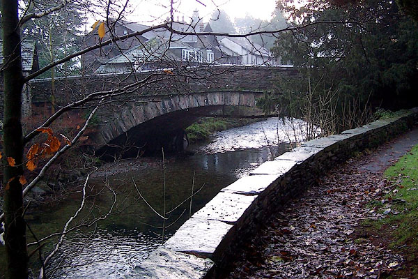 BLK98.jpg "W.C.C. CHURCH BRIDGE WIDENED 1926" (taken 5.12.2005) |
||
|
|
||
| evidence:- | old map:- OS County Series (Wmd 26 1) placename:- Church Bridge |
|
| source data:- | Maps, County Series maps of Great Britain, scales 6 and 25
inches to 1 mile, published by the Ordnance Survey, Southampton,
Hampshire, from about 1863 to 1948. |
|
|
|
||
| evidence:- | old map:- Saxton 1579 |
|
| source data:- | Map, hand coloured engraving, Westmorlandiae et Cumberlandiae Comitatus ie Westmorland
and Cumberland, scale about 5 miles to 1 inch, by Christopher Saxton, London, engraved
by Augustinus Ryther, 1576, published 1579-1645.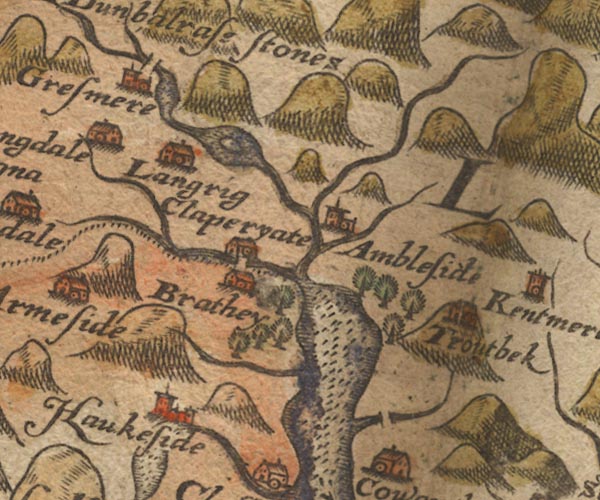 Sax9NY30.jpg At Grasmere. item:- private collection : 2 Image © see bottom of page |
|
|
|
||
| evidence:- | probably old map:- Seller 1694 (Wmd) |
|
| source data:- | Map, hand coloured engraving, Westmorland, scale about 8 miles
to 1 inch, by John Seller, 1694. click to enlarge click to enlargeSEL7.jpg two lines cross a stream; bridge item:- Dove Cottage : 2007.38.87 Image © see bottom of page |
|
|
|
||
| evidence:- | old map:- Morden 1695 (Cmd) |
|
| source data:- | Map, uncoloured engraving, Cumberland, scale about 4 miles to 1
inch, by Robert Morden, 1695, published by Abel Swale, the
Unicorn, St Paul's Churchyard, Awnsham, and John Churchill, the
Black Swan, Paternoster Row, London, 1695-1715.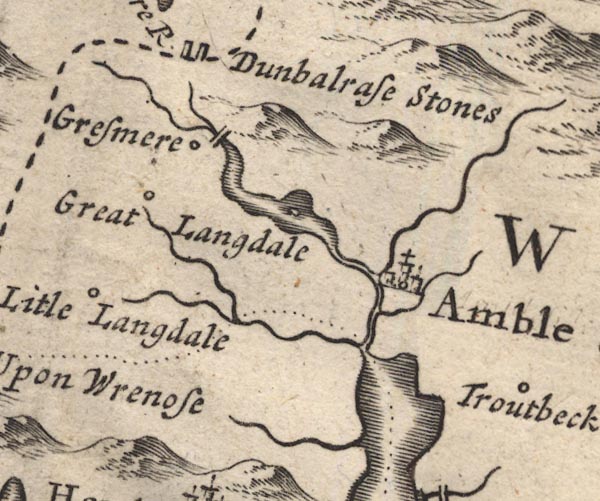 MD12NY30.jpg Double line over a stream, at Grasmere. item:- JandMN : 90 Image © see bottom of page |
|
|
|
||
| evidence:- | old map:- Jefferys 1770 (Wmd) |
|
| source data:- | Map, 4 sheets, The County of Westmoreland, scale 1 inch to 1
mile, surveyed 1768, and engraved and published by Thomas
Jefferys, London, 1770.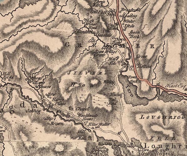 J5NY30NW.jpg double line, road, across a stream; bridge item:- National Library of Scotland : EME.s.47 Image © National Library of Scotland |
|
|
|
||
| evidence:- | database:- Listed Buildings 2010 |
|
| source data:- | courtesy of English Heritage "BRIDGE BESIDE ST OSWALDS CHURCH / / / LAKES / SOUTH LAKELAND / CUMBRIA / II / 451916 / NY3374807347" |
|
| source data:- | courtesy of English Heritage "Widened in C20. Single segmental arch of local slate rubble, with a slightly arched parapet. Date uncertain." "For group notes see General group description under Grasmere." |
|
|
|
||
 Lakes Guides menu.