 |
 |
   |
|
|
|
Castle Howe |
| locality:- |
Kendal |
| civil parish:- |
Kendal (formerly Westmorland) |
| county:- |
Cumbria |
| locality type:- |
motte and bailey |
| locality type:- |
castle |
| coordinates:- |
SD51249240 |
| 1Km square:- |
SD5192 |
| 10Km square:- |
SD59 |
|
|
|
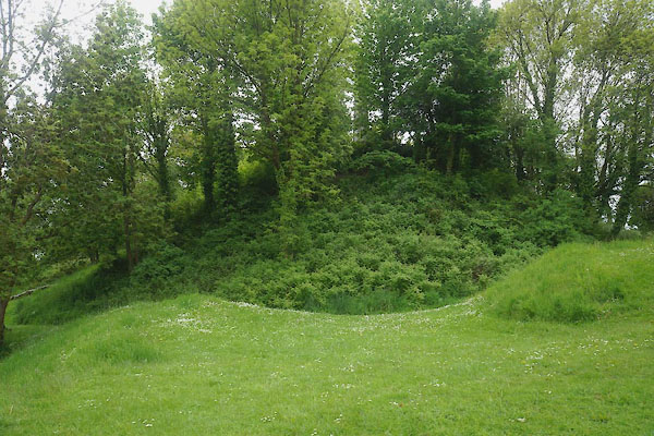
CDE12.jpg (taken 3.6.2015)
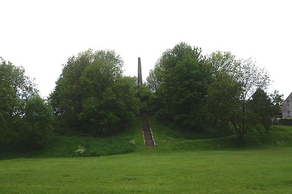
CDE13.jpg (taken 3.6.2015)
|
|
|
| evidence:- |
old map:- OS County Series (Wmd 38 8)
placename:- Castle Howe
|
| source data:- |
Maps, County Series maps of Great Britain, scales 6 and 25
inches to 1 mile, published by the Ordnance Survey, Southampton,
Hampshire, from about 1863 to 1948.
|
|
|
| evidence:- |
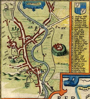
old map:- Speed 1611
placename:- Mount, The
|
| source data:- |
Map, hand coloured engraving, The Countie Westmorland and
Kendale the Cheif Towne, scale about 2.5 miles to 1 inch, by
John Speed, 1610, published by George Humble, Popes Head Alley,
London, 1611-12.
 click to enlarge click to enlarge
SP14Mk.jpg
"S The Mount"
hillock
item:- Armitt Library : 2008.14.5
Image © see bottom of page
|
|
|
| evidence:- |
old map:- Ogilby 1675 (plate 38)
|
| source data:- |
Road strip map, hand coloured engraving, continuation of the
Road from London to Carlisle, scale about 1 inch to 1 mile, by
John Ogilby, London, 1675.
OG38m252.jpg
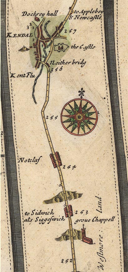
In mile 256, Westmoreland.
Hillock with an unidentified feature on top, to the left.
item:- JandMN : 21
Image © see bottom of page
|
|
|
| evidence:- |
old map:- Bowen and Kitchin 1760
placename:- Mount, The
|
| source data:- |
Map, hand coloured engraving, A New Map of the Counties of
Cumberland and Westmoreland Divided into their Respective Wards,
scale about 4 miles to 1 inch, by Emanuel Bowen and Thomas
Kitchin et al, published by T Bowles, Robert Sayer, and John
Bowles, London, 1760.
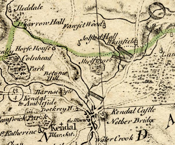
BO18SD49.jpg
"The Mount"
no symbol
item:- Armitt Library : 2008.14.10
Image © see bottom of page
|
|
|
| evidence:- |
old map:- Jefferys 1770
|
| source data:- |
Map, 4 sheets, The County of Westmoreland, scale 1 inch to 1
mile, surveyed 1768, and engraved and published by Thomas
Jefferys, London, 1770.
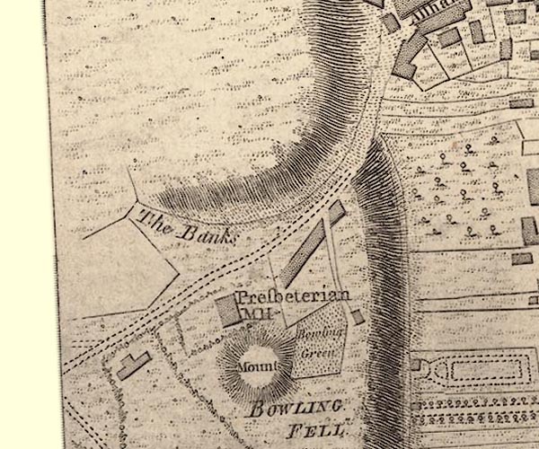
J55192H.jpg
"Mount"
hill hachuring
item:- National Library of Scotland : EME.s.47
Image © National Library of Scotland |
|
|
| evidence:- |
old map:- Jefferys 1770 (Wmd)
placename:- Mount
|
| source data:- |
Map, 4 sheets, The County of Westmoreland, scale 1 inch to 1
mile, surveyed 1768, and engraved and published by Thomas
Jefferys, London, 1770.
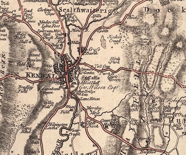
J5SD59SW.jpg
"Mount"
hill Hachuring; small hill
item:- National Library of Scotland : EME.s.47
Image © National Library of Scotland |
|
|
| evidence:- |
descriptive text:- West 1778 (11th edn 1821)
placename:- Castle Law Hill
item:- law
|
| source data:- |
Guide book, A Guide to the Lakes, by Thomas West, published by
William Pennington, Kendal, Cumbria once Westmorland, and in
London, 1778 to 1821.
 goto source goto source
Page 188:- "Before you leave Kendal, visit the Castle-law-hill. This is an artificial mount, that
overlooks the town, and faces the castle, and surpasses it in antiquity, being one
of those hills called Laws, where in ancient times distributive justice was administered.
From its present appearance, it seems to have been converted to different purposes,
but though well situated as a watch upon the castle, it could never be a proper place
to batter it from, as has been reported.[1]"
|
|
|
| evidence:- |
old text:- Camden 1789 (Gough Additions)
placename:- Castlehow Hill
|
| source data:- |
Book, Britannia, or A Chorographical Description of the Flourishing Kingdoms of England,
Scotland, and Ireland, by William Camden, 1586, translated from the 1607 Latin edition
by Richard Gough, published London, 1789.
 goto source goto source
Page 152:- "... opposite to it [Kendal Castle] is a large exploratory mount called Castlehow hill;
whether Roman or not is uncertain: it is flat at top, surrounded by a ditch crossed
by another. Round the base a deep foss and high dike strengthened by two bastions
on the east side. Dr. Stukeley calls it Saxon. Immediately below it is a spot called
Battle place. ..."
|
|
|
| evidence:- |
descriptive text:- Baker 1802
placename:- Castlebow Hill
|
| source data:- |
Perspective road map with sections in Lancashire, Westmorland,
and Cumberland, by J Baker, London 1802.
pp.25-26:- "[Kendal] ... Another similar eminence, ornamented with an obelisk, is called Castlebow
Hill."
|
|
|
| evidence:- |
old map:- Baker 1802
|
| source data:- |
Perspective road maps with sections in Lancashire, Westmorland
and Cumberland, by J Baker, London 1802.

Bk03Vg13.jpg
item:- private collection : 3
Image © see bottom of page
|
|
|
| evidence:- |
old text:- Capper 1808
placename:- Castle Law Hill
|
| source data:- |
Gazetteer, A Topographical Dictionary of the United Kingdom,
compiled by Benjamin Pitts Capper, published by Richard
Phillips, Bridge Street, Blackfriars, London, 1808; published
1808-29.
 goto source goto source
"[Kendal] ... an artificial cone-shaped mount, called Castle Law hill. ..."
|
|
|
| evidence:- |
descriptive text:- Otley 1823 (8th edn 1849)
placename:- Castle Law Hill
placename:- Cassy Co Hill
|
| source data:- |
Guide book, A Concise Description of the English Lakes, the
mountains in their vicinity, and the roads by which they may be
visited, with remarks on the mineralogy and geology of the
district, by Jonathan Otley, published by the author, Keswick,
Cumberland now Cumbria, by J Richardson, London, and by Arthur
Foster, Kirkby Lonsdale, Cumbria, 1823; published 1823-49,
latterly as the Descriptive Guide to the English Lakes.
 goto source goto source
Page 175:- "ANCIENT MOUNDS.- ... The observant traveller through Lunesdale cannot but be struck
with several artificial mounds, ... It is remarkable that a majority of them are situated
near our old parish churches: for instance, at Halton, Melling, Arkholme, Kirkby Lonsdale,
and Sedbergh.[1] For whatever purpose they were originally designed, whether as places
of defence, or 'moot-hills' where justice was dispensed; in latter days they appear
to have been put to more ignoble uses. ..."
"[1] At Kendal is a mound of a similar description, called Castle-Law-Hill, modernized
in common parlance to Cassy-Co-Hill. It has been said - but without any apparent grounds
- that it was thrown up by Oliver Cromwell from whence - a distance of some half-a-mile
- to batter down the old Castle on the other side of the town, which he would scarcely
have deemed necessary, as even in his days it was in a state of delapidation."
|
|
|
| evidence:- |
site plan:- Curwen 1913
placename:- Castle How
|
| source data:- |
Site plan, lithograph, Castle How, Kendal, Westmorland, published for the Cumberland
and Westmorland Antiquarian and Archaeological Society by Titus Wilson, Kendal, Westmorland,
1913.
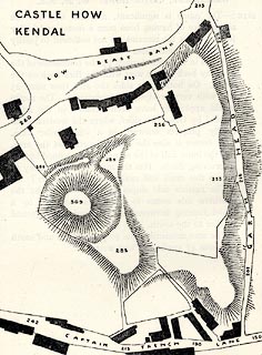 click to enlarge click to enlarge
CW0105.jpg
On p.30 of The Castles and Fortified Towers of Cumberland, Westmorland, and Lancashire
North of the Sands, by John F Curwen.
printed at upper left:- "CASTLE HOW / KENDAL"
item:- Armitt Library : A782.5
Image © see bottom of page
|
|
|
| evidence:- |
old print:- Curwen 1913
placename:- Castle How
|
| source data:- |
Print, halftone photograph, Kendal Castle How, from the bailey, Kendal, Westmorland,
published for the Cumberland and Westmorland Antiquarian and Archaeological Society
by Titus Wilson, Kendal, Westmorland, 1913.
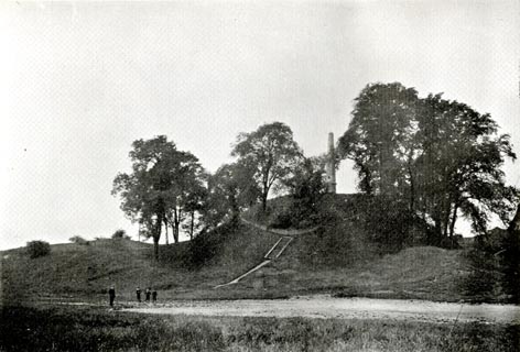 click to enlarge click to enlarge
CW0106.jpg
Tipped in opposite p.30 of The Castles and Fortified Towers of Cumberland, Westmorland,
and Lancashire North of the Sands, by John F Curwen.
item:- Armitt Library : A782.6
Image © see bottom of page
|
|
|
hearsay:-
|
Norman motte for a castle, built on a ridge to the west of present day Kendal.
|
|
|
notes:-
|
motte and bailey
|
|
Perriam, D R &Robinson, J: 1998: Medieval Fortified Buildings of Cumbria: CWAAS::
ISBN 1 873124 23 6
|
|
|


 click to enlarge


 goto source
 goto source
 goto source
 goto source
 click to enlarge
 click to enlarge