Old Cumbria Gazetteer
 |
 |
|
||
| Abbey Town, Holme Abbey | ||||
| Abbey Town | ||||
| civil parish:- | Holme Abbey (formerly Cumberland) | |||
| county:- | Cumbria | |||
| locality type:- | locality | |||
| locality type:- | buildings | |||
| locality type:- | selected place | |||
| coordinates:- | NY17655081 (etc) | |||
| 1Km square:- | NY1750 | |||
| 10Km square:- | NY15 | |||
| latitude; longitude:- | 3d 16.9m W; 54d 50.7m N | |||
|
|
||||
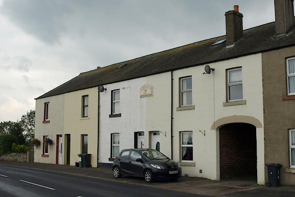
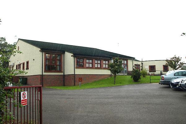
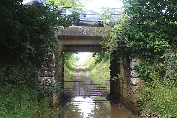
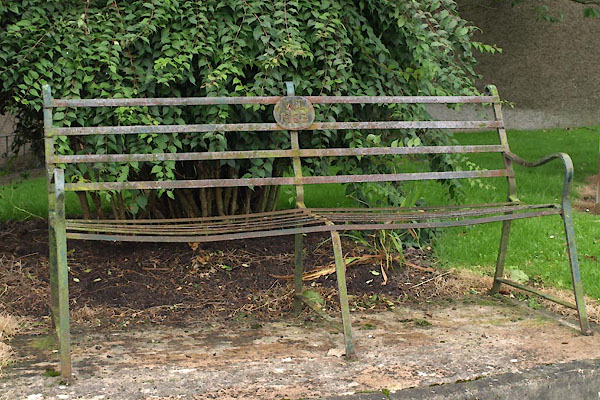
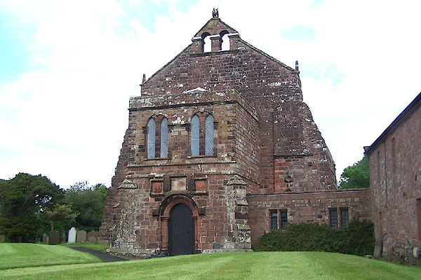 BNV91.jpg (taken 20.6.2007) |
||||
|
|
||||
| evidence:- | old map:- Saxton 1579 placename:- Holme |
|||
| source data:- | Map, hand coloured engraving, Westmorlandiae et Cumberlandiae Comitatus ie Westmorland
and Cumberland, scale about 5 miles to 1 inch, by Christopher Saxton, London, engraved
by Augustinus Ryther, 1576, published 1579-1645.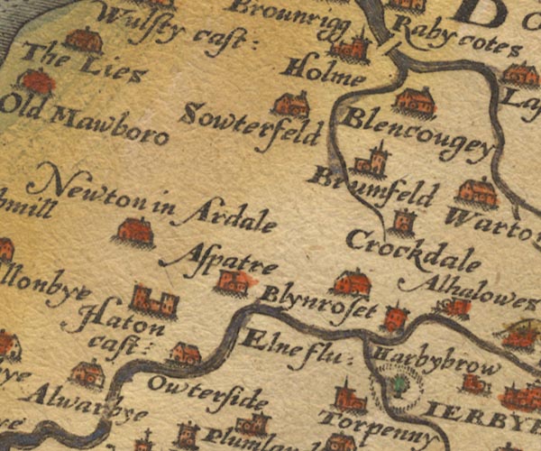 Sax9NY14.jpg Church, symbol for a parish or village, with a parish church. "Holme" item:- private collection : 2 Image © see bottom of page |
|||
|
|
||||
| evidence:- | old map:- Mercator 1595 (edn?) placename:- Holme |
|||
| source data:- | Map, hand coloured engraving, Northumbria, Cumberlandia, et
Dunelmensis Episcopatus, ie Northumberland, Cumberland and
Durham etc, scale about 6.5 miles to 1 inch, by Gerard Mercator,
Duisberg, Germany, about 1595.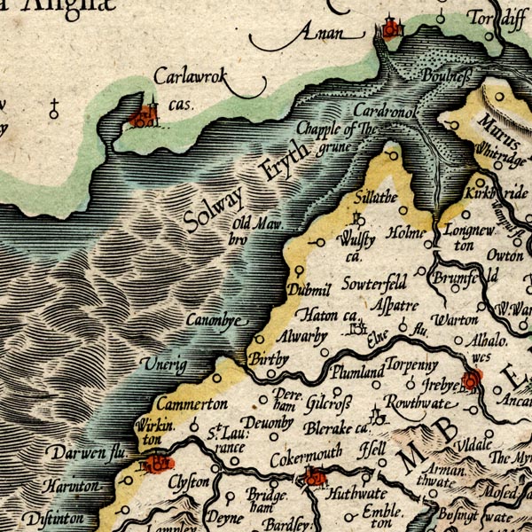 MER8CumB.jpg "Holme" circle item:- JandMN : 169 Image © see bottom of page |
|||
|
|
||||
| evidence:- | old map:- Speed 1611 (Cmd) placename:- Holme |
|||
| source data:- | Map, hand coloured engraving, Cumberland and the Ancient Citie
Carlile Described, scale about 4 miles to 1 inch, by John Speed,
1610, published by J Sudbury and George Humble, Popes Head
Alley, London, 1611-12.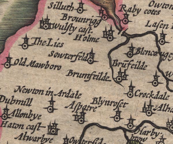 SP11NY14.jpg "Holme" circle, building, tower item:- private collection : 16 Image © see bottom of page |
|||
|
|
||||
| evidence:- | old map:- Seller 1694 (Cmd) placename:- Holme |
|||
| source data:- | Map, uncoloured engraving, Cumberland, scale about 12 miles to 1
inch, by John Seller, 1694. click to enlarge click to enlargeSEL9.jpg "Holme" circle, italic lowercase text; settlement or house item:- Dove Cottage : 2007.38.89 Image © see bottom of page |
|||
|
|
||||
| evidence:- | probably old map:- Morden 1695 (EW) placename:- Holm |
|||
| source data:- | Map, hand coloured engraving, England, including Wales, scale
about 27 miles to 1 inch, by Robert Morden, published by Abel
Swale Awnsham and John Churchil, London, about 1695. click to enlarge click to enlargeMRD3Cm.jpg "Holm" circle; village or town item:- JandMN : 339 Image © see bottom of page |
|||
|
|
||||
| evidence:- | old map:- Morden 1695 (Cmd) placename:- Holm Cultrum |
|||
| source data:- | Map, uncoloured engraving, Cumberland, scale about 4 miles to 1
inch, by Robert Morden, 1695, published by Abel Swale, the
Unicorn, St Paul's Churchyard, Awnsham, and John Churchill, the
Black Swan, Paternoster Row, London, 1695-1715.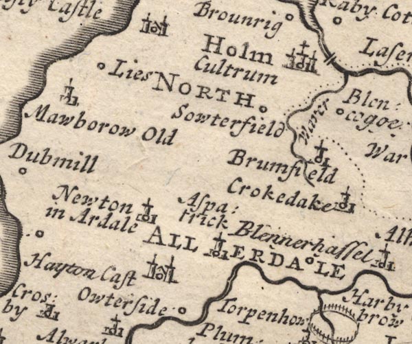 MD12NY14.jpg "Holm Cultrum" Circle, buildings, towers, with a cross; the first word upright, the second italic. item:- JandMN : 90 Image © see bottom of page |
|||
|
|
||||
| evidence:- | old map:- Badeslade 1742 placename:- Holm |
|||
| source data:- | Map, uncoloured engraving, A Map of Cumberland North from
London, scale about 11 miles to 1 inch, with descriptive text,
by Thomas Badeslade, London, engraved and published by William
Henry Toms, Union Court, Holborn, London, 1742. click to enlarge click to enlargeBD10.jpg "Holm" circle, tower/s, upright lowercase text; town item:- JandMN : 115 Image © see bottom of page |
|||
|
|
||||
| evidence:- | probably old map:- Bickham 1753-54 (Cmd) placename:- Holm |
|||
| source data:- | Map, uncoloured engraving, perspective map, Map of Cumberland
North from London, by George Bickham, James Street, Bunhill
Fields, London, 1753, published by F Jollie and Sons, Carlisle,
Cumberland, 1811. click to enlarge click to enlargeJL05.jpg "Holm" view (sort of) item:- Carlisle Library : 4.2 Image © Carlisle Library |
|||
|
|
||||
| evidence:- | old map:- Bowen and Kitchin 1760 placename:- Holme Cultraim |
|||
| source data:- | Map, hand coloured engraving, A New Map of the Counties of
Cumberland and Westmoreland Divided into their Respective Wards,
scale about 4 miles to 1 inch, by Emanuel Bowen and Thomas
Kitchin et al, published by T Bowles, Robert Sayer, and John
Bowles, London, 1760.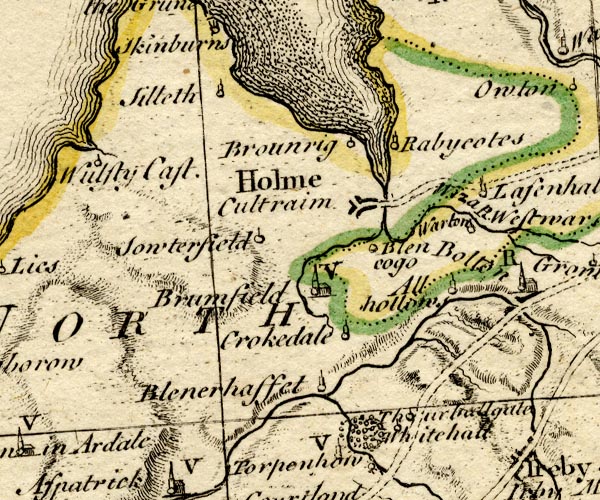 BO18NY14.jpg "Holme Cultraim" blocks, town, at end of road item:- Armitt Library : 2008.14.10 Image © see bottom of page |
|||
|
|
||||
| evidence:- | old map:- Donald 1774 (Cmd) placename:- Abbey Holm |
|||
| source data:- | Map, hand coloured engraving, 3x2 sheets, The County of Cumberland, scale about 1
inch to 1 mile, by Thomas Donald, engraved and published by Joseph Hodskinson, 29
Arundel Street, Strand, London, 1774.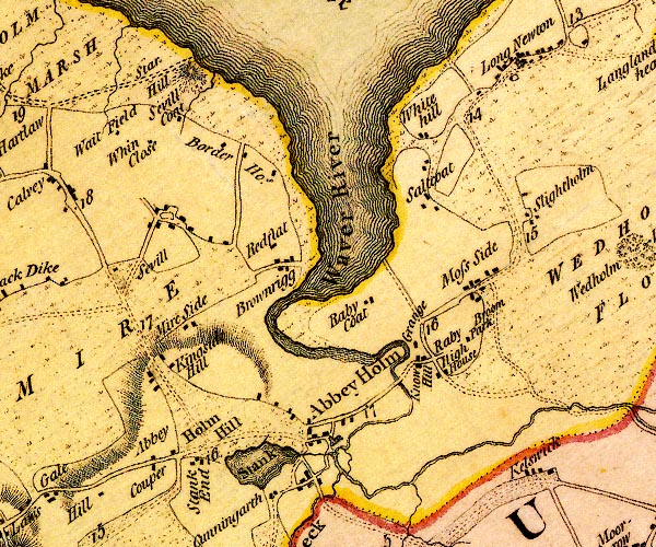 D4NY15SE.jpg "Abbey Holm" blocks, and usually a church, labelled in upright lowercase; a village item:- Carlisle Library : Map 2 Image © Carlisle Library |
|||
|
|
||||
| evidence:- | old map:- Donald 1774 (Cmd) placename:- Abbey Holm |
|||
| source data:- | Map, hand coloured engraving, 3x2 sheets, The County of Cumberland, scale about 1
inch to 1 mile, by Thomas Donald, engraved and published by Joseph Hodskinson, 29
Arundel Street, Strand, London, 1774.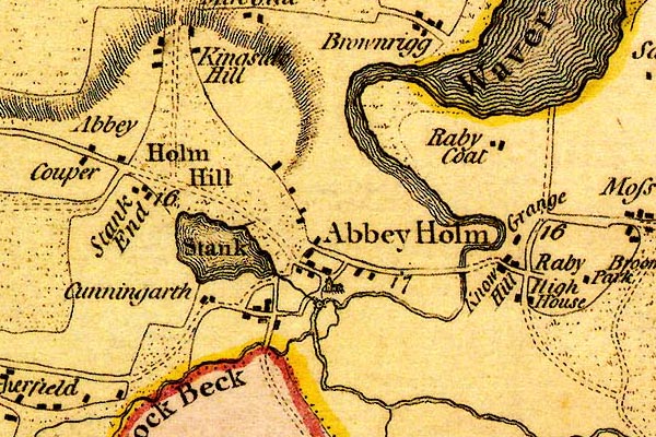 DN04AbTw.jpg "Abbey Holm" blocks, and usually a church, labelled in upright lowercase; a village item:- Carlisle Library : Map 2 Image © Carlisle Library |
|||
|
|
||||
| evidence:- | old map:- Pennant 1777 placename:- Holm |
|||
| source data:- | Map, hand coloured engraving, A Map of Scotland, Hebrides and
Part of England, drawn for Thomas Pennant, engraved by J Bayly,
published by Benjamin White, London, 1777. click to enlarge click to enlargePEN1Cm.jpg "Holm" circle; buildings, village, etc item:- private collection : 66 Image © see bottom of page |
|||
|
|
||||
| evidence:- | old map:- Bailey 1797 placename:- Holm Abbey |
|||
| source data:- | Map, soil etc, uncoloured engraving, Cumberland, scale about 21
miles to 1 inch, by J Bailey, engraved by Neele, Strand,
published by Messrs Robinson, Paternoster Row and G Nicol, Pall
Mall, London, 1797. click to enlarge click to enlargeBY04.jpg "Holm Abbey" no symbol item:- Armitt Library : A680.2 Image © see bottom of page |
|||
|
|
||||
| evidence:- | road book:- Cary 1798 (2nd edn 1802) placename:- Abbey Holme |
|||
| source data:- | Road book, itineraries, Cary's New Itinerary, by John Cary, 181
Strand, London, 2nd edn 1802. goto source goto source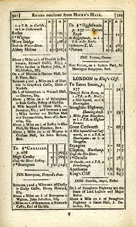 click to enlarge click to enlargeC38321.jpg page 321-322 "Abbey Holme" item:- JandMN : 228.1 Image © see bottom of page |
|||
|
|
||||
| evidence:- | old map:- Cooke 1802 placename:- Holm Abbey |
|||
| source data:- | Map, Cumberland, scale about 15.5 miles to 1 inch, by George
Cooke, 1802, bound in Gray's New Book of Roads, 1824, published
by Sherwood, Jones and Co, Paternoster Road, London, 1824. click to enlarge click to enlargeGRA1Cd.jpg "Holm Abbey / 308" blocks, upright lowercase text; town, distance from London item:- Hampshire Museums : FA2000.62.2 Image © see bottom of page |
|||
|
|
||||
| evidence:- | old map:- Laurie and Whittle 1806 placename:- Abbey Holme |
|||
| source data:- | Road map, Completion of the Roads to the Lakes, scale about 10
miles to 1 inch, by Nathaniel Coltman? 1806, published by Robert
H Laurie, 53 Fleet Street, London, 1834. click to enlarge click to enlargeLw18.jpg "Abbey Holme 310½" village or other place; distance from London item:- private collection : 18.18 Image © see bottom of page |
|||
|
|
||||
| evidence:- | old text:- Capper 1808 placename:- Abbey Holm placename:- Holm Coultram item:- population; market |
|||
| source data:- | Gazetteer, A Topographical Dictionary of the United Kingdom,
compiled by Benjamin Pitts Capper, published by Richard
Phillips, Bridge Street, Blackfriars, London, 1808; published
1808-29. goto source "..." "ABBEY-HOLM, or HOLM-CULTRAM, a parish and market-town in the division of Allerdale ward, Cumberland, 4 miles from Wigton, and 309 from London; containing 428 houses and 2187 inhabitants, of whom 250 were returned employed in trade. The parish is divided into four townships, was formerly of great repute, and had a stately abbey, founded by David I. king of Scotland, who resided chiefly in Cumberland. The church is dedicated to St. Mary, and is a vicarage, value, 6l. 13s. 4d. Patron, the University of Oxford. The town is pleasantly situated on the river Waver, near Solway Frith. About 5 miles distant from the sea-shore are the vestiges of an ancient castle, built by the abbots of Holm-Cultram, for securing their books and charters from the depredations of the Scots. Here formerly was a good market on Saturday, now almost in disuse. Houseman's Description of Cumberland." "..." |
|||
|
|
||||
| evidence:- | probably old map:- Cooper 1808 placename:- Holm Cultram |
|||
| source data:- | Map, uncoloured engraving, Cumberland, scale about 10.5 miles to
1 inch, drawn and engraved by Cooper, published by R Phillips,
Bridge Street, Blackfriars, London, 1808. click to enlarge click to enlargeCOP3.jpg "Holm Cultram" circle; village or hamlet item:- JandMN : 86 Image © see bottom of page |
|||
|
|
||||
| evidence:- | old map:- Wallis 1810 (Cmd) placename:- Abbey Holme |
|||
| source data:- | Road map, hand coloured engraving, Cumberland, scale about 16
miles to 1 inch, by James Wallis, 77 Berwick Stree, Soho,
London, 1810. click to enlarge click to enlargeWL13.jpg "Abbey Holme / 305" town; distance from London item:- Dove Cottage : 2009.81.10 Image © see bottom of page |
|||
|
|
||||
| evidence:- | old map:- Hall 1820 (Cmd) placename:- Holme Coultram |
|||
| source data:- | Map, hand coloured engraving, Cumberland, scale about 21 miles
to 1 inch, engraved by Sidney Hall, published by S Leigh, 18
Strand, London, 1820-31. click to enlarge click to enlargeHA14.jpg "Holme Coultram" circle, italic lowercase text; settlement item:- JandMN : 91 Image © see bottom of page |
|||
|
|
||||
| evidence:- | old map:- Perrot 1823 placename:- Holm |
|||
| source data:- | Map, hand coloured engraving, Cumberland and Westmoreland ie
Westmorland, scale about 38 miles to 1 inch, by Aristide Michel
Perrot, engraved by Migneret, 1823, published by Etienne Ledoux,
9 Rue Guenegaud, Paris, France, 1824-48. click to enlarge click to enlargePER2.jpg "Holm" circle; town item:- Dove Cottage : 2007.38.45 Image © see bottom of page |
|||
|
|
||||
| evidence:- | presumably old map:- Ford 1839 map placename:- Abbey Holme |
|||
| source data:- | Map, uncoloured engraving, Map of the Lake District of
Cumberland, Westmoreland and Lancashire, scale about 3.5 miles
to 1 inch, published by Charles Thurnam, Carlisle, and by R
Groombridge, 5 Paternoster Row, London, 3rd edn 1843.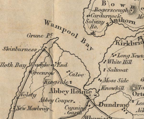 FD02NY15.jpg "Abbey Holme" item:- JandMN : 100.1 Image © see bottom of page |
|||
|
|
||||
| evidence:- | old map:- Garnett 1850s-60s H placename:- Abbeyholme |
|||
| source data:- | Map of the English Lakes, in Cumberland, Westmorland and
Lancashire, scale about 3.5 miles to 1 inch, published by John
Garnett, Windermere, Westmorland, 1850s-60s.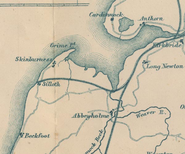 GAR2NY15.jpg "Abbeyholme" blocks, settlement item:- JandMN : 82.1 Image © see bottom of page |
|||
|
|
||||
| evidence:- | old map:- Post Office 1850s-1900s placename:- Abbey Town |
|||
| source data:- | Post road maps, General Post Office Circulation Map for England
and Wales, for the General Post Office, London, 1850s-1900s. click to enlarge click to enlargePF10Cm.jpg "Abbey Town" map date 1892 |
|||
|
|
||||
| evidence:- | old map:- Post Office 1850s-1900s placename:- Abbey Town |
|||
| source data:- | Post road maps, General Post Office Circulation Map for England
and Wales, for the General Post Office, London, 1850s-1900s. click to enlarge click to enlargePOF2Cm.jpg "Abbey Town" map date 1890 |
|||
|
|
||||
| evidence:- | old map:- Post Office 1850s-1900s placename:- Abbey Town |
|||
| source data:- | Post road maps, General Post Office Circulation Map for England
and Wales, for the General Post Office, London, 1850s-1900s. click to enlarge click to enlargePOF8Cm.jpg "Abbey Town / Stn." map date 1873 |
|||
|
|
||||
| evidence:- | old map:- Post Office 1850s-1900s placename:- Abbey Town |
|||
| source data:- | Post road maps, General Post Office Circulation Map for England
and Wales, for the General Post Office, London, 1850s-1900s.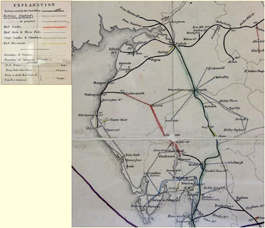 click to enlarge click to enlargePOF9Cm.jpg "Abbey Town / Stn." map date 1863 |
|||
|
|
||||
| :- |
images courtesy of the British Postal Museum and Hampshire CC Museums |
|||
|
|
||||
| places:- |
|
|||
|
||||
|
||||
|
||||
|
||||
|
||||
|
||||
|
||||
|
||||
|
||||
|
||||
|
||||
|
||||
|
||||
|
||||
|
||||
|
||||
|
||||
|
||||
|
||||
|
||||
|
||||
Lakes Guides menu.