Old Cumbria Gazetteer
 |
 |
|
||
| road, Kendal to Appleby | ||||
| Kendal to Appleby | ||||
| Appleby to Kendal | ||||
| civil parish:- | Kendal (formerly Westmorland) | |||
| civil parish:- | Appleby-in-Westmorland (formerly Westmorland) | |||
| county:- | Cumbria | |||
| locality type:- | road route | |||
|
|
||||
| route parts:- |  Kendal to Tebay Tebay to Appleby Kendal to Tebay Tebay to Appleby |
|||
|
|
||||
| evidence:- | old map:- Speed 1611 placename:- |
|||
| source data:- | Map, hand coloured engraving, The Countie Westmorland and
Kendale the Cheif Towne, scale about 2.5 miles to 1 inch, by
John Speed, 1610, published by George Humble, Popes Head Alley,
London, 1611-12.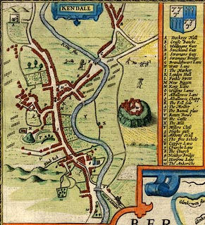 click to enlarge click to enlargeSP14Mk.jpg road NE from Cross Bank ie Longpool item:- Armitt Library : 2008.14.5 Image © see bottom of page |
|||
|
|
||||
| evidence:- | old map:- Ogilby 1675 (plate 38) |
|||
| source data:- | Road strip map, hand coloured engraving, continuation of the
Road from London to Carlisle, scale about 1 inch to 1 mile, by
John Ogilby, London, 1675.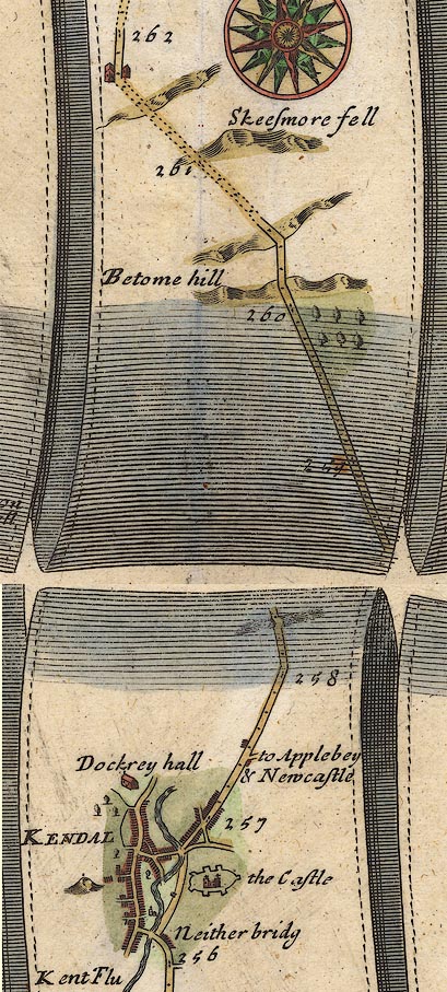 OG38m257.jpg In mile 257, Westmoreland. Turning right:- "to Applebey &Newcastle" Houses drawn at the junction. item:- JandMN : 21 Image © see bottom of page |
|||
|
|
||||
| evidence:- | old map:- Jefferys 1770 |
|||
| source data:- | Map, 4 sheets, The County of Westmoreland, scale 1 inch to 1
mile, surveyed 1768, and engraved and published by Thomas
Jefferys, London, 1770. J55192Z.jpg road item:- National Library of Scotland : EME.s.47 Image © National Library of Scotland |
|||
|
|
||||
| evidence:- | old map:- Jefferys 1770 (Wmd) |
|||
| source data:- | Map, 4 sheets, The County of Westmoreland, scale 1 inch to 1
mile, surveyed 1768, and engraved and published by Thomas
Jefferys, London, 1770.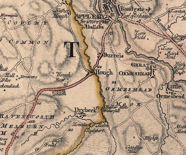 J5NY61NE.jpg 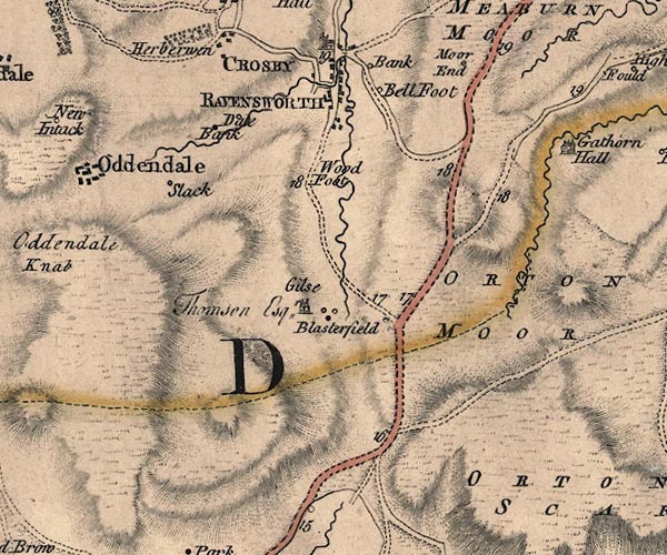 J5NY61SW.jpg 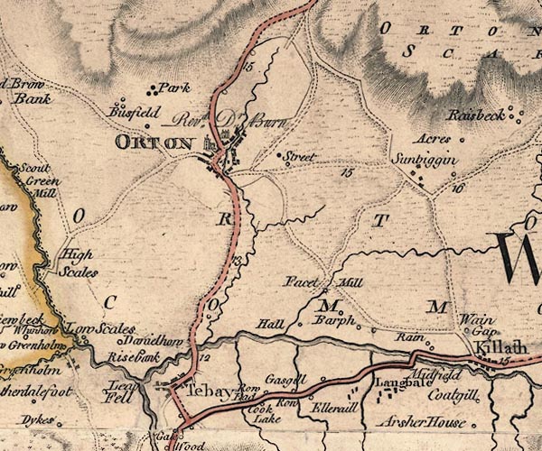 J5NY60NW.jpg 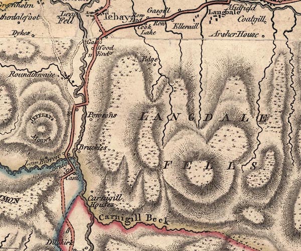 J5NY60SW.jpg 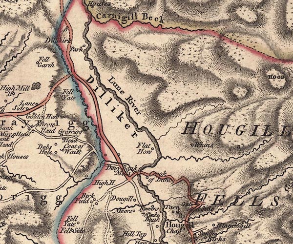 J5SD69NW.jpg 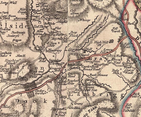 J5SD59NE.jpg  J5SD59SW.jpg double line; road, bold, main road, with mile numbers item:- National Library of Scotland : EME.s.47 Images © National Library of Scotland |
|||
|
|
||||
| evidence:- | road map:- Cary 1790 (Wmd/edn 1792) |
|||
| source data:- | Road map, hand coloured engraving, Westmoreland, scale about
11.5 miles to 1 inch, by John Cary, 181 Strand, London, 1790,
edn 1792. click to enlarge click to enlargeCY16.jpg double line, with road distances from Kendal to Tebay item:- JandMN : 44 Image © see bottom of page |
|||
|
|
||||
| evidence:- | road book:- Cary 1798 (2nd edn 1802) |
|||
| source data:- | Road book, itineraries, Cary's New Itinerary, by John Cary, 181
Strand, London, 2nd edn 1802. goto source goto source click to enlarge click to enlargeC38267.jpg page 267-268 "At Kendal, on r. T.Rs. to Sedbergh, Kirkby Stephen, and Appleby ..." goto source click to enlarge click to enlargeC38281.jpg page 281-282 "At Appleby on r. a T.R. to Kendal." goto source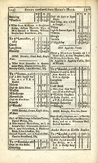 click to enlarge click to enlargeC38315.jpg page 315-316 described and noted:- "Between 11 and 12 Miles from Kendal, on l. a T.R. to Appleby." item:- JandMN : 228.1 Image © see bottom of page |
|||
|
|
||||
| evidence:- | old map:- Laurie and Whittle 1806 |
|||
| source data:- | Road map, Continuation of the Roads to Glasgow and Edinburgh,
scale about 10 miles to 1 inch, by Nathaniel Coltman? 1806,
published by Robert H Laurie, 53 Fleet Street, London, 1834. click to enlarge click to enlargeLw21.jpg light line; 'Other Direct Roads from LONDON' item:- private collection : 18.21 Image © see bottom of page |
|||
|
|
||||
| evidence:- | gradient diagram:- Gall and Inglis 1890s-1900s (Roads) |
|||
| source data:- | Contour Road Book of England, Northern Division, by Harry R G Inglis, published by
Gall and Inglis, 25 Paternoster Square, London and Edinburgh, 1898.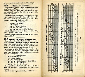 click to enlarge click to enlargeIG5192.jpg Itinerary, with gradient diagram, route 192, Kendal to Appleby and route 193, Kendal to Kirkby Stephen, etc, Westmorland and Durham, 1898. item:- JandMN : 763.20 Image © see bottom of page |
|||
|
|
||||
| Act of Parliament |
||||
|
|
||||
| places:- |
|
|||
|
||||
|
||||
|
||||
Lakes Guides menu.