 Old Cumbria Gazetteer
 |
 |
|
|
| road, Bampton to Askham | |||
| Bampton to Askham | |||
| Askham to Bampton | |||
| civil parish:- | Bampton (formerly Westmorland) | ||
| civil parish:- | Askham (formerly Westmorland) | ||
| county:- | Cumbria | ||
| locality type:- | route | ||
| 10Km square:- | NY51 | ||
| 10Km square:- | NY52 | ||
|
|
|||
| evidence:- | old map:- Jefferys 1770 (Wmd) |
||
| source data:- | Map, 4 sheets, The County of Westmoreland, scale 1 inch to 1
mile, surveyed 1768, and engraved and published by Thomas
Jefferys, London, 1770.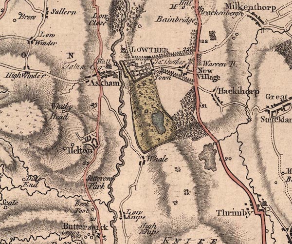 J5NY52SW.jpg 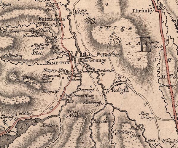 J5NY51NW.jpg double line; road, with mile numbers item:- National Library of Scotland : EME.s.47 Images © National Library of Scotland |
||
|
|
|||
| evidence:- | gradient diagram:- Gall and Inglis 1890s-1900s (Roads) |
||
| source data:- | Contour Road Book of England, Northern Division, by Harry R G Inglis, published by
Gall and Inglis, 25 Paternoster Square, London and Edinburgh, 1898.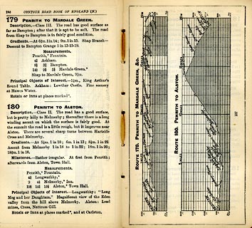 click to enlarge click to enlargeIG5179.jpg Itinerary, with gradient diagram, route 179, Penrith to Mardale Green, and route 180, Penrith to Alston, Westmorland and Cumberland, 1898. item:- JandMN : 763.15 Image © see bottom of page |
||
|
|
|||
| places:- |  Bampton Helton, Askham Askham Bampton Helton, Askham Askham |
||
|
|
|||
Lakes Guides menu.