 Old Cumbria Gazetteer
 |
 |
|
||
| sands road, Duddon Sands | ||||
| Duddon Sands road | ||||
| site name:- | Duddon Estuary | |||
| civil parish:- | Askam and Ireleth (formerly Lancashire) | |||
| civil parish:- | Kirkby Ireleth (formerly Lancashire) | |||
| civil parish:- | Millom (formerly Cumberland) | |||
| county:- | Cumbria | |||
| locality type:- | sands road | |||
| locality type:- | route | |||
| 10Km square:- | SD27 | |||
| 10Km square:- | SD17 | |||
|
|
||||
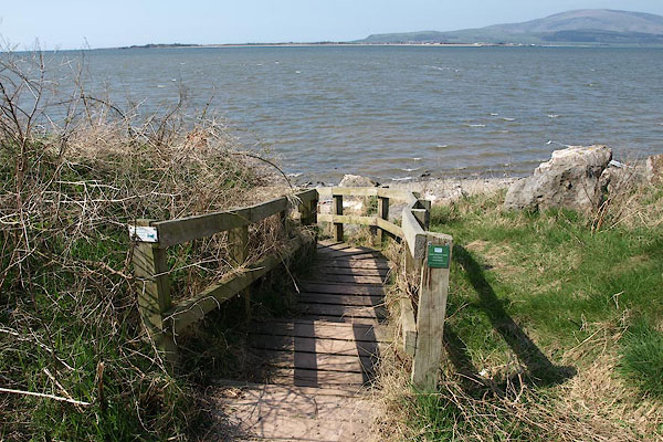 BSM90.jpg Askam end; tide on the flood. (taken 16.4.2010) 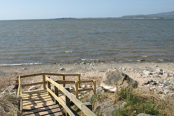 BSM91.jpg Askam end; tide on the flood. (taken 16.4.2010) |
||||
|
|
||||
| evidence:- | old map:- Bowen and Kitchin 1760 |
|||
| source data:- | Map, hand coloured engraving, A New Map of the Counties of
Cumberland and Westmoreland Divided into their Respective Wards,
scale about 4 miles to 1 inch, by Emanuel Bowen and Thomas
Kitchin et al, published by T Bowles, Robert Sayer, and John
Bowles, London, 1760.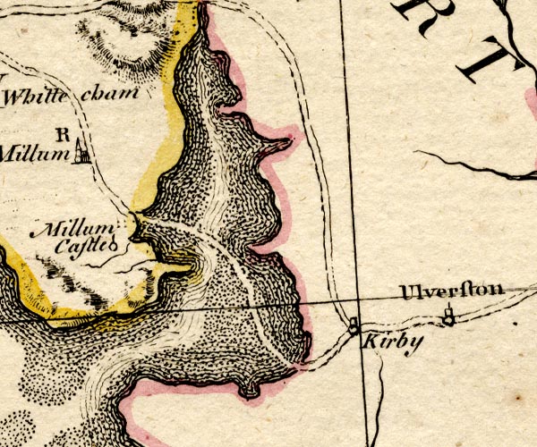 BO18SD17.jpg double line, dotted item:- Armitt Library : 2008.14.10 Image © see bottom of page |
|||
|
|
||||
| evidence:- | old text:- Camden 1789 (Gough Additions) item:- sands guide |
|||
| source data:- | Book, Britannia, or A Chorographical Description of the Flourishing Kingdoms of England,
Scotland, and Ireland, by William Camden, 1586, translated from the 1607 Latin edition
by Richard Gough, published London, 1789. goto source goto sourcePage 142:- "..." "The three sands mentioned by Mr. Camden are very dangerous to travellers by the tides and the many quicksands. There is a guide on horseback appointed to Ken or Lancaster sand ... but to Dudden, which are most dangerous, none; ..." |
|||
|
|
||||
| evidence:- | road map:- Cary 1790 (Lan/edn 1792) |
|||
| source data:- | Road map, hand coloured engraving, Lancashire, scale about 18
miles to 1 inch, by John Cary, 181 Strand, London, 1790, edn
1792.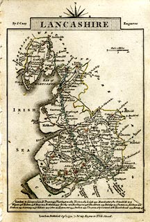 click to enlarge click to enlargeCY46.jpg "from Ravenglass" double line item:- JandMN : 418 Image © see bottom of page |
|||
|
|
||||
| evidence:- | road map:- Cary 1790 (Cmd/edn 1789) |
|||
| source data:- | Road map, hand coloured engraving, Cumberland, scale about 15
miles to 1 inch, by John Cary, 181 Strand, London, 1790, edn
1789.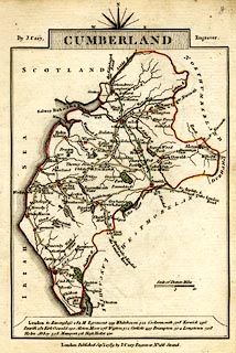 click to enlarge click to enlargeCY47.jpg from Ulverston double line item:- JandMN : 419 Image © see bottom of page |
|||
|
|
||||
| evidence:- | old map:- Cooke 1802 |
|||
| source data:- | Map, Cumberland, scale about 15.5 miles to 1 inch, by George
Cooke, 1802, bound in Gray's New Book of Roads, 1824, published
by Sherwood, Jones and Co, Paternoster Road, London, 1824. click to enlarge click to enlargeGRA1Cd.jpg double line, dotted, across Duddon Sands item:- Hampshire Museums : FA2000.62.2 Image © see bottom of page |
|||
|
|
||||
| evidence:- | old map:- Cooke 1802 |
|||
| source data:- | Map, Lancashire, scale about 18 miles to 1 inch, by George
Cooke, 1802, bound in Gray's New Book of Roads, 1824, published
by Sherwood, Jones and Co, Paternoster Road, London, 1824.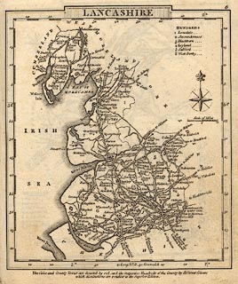 click to enlarge click to enlargeGRA1La.jpg "from Ravenglass" double line, light dark solid; road, across Duddon Sands item:- Hampshire Museums : FA2000.62.6 Image © see bottom of page |
|||
|
|
||||
| evidence:- | old map:- Otley 1818 |
|||
| source data:- | Map, uncoloured engraving, The District of the Lakes,
Cumberland, Westmorland, and Lancashire, scale about 4 miles to
1 inch, by Jonathan Otley, 1818, engraved by J and G Menzies,
Edinburgh, Scotland, published by Jonathan Otley, Keswick,
Cumberland, et al, 1833.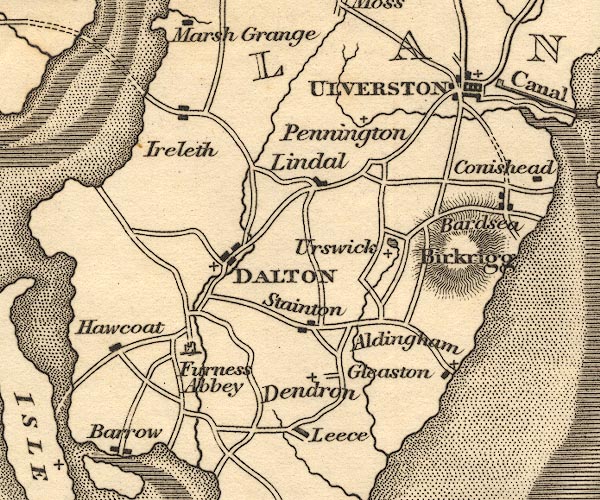 OT02SD27.jpg Drawn by a double dotted line across the estuary. item:- JandMN : 48.1 Image © see bottom of page |
|||
|
|
||||
| evidence:- | old map:- Ford 1839 map |
|||
| source data:- | Map, uncoloured engraving, Map of the Lake District of
Cumberland, Westmoreland and Lancashire, scale about 3.5 miles
to 1 inch, published by Charles Thurnam, Carlisle, and by R
Groombridge, 5 Paternoster Row, London, 3rd edn 1843.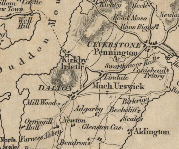 FD02SD27.jpg Dotted line from Kirkby Ireleth to road to Millom. item:- JandMN : 100.1 Image © see bottom of page |
|||
|
|
||||
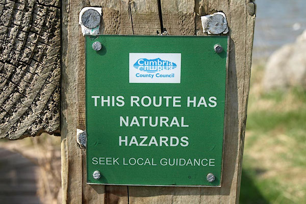 BSM92.jpg Askam end; warning. (taken 16.4.2010) |
||||
|
|
||||
| hearsay:- |
Travellers crossing Duddon Sands came ashore, east, at Gallow Bank, Millom. |
|||
| One local man, Francis Roudley, was a tide walker or tide waiter, he brogged the route
across the sands ie at low water he went out and marked the way with branches stuck
in the sand. |
||||
|
|
||||
| places:- | one of several routes [Askam in Furness, Askam and Ireleth] Gallow Bank, Millom Millom |
|||
|
|
||||
| places:- |
|
|||
|
||||
|
||||
Lakes Guides menu.