 |
 |
   |
|
|
|
Redbank Wood |
| locality:- |
Red Bank |
| locality:- |
Grasmere |
| civil parish:- |
Lakes (formerly Westmorland) |
| county:- |
Cumbria |
| locality type:- |
wood |
| coordinates:- |
NY33800590 |
| 1Km square:- |
NY3305 |
| 10Km square:- |
NY30 |
|
|
| evidence:- |
old map:- OS County Series (Wmd 26 5)
placename:- Redbank Wood
|
| source data:- |
Maps, County Series maps of Great Britain, scales 6 and 25
inches to 1 mile, published by the Ordnance Survey, Southampton,
Hampshire, from about 1863 to 1948.
|
|
|
| evidence:- |
old drawing:-
placename:- Red Bank Wood
|
| source data:- |
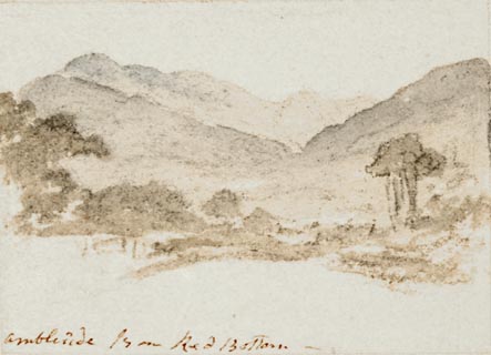
Drawing, Ambleside from Red Bank Wood, Westmorland, by William Havell, 1800s-10s.
 click to enlarge click to enlarge
PR1392.jpg
View of Ambleside from Red Bank Wood. Trees in foreground, hills in background. One
of a set of twenty views of the lake district executed by the artist on one sheet
of paper.
at bottom:- "Ambleside from Red Bank Wood"
item:- Tullie House Museum : 2009.89.36
Image © Tullie House Museum |
|
|


 click to enlarge
 Lakes Guides menu.