 Old Cumbria Gazetteer
 |
 |
|
| mill, Ambleside (2) | ||
| site name:- | Stock Ghyll | |
| Street:- | Rydal Road | |
| locality:- | Ambleside | |
| civil parish:- | Lakes (formerly Westmorland) | |
| county:- | Cumbria | |
| locality type:- | water mill (ex) | |
| locality type:- | mill (ex) | |
| locality type:- | saw mill (ex) | |
| coordinates:- | NY37590464 | |
| 1Km square:- | NY3704 | |
| 10Km square:- | NY30 | |
|
|
||
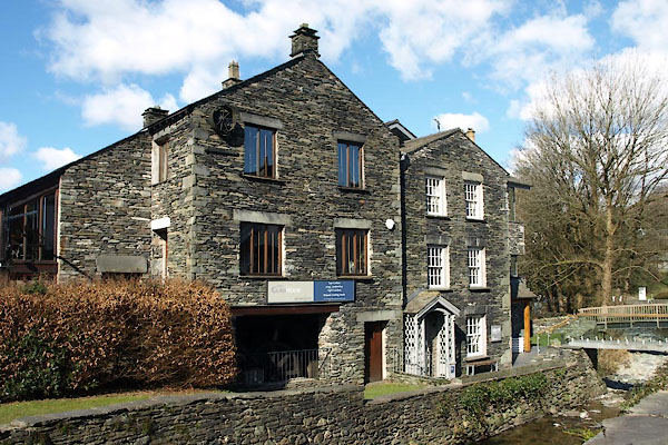 BXZ14.jpg (taken 13.3.2013) 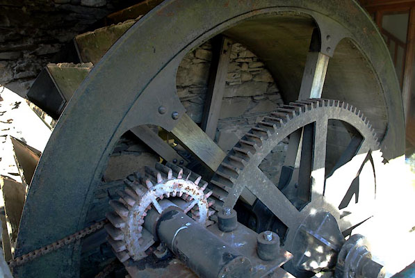 BXZ15.jpg Water wheel. (taken 13.3.2013) |
||
|
|
||
| evidence:- | old map:- OS County Series (Wmd 26 6) |
|
| source data:- | Maps, County Series maps of Great Britain, scales 6 and 25
inches to 1 mile, published by the Ordnance Survey, Southampton,
Hampshire, from about 1863 to 1948. "Saw Mill / sawpits" |
|
|
|
||
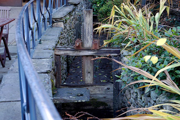 BZS29.jpg Sluice gear in mill lade. (taken 13.3.2013) |
||
|
|
||
| hearsay:- |
Perhaps this is Partridge's Woolen Mill, from before 1454, rebuilt 1795, closed 1844,
then used for storage. |
|
|
|
||
| Kelly, Michelle &Walsh, Deborah: 2015: Mills of Ambleside: Armitt Trust (Ambleside,
Cumbria):: ISBN 0 953944 4 8 |
||
|
|
||
 Lakes Guides menu.