 Old Cumbria Gazetteer
 |
 |
|
|
| road, Kirkby Stephen to Appleby | |||
| Kirkby Stephen to Appleby | |||
| Appleby to Kirkby Stephen | |||
| B6259 | |||
| civil parish:- | Kirkby Stephen (formerly Westmorland) | ||
| civil parish:- | Winton (formerly Westmorland) | ||
| civil parish:- | Musgrave (formerly Westmorland) | ||
| civil parish:- | Warcop (formerly Westmorland) | ||
| civil parish:- | Murton (formerly Westmorland) | ||
| civil parish:- | Appleby-in-Westmorland (formerly Westmorland) | ||
| county:- | Cumbria | ||
| locality type:- | route | ||
| 10Km square:- | NY70 | ||
| 10Km square:- | NY71 | ||
| 10Km square:- | NY61 | ||
| 10Km square:- | NY60 | ||
|
|
|||
| evidence:- | old map:- Bowen and Kitchin 1760 |
||
| source data:- | Map, hand coloured engraving, A New Map of the Counties of
Cumberland and Westmoreland Divided into their Respective Wards,
scale about 4 miles to 1 inch, by Emanuel Bowen and Thomas
Kitchin et al, published by T Bowles, Robert Sayer, and John
Bowles, London, 1760.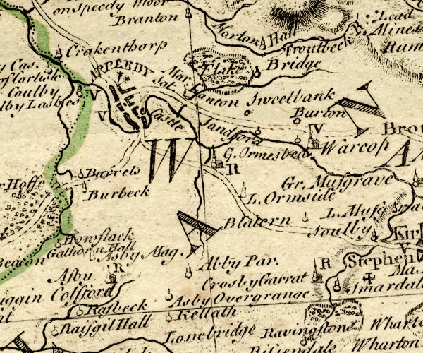 BO18NY61.jpg double line, solid 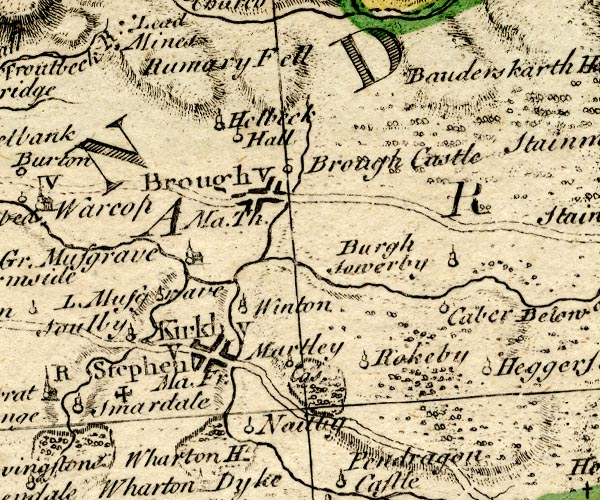 BO18NY71.jpg double line, solid item:- Armitt Library : 2008.14.10 Image © see bottom of page |
||
|
|
|||
| place:- |  Kirkby Stephen Warcop Appleby Kirkby Stephen Warcop Appleby |
||
|
|
|||
Lakes Guides menu.