 Old Cumbria Gazetteer
 |
 |
|
| Low Farm, Lindal in Furness | ||
| Low Farm | ||
| Low House | ||
| Street:- | Green (The) | |
| locality:- | Lindal in Furness | |
| civil parish:- | Lindal and Marton (formerly Lancashire) | |
| county:- | Cumbria | |
| locality type:- | buildings | |
| coordinates:- | SD25027585 | |
| 1Km square:- | SD2575 | |
| 10Km square:- | SD27 | |
| references:- | Listed Buildings 2010 |
|
|
|
||
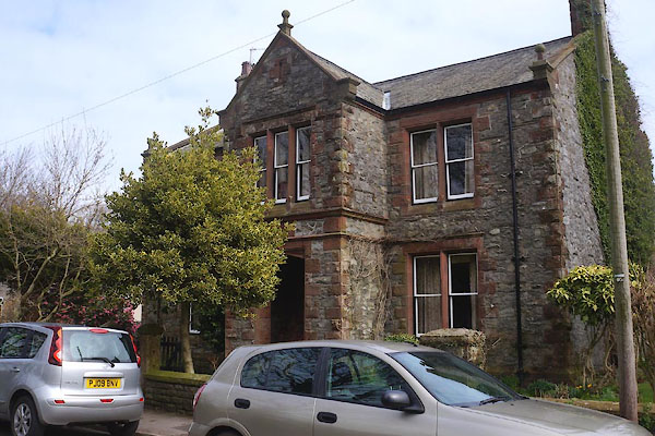 CCR91.jpg (taken 27.3.2015) 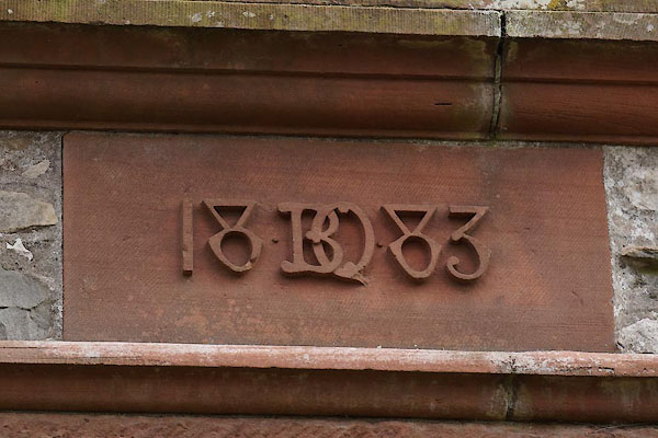 CCR92.jpg Date stone:- "18 BQ 83" (taken 27.3.2015) |
||
| This is probably an 'estate' house, the BQ is seen elsewhere. |
||
|
|
||
| evidence:- | old map:- OS County Series (Lan 16 10) placename:- Low Farm placename:- Farm, Low |
|
| source data:- | Maps, County Series maps of Great Britain, scales 6 and 25
inches to 1 mile, published by the Ordnance Survey, Southampton,
Hampshire, from about 1863 to 1948. |
|
|
|
||
| evidence:- | database:- Listed Buildings 2010 placename:- Low Farmhouse |
|
| source data:- | courtesy of English Heritage "LOW FARMHOUSE / / THE GREEN / DALTON TOWN WITH NEWTON / BARROW IN FURNESS / CUMBRIA / II / 388617 / SD2502375856" |
|
|
|
||
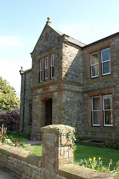 BSM54.jpg (taken 16.4.2010) |
||
|
|
||
 Lakes Guides menu.