 Old Cumbria Gazetteer
 |
 |
|
| Knott House Farm, Grasmere | ||
| Knott House Farm | ||
| locality:- | Grasmere | |
| civil parish:- | Lakes (formerly Westmorland) | |
| county:- | Cumbria | |
| locality type:- | buildings | |
| coordinates:- | NY33950857 | |
| 1Km square:- | NY3308 | |
| 10Km square:- | NY30 | |
| references:- | Listed Buildings 2010 |
|
|
|
||
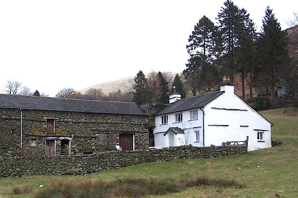 BLP84.jpg (taken 15.2.2006) |
||
|
|
||
| evidence:- | old map:- OS County Series (Wmd 19 13) placename:- Knott Houses |
|
| source data:- | Maps, County Series maps of Great Britain, scales 6 and 25
inches to 1 mile, published by the Ordnance Survey, Southampton,
Hampshire, from about 1863 to 1948. |
|
|
|
||
| evidence:- | old map:- Clarke 1787 map (Ambleside to Keswick) placename:- Knott |
|
| source data:- | Map, A Map of the Roads Lakes etc between Keswick and Ambleside,
scale about 2.5 ins to 1 mile, by James Clarke, engraved by S J
Neele, 352 Strand, published by James Clarke, Penrith,
Cumberland and in London etc, 1787.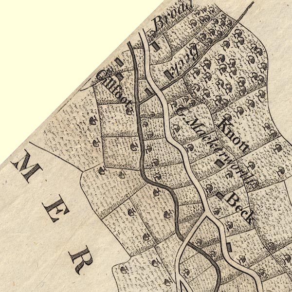 CL9NY30J.jpg "Knott / G. Mackerworth" item:- private collection : 10.9 Image © see bottom of page |
|
|
|
||
| evidence:- | database:- Listed Buildings 2010 placename:- Knott House Farm item:- spice cupboard |
|
| source data:- | courtesy of English Heritage "KNOTT HOUSE FARMHOUSE WITH ADJOINING FARM BUILDING TO NORTH. / / / LAKES / SOUTH LAKELAND / CUMBRIA / II / 452102 / NY3395008578" |
|
|
|
||
 Lakes Guides menu.