 Old Cumbria Gazetteer
 |
 |
|
| Isthmus Bay, Derwent Water | ||
| Isthmus Bay | ||
| site name:- | Derwent Water | |
| civil parish:- | Keswick (formerly Cumberland) | |
| county:- | Cumbria | |
| locality type:- | bay | |
| coordinates:- | NY26022271 (about) | |
| 1Km square:- | NY2622 | |
| 10Km square:- | NY22 | |
|
|
||
| evidence:- | old map:- OS County Series (Cmd 64 6) placename:- Isthmus Bay |
|
| source data:- | Maps, County Series maps of Great Britain, scales 6 and 25
inches to 1 mile, published by the Ordnance Survey, Southampton,
Hampshire, from about 1863 to 1948. |
|
|
|
||
| evidence:- | old map:- Crosthwaite 1783-94 (Der) |
|
| source data:- | Map, uncoloured engraving, An Accurate Map of the Matchless Lake
of Derwent, ie Derwent Water, scale about 3 inches to 1 mile, by
Peter Crosthwaite, Keswick, Cumberland, 1783, version published
1800.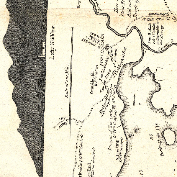 CT2NY22K.jpg item:- Armitt Library : 1959.191.3 Image © see bottom of page |
|
|
|
||
| evidence:- | old map:- Clarke 1787 map (Der) placename:- |
|
| source data:- | Map, uncoloured engraving, Map of Derwentwater and its Environs,
scale about 13 ins to 1 mile, by James Clarke, engraved by S J
Neele, published by James Clarke, Penrith, Cumberland and in
London etc, 1787.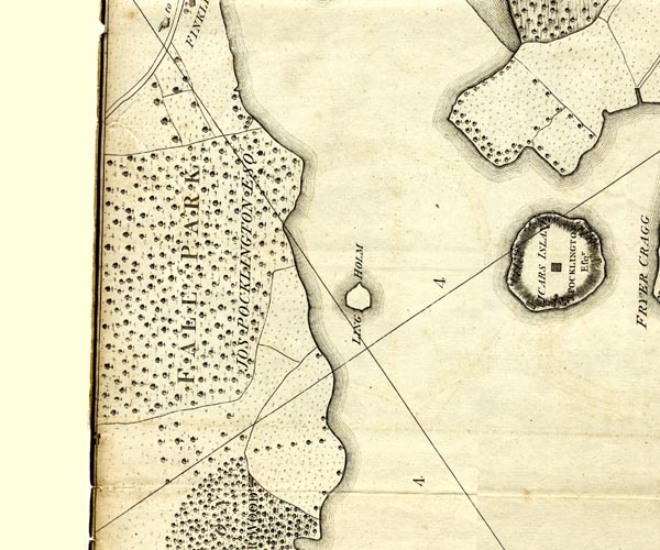 CL152522.jpg bay item:- private collection : 169 Image © see bottom of page |
|
|
|
||
| evidence:- | old print:- Green 1815 item:- sailing boat; boat |
|
| source data:- | Print, coloured aquatint, Derwent Water from Isthmus, Keswick, Cumberland, by William
Green, Ambleside, Westmorland, 1815.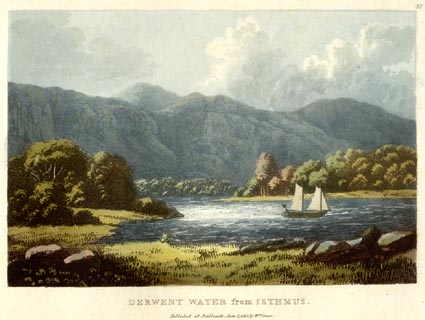 click to enlarge click to enlargeGN0534.jpg Plate 37 in Lake Scenery. printed at upper right:- "37" printed at bottom:- "DERWENT WATER from ISTHMUS. / Published at Ambleside, June 1, 1815, by Wm. Green." item:- Armitt Library : A6646.34 Image © see bottom of page |
|
|
|
||
 Lakes Guides menu.