 Old Cumbria Gazetteer
 |
 |
|
| Punch Bowl, Underbarrow | ||
| Punch Bowl | ||
| Punchbowl | ||
| locality:- | Underbarrow | |
| civil parish:- | Underbarrow and Bradleyfield (formerly Westmorland) | |
| county:- | Cumbria | |
| locality type:- | inn | |
| coordinates:- | SD46819216 | |
| 1Km square:- | SD4692 | |
| 10Km square:- | SD49 | |
|
|
||
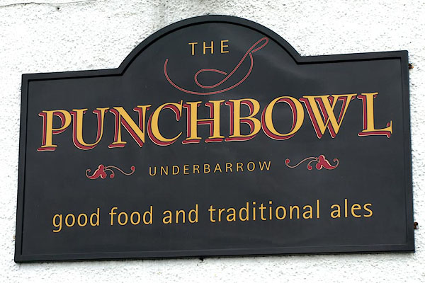 BSL90.jpg Innsign - with a punch bowl and ladle. (taken 9.4.2010) 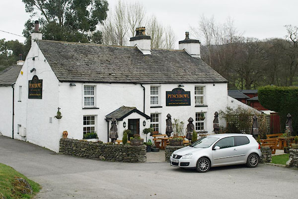 BSL89.jpg (taken 9.4.2010) |
||
|
|
||
| evidence:- | old map:- OS County Series (Wmd 38 6) placename:- Punchbowl |
|
| source data:- | Maps, County Series maps of Great Britain, scales 6 and 25
inches to 1 mile, published by the Ordnance Survey, Southampton,
Hampshire, from about 1863 to 1948. |
|
|
|
||
| evidence:- | old map:- Jefferys 1770 (Wmd) placename:- Punch Bowl |
|
| source data:- | Map, 4 sheets, The County of Westmoreland, scale 1 inch to 1
mile, surveyed 1768, and engraved and published by Thomas
Jefferys, London, 1770.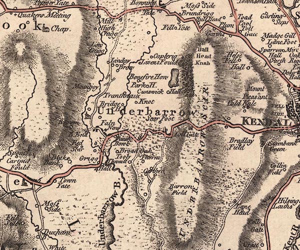 J5SD49SE.jpg "Punch Bowl" inn item:- National Library of Scotland : EME.s.47 Image © National Library of Scotland |
|
|
|
||
 Lakes Guides menu.