 Old Cumbria Gazetteer
 |
 |
|
| Townend Hall, Whitbeck | ||
| Townend Hall | ||
| locality:- | Whitbeck | |
| civil parish:- | Whicham (formerly Cumberland) | |
| county:- | Cumbria | |
| locality type:- | buildings | |
| coordinates:- | SD11988400 | |
| 1Km square:- | SD1184 | |
| 10Km square:- | SD18 | |
|
|
||
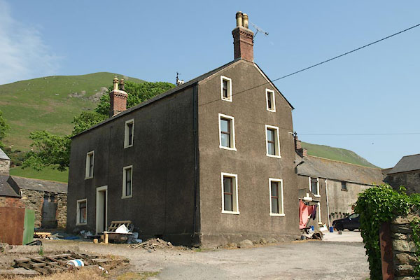 BWP63.jpg (taken 28.5.2012) 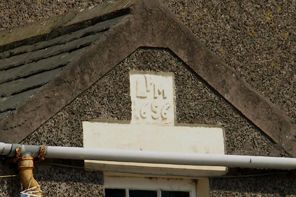 BWP64.jpg Date stone:- "P / L M / 1656" (taken 28.5.2012) |
||
|
|
||
| evidence:- | old map:- OS County Series (Cmd 87 8) placename:- Townend Hall |
|
| source data:- | Maps, County Series maps of Great Britain, scales 6 and 25
inches to 1 mile, published by the Ordnance Survey, Southampton,
Hampshire, from about 1863 to 1948. "Townend Hall" |
|
|
|
||
| evidence:- | database:- Listed Buildings 2010 placename:- Townend Hall item:- date stone (1656) |
|
| source data:- | courtesy of English Heritage "TOWNEND HALL AND ADJOINING OUTBUILDINGS / / A 595 / WHICHAM / COPELAND / CUMBRIA / II / 76380 / SD1199983988" |
|
|
|
||
 Lakes Guides menu.