Old Cumbria Gazetteer
 |
 |
|
||
| included in:- |
 road, Kendal to Hawes road, Kirkby Stephen to Hawes from the Moorcock Inn road, Kendal to Hawes road, Kirkby Stephen to Hawes from the Moorcock Inn
|
|||
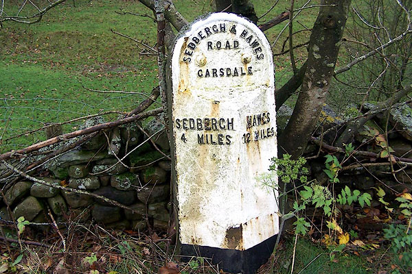
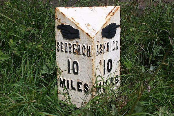
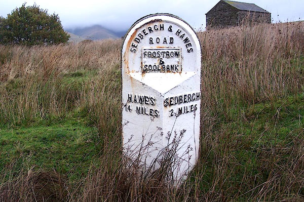
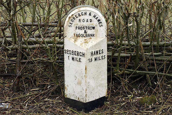
| road, Sedbergh to Hawes | ||||
| Sedbergh to Hawes | ||||
| Hawes to Sedbergh | ||||
| A684 | ||||
| civil parish:- | Sedbergh (formerly Yorkshire) | |||
| civil parish:- | Garsdale (formerly Yorkshire) | |||
| county:- | Cumbria | |||
| locality type:- | road route | |||
| 10Km square:- | SD69 | |||
| 10Km square:- | SD79 | |||
| county:- | North Yorkshire | |||
| locality type:- | road | |||
| locality type:- | route | |||
| 10Km square:- | SD89 | |||
|
|
||||
| evidence:- | old map:- OS County Series (Yrk 65) |
|||
| source data:- | Maps, County Series maps of Great Britain, scales 6 and 25
inches to 1 mile, published by the Ordnance Survey, Southampton,
Hampshire, from about 1863 to 1948. "SEDBERGH AND HAWES TRUST" along road |
|||
|
|
||||
| evidence:- | old map:- Jefferys 1770 (Wmd) |
|||
| source data:- | Map, 4 sheets, The County of Westmoreland, scale 1 inch to 1
mile, surveyed 1768, and engraved and published by Thomas
Jefferys, London, 1770.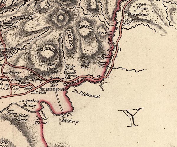 J5SD69SE.jpg "To Richmond" double line; road, but stops before the river where New Bridge is now item:- National Library of Scotland : EME.s.47 Image © National Library of Scotland |
|||
|
|
||||
| evidence:- | road map:- Cary 1790 (Wmd/edn 1792) |
|||
| source data:- | Road map, hand coloured engraving, Westmoreland, scale about
11.5 miles to 1 inch, by John Cary, 181 Strand, London, 1790,
edn 1792.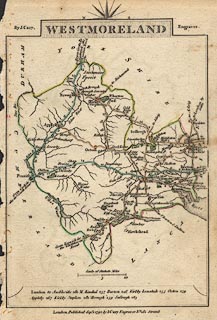 click to enlarge click to enlargeCY16.jpg "to Askrig" double line item:- JandMN : 44 Image © see bottom of page |
|||
|
|
||||
| evidence:- | road book:- Cary 1798 (2nd edn 1802) |
|||
| source data:- | Road book, itineraries, Cary's New Itinerary, by John Cary, 181
Strand, London, 2nd edn 1802. goto source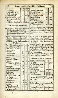 click to enlarge click to enlargeC38317.jpg page 317-318 "At Sedbergh, on r. a T.R. to Askrigg." item:- JandMN : 228.1 Image © see bottom of page |
|||
|
|
||||
| evidence:- | road book:- Cary 1798 (2nd edn 1802) |
|||
| source data:- | Road book, itineraries, Cary's New Itinerary, by John Cary, 181
Strand, London, 2nd edn 1802. goto source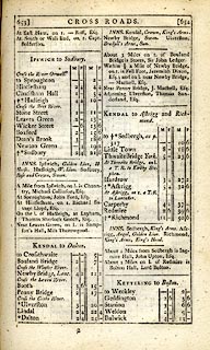 click to enlarge click to enlargeC38653.jpg page 653-654 "KENDAL to Askrigg and Richmond." item:- JandMN : 228.2 Image © see bottom of page |
|||
|
|
||||
| evidence:- | old map:- Cooke 1802 |
|||
| source data:- | Map, West Riding of Yorkshire, ie West Yorkshire, scale about 21
miles to 1 inch, by George Cooke, 1802, bound in Gray's New Book
of Roads, 1824, published by Sherwood, Jones and Co, Paternoster
Road, London, 1824.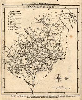 click to enlarge click to enlargeGRA1Wy.jpg "to Askrigg" double line, light dark solid; road item:- Hampshire Museums : FA2000.62.12 Image © see bottom of page |
|||
|
|
||||
| evidence:- | old map:- Laurie and Whittle 1806 |
|||
| source data:- | Road map, Continuation of the Roads to Glasgow and Edinburgh,
scale about 10 miles to 1 inch, by Nathaniel Coltman? 1806,
published by Robert H Laurie, 53 Fleet Street, London, 1834. click to enlarge click to enlargeLw21.jpg bold line; 'Principal Travelling Roads' item:- private collection : 18.21 Image © see bottom of page |
|||
|
|
||||
| evidence:- | old map:- Wallis 1810 (Wmd) |
|||
| source data:- | Road map, Westmoreland, scale about 19 miles to 1 inch, by James
Wallis, 77 Berwick Street, Soho, 1810, published by W Lewis,
Finch Lane, London, 1835? click to enlarge click to enlargeWAL5.jpg "to Askrig" double line, light bold; 'Turnpike Road' item:- JandMN : 63 Image © see bottom of page |
|||
|
|
||||
 Act of Parliament Act of Parliament |
||||
|
|
||||
| evidence:- | old map, old map:- OS County series (Yrk 63) |
|||
| source data:- | "SEDBERGH TRUST" labelled at SD676917 OS County series (Yrk 64) "SEDBERGH TRUST" labelled at SD705908 |
|||
|
|
||||
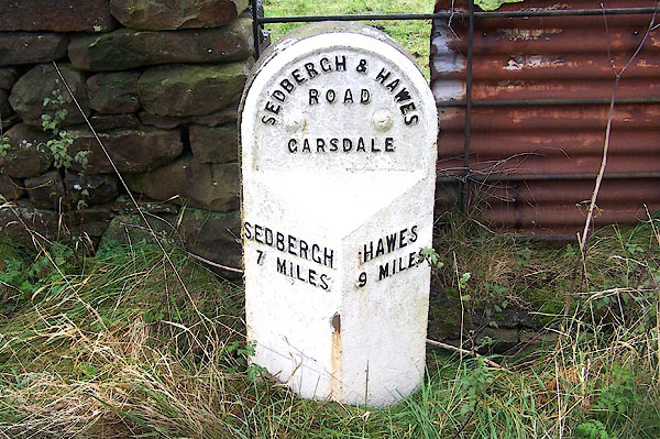
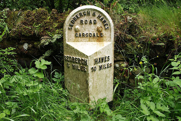
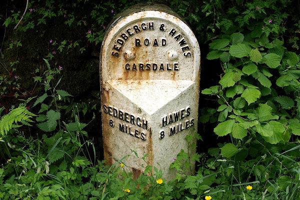
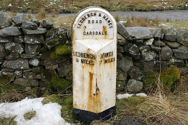
| places:- | Sedbergh Garsdale Head, Garsdale Moorcock Inn, North Yorkshire Hawes, North Yorkshire |
|||
|
|
||||
| places:- |
|
|||
|
||||
|
||||
|
||||
|
||||
|
||||
|
||||
|
||||
|
||||
|
||||
Lakes Guides menu.