 Old Cumbria Gazetteer
 |
 |
|
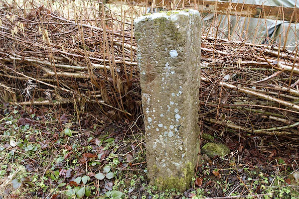
| milestone, Sedbergh (17) | ||
| site name:- | road, Sedbergh to Hawes (?) | |
| civil parish:- | Sedbergh (formerly Yorkshire) | |
| county:- | Cumbria | |
| locality type:- | milestone | |
| coordinates:- | SD67099174 | |
| 1Km square:- | SD6791 | |
| 10Km square:- | SD69 | |
|
|
||
 BSF08.jpg (taken 26.2.2010) 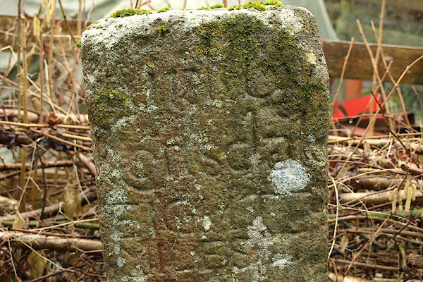 BSF07.jpg Difficult to read, perhaps:- "[ oute] / Garsdale / EIGHT / MILES" The a inside the G. (taken 26.2.2010) |
||
|
|
||
| evidence:- | database:- Listed Buildings 2010 |
|
| source data:- | courtesy of English Heritage "MILESTONE ON CORNER OF GARSDALE ROAD AND FROSTROW LANE ON SOUTH SIDE OF GARSDALE ROAD 100 YARDS FROM LOW MOSS / / / SEDBERGH / SOUTH LAKELAND / CUMBRIA / II / 484567 / SD6710091741" |
|
| source data:- | courtesy of English Heritage "Milestone. Probably C17. Sandstone. Roughly-hewn square shaft approx. one metre high, with crudely incised lettering at the top (partially obliterated), probably: "Kikby Stephen EIGHTEEN MILES" and "Garsdale". Similar to milestone on east side of Howgill Lane opposite junction with Slacks Lane (qv). FORMERLY KNOWN AS: Milestone on corner of Garsdale Road and Frostrow Lane on south side of Garsdale Road, 100 yards from Low Moss." |
|
|
|
||
| evidence:- | old map:- OS County series (Yrk 63) |
|
| source data:- | "Old Mile Stone" |
|
|
|
||
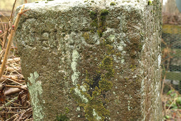 BSF09.jpg Inscribed:- "Garsdale" (taken 26.2.2010) |
||
|
|
||
 Lakes Guides menu.