Old Cumbria Gazetteer
 |
 |
|
||
| road, Carlisle to Wigton | ||||
| Carlisle to Wigton | ||||
| Wigton to Carlisle | ||||
| civil parish:- | Carlisle (formerly Cumberland) | |||
| civil parish:- | Wigton (formerly Cumberland) | |||
| civil parish:- | Thursby (formerly Cumberland) | |||
| civil parish:- | Woodside (formerly Cumberland) | |||
| civil parish:- | Carlisle (formerly Cumberland) | |||
| county:- | Cumbria | |||
| locality type:- | route | |||
|
|
||||
| route parts:- |  Carlisle to Cockermouth as far as Thursby Thursby to Wigton Carlisle to Cockermouth as far as Thursby Thursby to Wigton |
|||
|
|
||||
| evidence:- | old map:- Donald 1774 (Cmd) |
|||
| source data:- | Map, hand coloured engraving, 3x2 sheets, The County of Cumberland, scale about 1
inch to 1 mile, by Thomas Donald, engraved and published by Joseph Hodskinson, 29
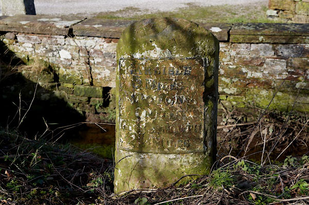
Arundel Street, Strand, London, 1774. double line, narrower, solid or dotted with a dot and number at 1 mile intervals; road 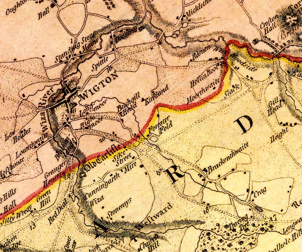 D4NY24NE.jpg 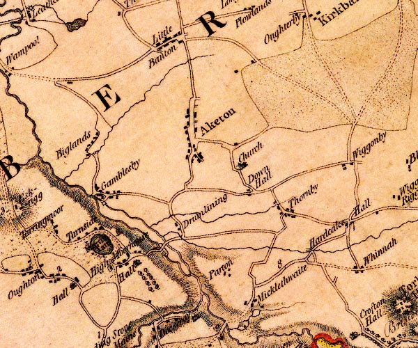 D4NY25SE.jpg 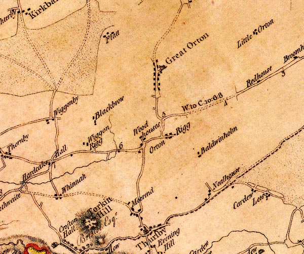 D4NY35SW.jpg "W. to C. 10:6:8" miles.furlongs.poles; Wigton to Carlisle 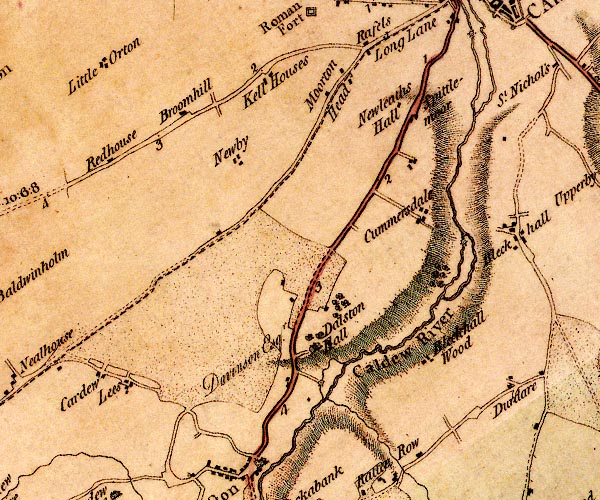 D4NY35SE.jpg 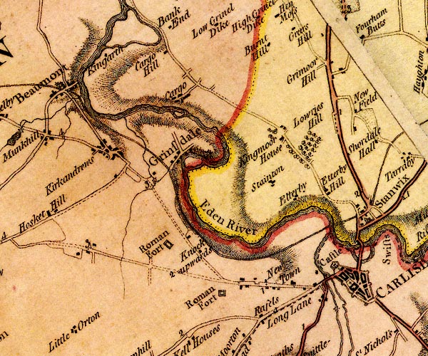 D4NY35NE.jpg item:- Carlisle Library : Map 2 Images © Carlisle Library |
|||
|
|
||||
| evidence:- | road book:- Cary 1798 (2nd edn 1802) |
|||
| source data:- | Road book, itineraries, Cary's New Itinerary, by John Cary, 181
Strand, London, 2nd edn 1802. goto source goto source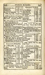 click to enlarge click to enlargeC38555.jpg page 555-556 "CARLISLE to Allonby" "CARLISLE to Maryport." item:- JandMN : 228.2 Image © see bottom of page |
|||
|
|
||||
| evidence:- | old map:- Laurie and Whittle 1806 |
|||
| source data:- | Road map, Completion of the Roads to the Lakes, scale about 10
miles to 1 inch, by Nathaniel Coltman? 1806, published by Robert
H Laurie, 53 Fleet Street, London, 1834. click to enlarge click to enlargeLw18.jpg "W. to C. 10¾m." light line; 'Other Direct Roads from LONDON' item:- private collection : 18.18 Image © see bottom of page |
|||
|
|
||||
| Act of Parliament |
||||
|
|
||||
| places:- |
|
|||
|
||||
|
||||
|
||||
|
||||
|
||||
Lakes Guides menu.