 Old Cumbria Gazetteer
 |
 |
|
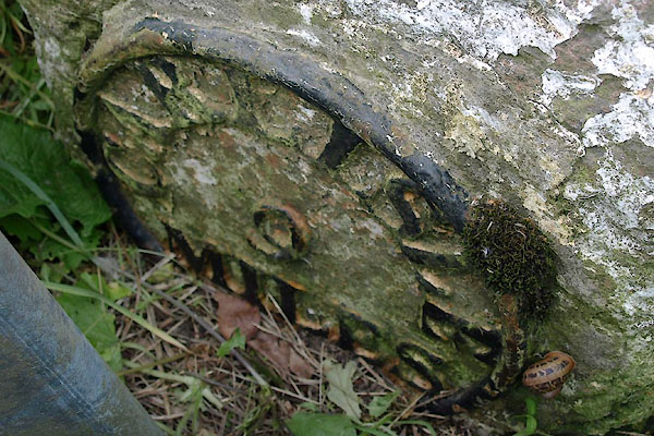
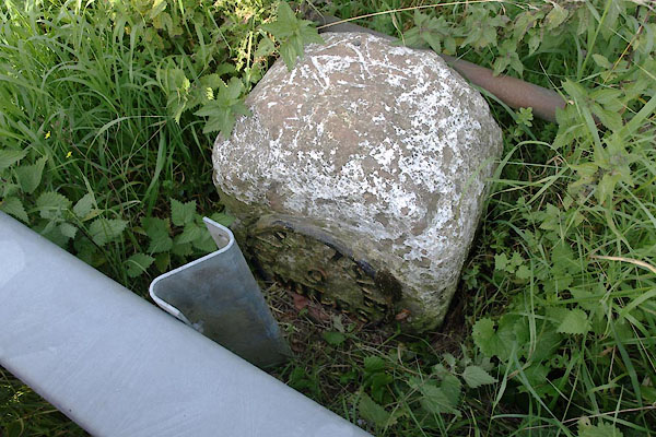
| milestone, Kirkandrews (9) | ||
| site name:- | road, Longtown to Gretna | |
| civil parish:- | Kirkandrews (formerly Cumberland) | |
| county:- | Cumbria | |
| locality type:- | milestone | |
| coordinates:- | NY36806875 | |
| 1Km square:- | NY3668 | |
| 10Km square:- | NY36 | |
| references:- | OS County Series |
|
|
|
||
 BTM13.jpg (taken 3.9.2010) |
||
|
|
||
| evidence:- | old map:- OS County Series (Cmd 10 2) |
|
| source data:- | Maps, County Series maps of Great Britain, scales 6 and 25
inches to 1 mile, published by the Ordnance Survey, Southampton,
Hampshire, from about 1863 to 1948. "M.S. Carlisle .. 9" |
|
|
|
||
| evidence:- | database:- Listed Buildings 2010 |
|
| source data:- | courtesy of English Heritage "MILESTONE SOUTH OF SMALMSTON AT NGR 367 687 / / / KIRKANDREWS / CARLISLE / CUMBRIA / II / 78157 / NY3680868761" |
|
| source data:- | courtesy of English Heritage "Milestone. Early C19 for Longtown to Gretna road. Red sandstone, cast iron plate. Squared stone with round top. Circular cast plate to front with lettering CARLISLE 9 MILES. Whitewashed and lettering picked out in black." |
|
|
|
||
 BTM12.jpg (taken 3.9.2010) |
||
|
|
||
 Lakes Guides menu.