 Old Cumbria Gazetteer
 |
 |
|
| ford, Thornship | ||
| site name:- | Lowther, River | |
| locality:- | Thornship | |
| civil parish:- | Shap (formerly Westmorland) | |
| civil parish:- | Shap Rural (formerly Westmorland) | |
| county:- | Cumbria | |
| locality type:- | ford | |
| locality type:- | stepping stones | |
| coordinates:- | NY55611407 | |
| 1Km square:- | NY5514 | |
| 10Km square:- | NY51 | |
| references:- | OS County Series |
|
|
|
||
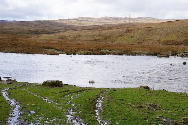 BZZ89.jpg After a rainy night. (taken 7.3.2014) |
||
|
|
||
| evidence:- | old map:- OS County Series (Wmd 14) |
|
| source data:- | Maps, County Series maps of Great Britain, scales 6 and 25
inches to 1 mile, published by the Ordnance Survey, Southampton,
Hampshire, from about 1863 to 1948. "Stepping Stones / Ford" |
|
|
|
||
| evidence:- | old map:- Jefferys 1770 (Wmd) |
|
| source data:- | Map, 4 sheets, The County of Westmoreland, scale 1 inch to 1
mile, surveyed 1768, and engraved and published by Thomas
Jefferys, London, 1770.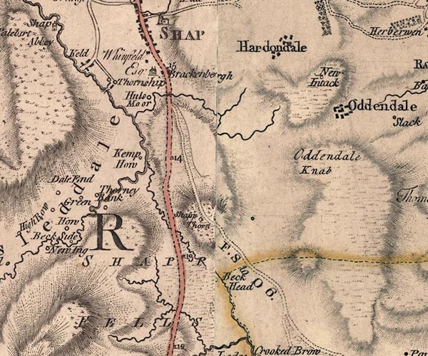 J5NY51SE.jpg double line, road, across a stream; bridge, clearly drawn as a bridge item:- National Library of Scotland : EME.s.47 Image © National Library of Scotland |
|
|
|
||
 Lakes Guides menu.