 Old Cumbria Gazetteer
 |
 |
|
| Low Stockgill Bridge, Ambleside | ||
| Low Stockgill Bridge | ||
| site name:- | Stock Ghyll | |
| Street:- | Rydal Road | |
| locality:- | Ambleside | |
| civil parish:- | Lakes (formerly Westmorland) | |
| county:- | Cumbria | |
| locality type:- | bridge | |
| coordinates:- | NY37590464 | |
| 1Km square:- | NY3704 | |
| 10Km square:- | NY30 | |
|
|
||
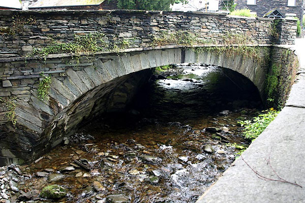 BQV85.jpg (taken 20.6.2009) |
||
|
|
||
| evidence:- | old map:- OS County Series (Wmd 26 6) placename:- Low Stockgill Bridge placename:- Stockgill Bridge, Low |
|
| source data:- | Maps, County Series maps of Great Britain, scales 6 and 25
inches to 1 mile, published by the Ordnance Survey, Southampton,
Hampshire, from about 1863 to 1948. |
|
|
|
||
| evidence:- | old map:- OS County Series placename:- Low Stockgill Bridge |
|
| source data:- | Maps, County Series maps of Great Britain, scales 6 and 25
inches to 1 mile, published by the Ordnance Survey, Southampton,
Hampshire, from about 1863 to 1948. "Low Stockgill Bridge" |
|
|
|
||
| evidence:- | old map:- Bowen and Kitchin 1760 |
|
| source data:- | Map, hand coloured engraving, A New Map of the Counties of
Cumberland and Westmoreland Divided into their Respective Wards,
scale about 4 miles to 1 inch, by Emanuel Bowen and Thomas
Kitchin et al, published by T Bowles, Robert Sayer, and John
Bowles, London, 1760.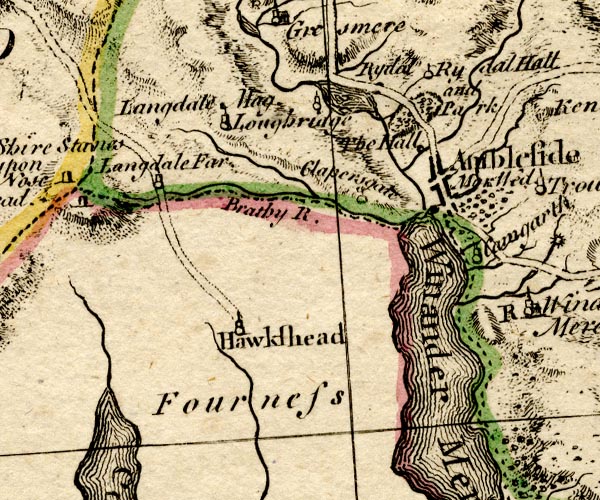 BO18SD29.jpg road across the Stock Ghyll item:- Armitt Library : 2008.14.10 Image © see bottom of page |
|
|
|
||
| evidence:- | old map:- Jefferys 1770 (Wmd) |
|
| source data:- | Map, 4 sheets, The County of Westmoreland, scale 1 inch to 1
mile, surveyed 1768, and engraved and published by Thomas
Jefferys, London, 1770.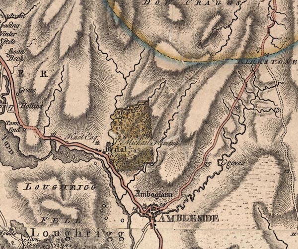 J5NY30NE.jpg double line, road, across a stream; bridge item:- National Library of Scotland : EME.s.47 Image © National Library of Scotland |
|
|
|
||
| evidence:- | possibly old drawing:- placename:- Stockbridge |
|
| source data:- | Drawing, Stockbridge, Ambleside, Westmorland, by William Havell, 1800s-10s.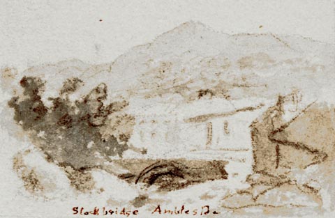 click to enlarge click to enlargePR1398.jpg View of bridge over river with buildings with trees either side and hills in background. One of a set of twenty views of the lake district executed by the artist on one sheet of paper. at bottom:- "Stockbridge Ambleside" item:- Tullie House Museum : 2009.89.42 Image © Tullie House Museum |
|
|
|
||
 Lakes Guides menu.