 Old Cumbria Gazetteer
 |
 |
|
|
| road, Maryport to Silloth | |||
| Maryport to Silloth | |||
| Silloth to Maryport | |||
| civil parish:- | Maryport (formerly Cumberland) | ||
| civil parish:- | Crosscanonby (formerly Cumberland) | ||
| civil parish:- | Oughterside and Allerby (formerly Cumberland) | ||
| civil parish:- | Hayton and Mealo (formerly Cumberland) | ||
| civil parish:- | Allonby (formerly Cumberland) | ||
| civil parish:- | Holme St Cuthbert (formerly Cumberland) | ||
| civil parish:- | Holme Low (formerly Cumberland) | ||
| civil parish:- | Silloth-on-Solway (formerly Cumberland) | ||
| county:- | Cumbria | ||
| locality type:- | route | ||
| 10Km square:- | NY03 | ||
| 10Km square:- | NY04 | ||
| 10Km square:- | NY05 | ||
| 10Km square:- | NY15 | ||
|
|
|||
| evidence:- | old map:- Donald 1774 (Cmd) |
||
| source data:- | Map, hand coloured engraving, 3x2 sheets, The County of Cumberland, scale about 1
inch to 1 mile, by Thomas Donald, engraved and published by Joseph Hodskinson, 29
Arundel Street, Strand, London, 1774. double line, narrower, solid or dotted with a dot and number at 1 mile intervals; road 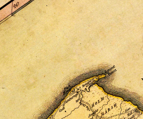 D4NY15NW.jpg a mile and a half beyond Skinburness to Grune Point; distances from Whitehaven 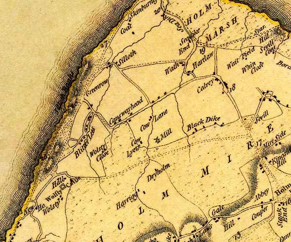 D4NY15SW.jpg 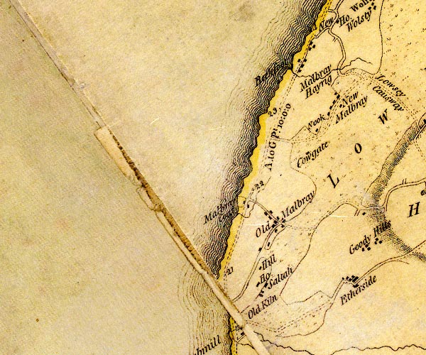 D4NY04NE.jpg "A. to GPt. 10:0:0" miles.furlongs.poles; Allonby to Grune Point 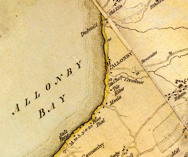 D4NY04SE.jpg "M. to A. 5:0:2" miles.furlongs.poles; Maryport to Allonby 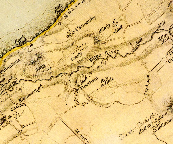 D4NY03NE.jpg 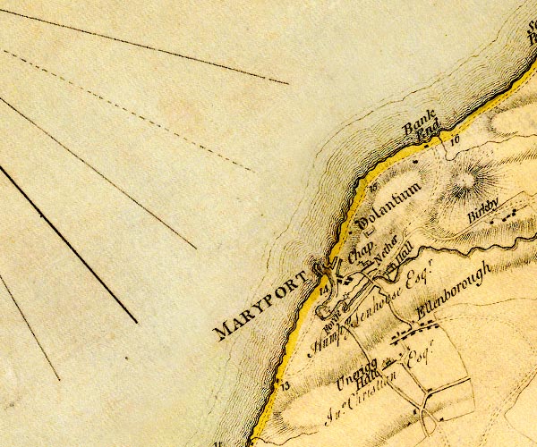 D4NY03NW.jpg item:- Carlisle Library : Map 2 Images © Carlisle Library |
||
|
|
|||
| evidence:- | road map:- Cary 1790 (Cmd/edn 1789) |
||
| source data:- | Road map, hand coloured engraving, Cumberland, scale about 15
miles to 1 inch, by John Cary, 181 Strand, London, 1790, edn
1789. click to enlarge click to enlargeCY47.jpg no Silloth double line item:- JandMN : 419 Image © see bottom of page |
||
|
|
|||
| evidence:- | old map:- Cooke 1802 |
||
| source data:- | Map, Cumberland, scale about 15.5 miles to 1 inch, by George
Cooke, 1802, bound in Gray's New Book of Roads, 1824, published
by Sherwood, Jones and Co, Paternoster Road, London, 1824. click to enlarge click to enlargeGRA1Cd.jpg double line, light dark solid; road item:- Hampshire Museums : FA2000.62.2 Image © see bottom of page |
||
|
|
|||
| evidence:- | old map:- Laurie and Whittle 1806 |
||
| source data:- | Road map, Completion of the Roads to the Lakes, scale about 10
miles to 1 inch, by Nathaniel Coltman? 1806, published by Robert
H Laurie, 53 Fleet Street, London, 1834. click to enlarge click to enlargeLw18.jpg bold line; 'Principal Travelling Roads', to Allonby item:- private collection : 18.18 Image © see bottom of page |
||
|
|
|||
| evidence:- | old map:- Wallis 1810 (Cmd) |
||
| source data:- | Road map, hand coloured engraving, Cumberland, scale about 16
miles to 1 inch, by James Wallis, 77 Berwick Stree, Soho,
London, 1810. click to enlarge click to enlargeWL13.jpg double line, light bold; 'Turnpike Road' item:- Dove Cottage : 2009.81.10 Image © see bottom of page |
||
|
|
|||
| evidence:- | old map:- Hall 1820 (Cmd) |
||
| source data:- | Map, hand coloured engraving, Cumberland, scale about 21 miles
to 1 inch, engraved by Sidney Hall, published by S Leigh, 18
Strand, London, 1820-31. click to enlarge click to enlargeHA14.jpg single line, solid; minor road; Maryport, Allonby, Wolsty, ... item:- JandMN : 91 Image © see bottom of page |
||
|
|
|||
| evidence:- | old map:- Ford 1839 map |
||
| source data:- | Map, uncoloured engraving, Map of the Lake District of
Cumberland, Westmoreland and Lancashire, scale about 3.5 miles
to 1 inch, published by Charles Thurnam, Carlisle, and by R
Groombridge, 5 Paternoster Row, London, 3rd edn 1843. FD02NY05.jpg 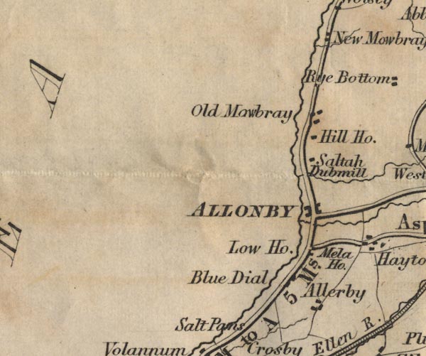 FD02NY04.jpg 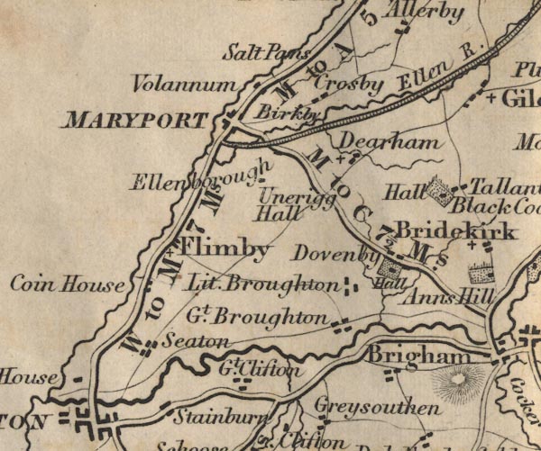 FD02NY03.jpg "M to A 5 Ms." item:- JandMN : 100.1 Image © see bottom of page |
||
|
|
|||
| evidence:- | gradient diagram:- Gall and Inglis 1890s-1900s (Roads) |
||
| source data:- | Contour Road Book of England, Northern Division, by Harry R G Inglis, published by
Gall and Inglis, 25 Paternoster Square, London and Edinburgh, 1898.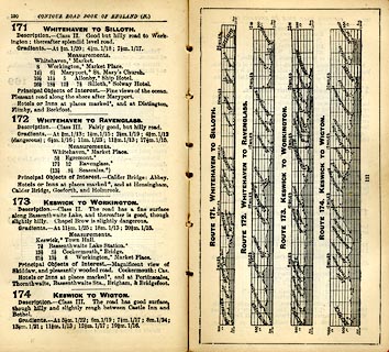 click to enlarge click to enlargeIG5171.jpg Itinerary, with gradient diagram, routes 171, Whitehaven to Silloth, 172, Whitehaven to Ravenglass, 173, Keswick to Workington, and 174, Keswick to Wigton, Cumberland, 1898. item:- JandMN : 763.12 Image © see bottom of page |
||
|
|
|||
| evidence:- | old map:- Bell 1892 |
||
| source data:- | Map, colour lithograph, Road Map of Cumberland, by George Joseph
Bell, scale about 2.5 miles to 1 inch, printed by Charles
Thurnam and Sons, Carlisle, Cumberland, 1892. BEL9NY15.jpg 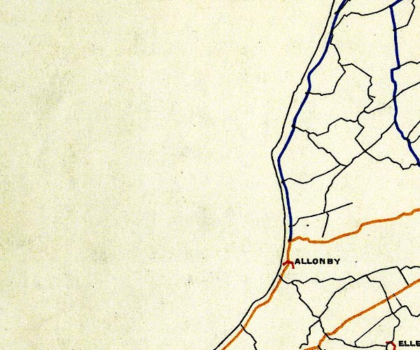 BEL9NY04.jpg 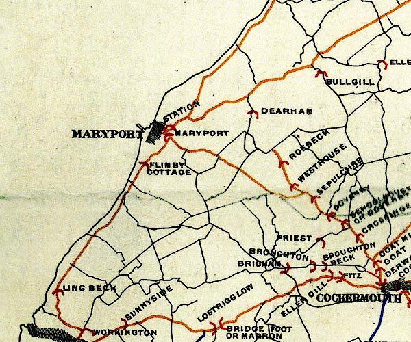 BEL9NY03.jpg orange - disturnpiked 'main road' under section 13 of the Highways Act 1878 since 1 September 1883; blue - declared 'main road' by magistrates, as the county authority, since 1878, under section 15 of the Highways Act 1878 Road map of Cumberland showing County Bridges item:- Carlisle Library : Map 38 Images © Carlisle Library |
||
|
|
|||
| places:- |  Maryport Allonby Silloth Maryport Allonby Silloth |
||
|
|
|||
Lakes Guides menu.