Old Cumbria Gazetteer
 |
 |
|
||
| included in:- |
 road, Kendal to Ulverston road, Kendal to Kirkby Ireleth road, Kendal to Ulverston road, Kendal to Kirkby Ireleth |
|||
| road, Kendal to Newby Bridge | ||||
| Kendal to Newby Bridge | ||||
| Newby Bridge to Kendal | ||||
| civil parish:- | Kendal (formerly Westmorland) | |||
| civil parish:- | Underbarrow and Bradleyfield (formerly Westmorland) | |||
| civil parish:- | Crosthwaite and Lyth (formerly Westmorland) | |||
| civil parish:- | Cartmel Fell (formerly Lancashire) | |||
| civil parish:- | Staveley-in-Cartmel (formerly Lancashire) | |||
| county:- | Cumbria | |||
| locality type:- | road route | |||
| 10Km square:- | SD59 | |||
| 10Km square:- | SD49 | |||
| 10Km square:- | SD48 | |||
| 10Km square:- | SD38 | |||
|
|
||||
| evidence:- | old map:- OS County Series (Lan 8) |
|||
| source data:- | Maps, County Series maps of Great Britain, scales 6 and 25
inches to 1 mile, published by the Ordnance Survey, Southampton,
Hampshire, from about 1863 to 1948. "KIRKBY KENDAL AND KIRKBY IRELETH TRUST" along road |
|||
|
|
||||
| evidence:- | old map:- Jefferys 1770 (Wmd) |
|||
| source data:- | Map, 4 sheets, The County of Westmoreland, scale 1 inch to 1
mile, surveyed 1768, and engraved and published by Thomas
Jefferys, London, 1770.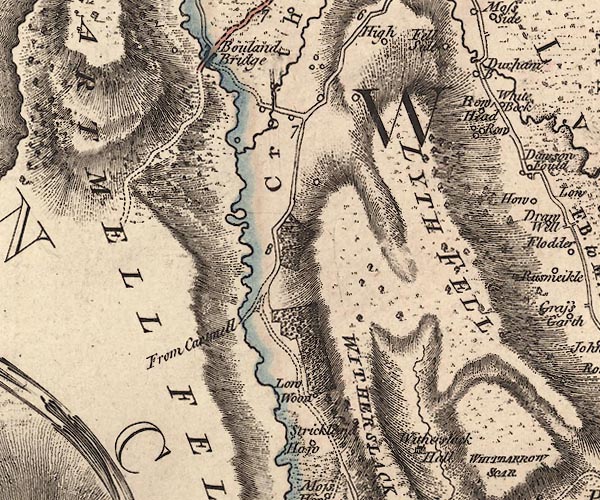 J5SD48NW.jpg 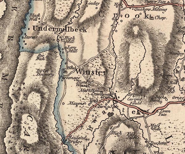 J5SD49SW.jpg 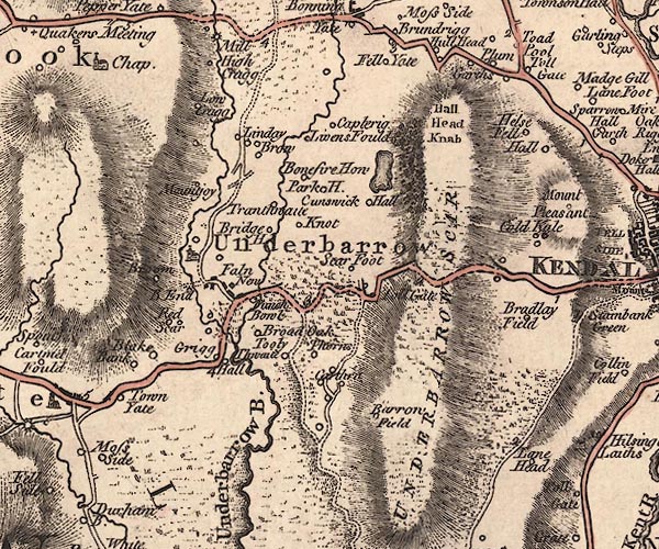 J5SD49SE.jpg  J5SD59SW.jpg double line; road, bold, main road, with some mile numbers item:- National Library of Scotland : EME.s.47 Images © National Library of Scotland |
|||
|
|
||||
| evidence:- | old map:- Cary 1789 (edn 1805) |
|||
| source data:- | Map, uncoloured engraving, Westmoreland, scale about 2.5 miles
to 1 inch, by John Cary, London, 1789; edition 1805.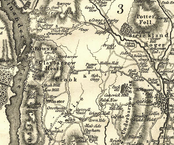 CY24SD49.jpg double line, bold light, numbered miles; main road item:- JandMN : 129 Image © see bottom of page |
|||
|
|
||||
| evidence:- | road map:- Cary 1790 (Lan/edn 1792) |
|||
| source data:- | Road map, hand coloured engraving, Lancashire, scale about 18
miles to 1 inch, by John Cary, 181 Strand, London, 1790, edn
1792.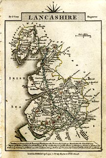 click to enlarge click to enlargeCY46.jpg double line, with road distances from Kendal item:- JandMN : 418 Image © see bottom of page |
|||
|
|
||||
| evidence:- | old map:- Cooke 1802 |
|||
| source data:- | Map, Westmoreland ie Westmorland, scale about 12 miles to 1
inch, by George Cooke, 1802, published by Sherwood, Jones and
Co, Paternoster Road, London, 1824. click to enlarge click to enlargeGRA1Wd.jpg "to Ulverston &Dalton" double line, light dark solid; road item:- Hampshire Museums : FA2000.62.4 Image © see bottom of page |
|||
|
|
||||
| evidence:- | old map:- Cooke 1802 |
|||
| source data:- | Map, Lancashire, scale about 18 miles to 1 inch, by George
Cooke, 1802, bound in Gray's New Book of Roads, 1824, published
by Sherwood, Jones and Co, Paternoster Road, London, 1824.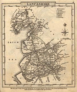 click to enlarge click to enlargeGRA1La.jpg "to Kendal" double line, light dark solid; road item:- Hampshire Museums : FA2000.62.6 Image © see bottom of page |
|||
|
|
||||
| evidence:- | old map:- Laurie and Whittle 1806 |
|||
| source data:- | Road map, Completion of the Roads to the Lakes, scale about 10
miles to 1 inch, by Nathaniel Coltman? 1806, published by Robert
H Laurie, 53 Fleet Street, London, 1834. click to enlarge click to enlargeLw18.jpg dotted line; 'Cross Roads' item:- private collection : 18.18 Image © see bottom of page |
|||
|
|
||||
| evidence:- | old map:- Cooper 1808 |
|||
| source data:- | Map, hand coloured engraving, Westmoreland ie Westmorland, scale
about 9 miles to 1 inch, by H Cooper, 1808, published by R
Phillips, Bridge Street, Blackfriars, London, 1808. click to enlarge click to enlargeCOP4.jpg double line; road item:- Dove Cottage : 2007.38.53 Image © see bottom of page |
|||
|
|
||||
| evidence:- | old map:- Wallis 1810 (Wmd) |
|||
| source data:- | Road map, Westmoreland, scale about 19 miles to 1 inch, by James
Wallis, 77 Berwick Street, Soho, 1810, published by W Lewis,
Finch Lane, London, 1835? click to enlarge click to enlargeWAL5.jpg "to Ulverton" double line, light bold; 'Turnpike Road' item:- JandMN : 63 Image © see bottom of page |
|||
|
|
||||
| evidence:- | old map:- Ford 1839 map |
|||
| source data:- | Map, uncoloured engraving, Map of the Lake District of
Cumberland, Westmoreland and Lancashire, scale about 3.5 miles
to 1 inch, published by Charles Thurnam, Carlisle, and by R
Groombridge, 5 Paternoster Row, London, 3rd edn 1843.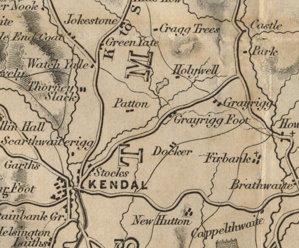 FD02SD59.jpg 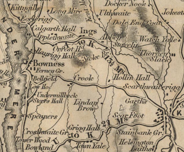 FD02SD49.jpg "U to K 21 Ms." 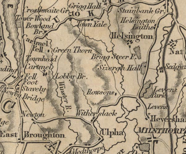 FD02SD48.jpg item:- JandMN : 100.1 Image © see bottom of page |
|||
|
|
||||
| evidence:- | gradient diagram:- Gall and Inglis 1890s-1900s (Roads) |
|||
| source data:- | Contour Road Book of England, Northern Division, by Harry R G Inglis, published by
Gall and Inglis, 25 Paternoster Square, London and Edinburgh, 1898.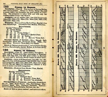 click to enlarge click to enlargeIG5185.jpg Itinerary, with gradient diagram, route 185, Kendal to Barrow, and route 187, Kendal to Keswick, Westmorland and Lancashire, 1898. item:- JandMN : 763.18 Image © see bottom of page |
|||
|
|
||||
| evidence:- | gradient diagram:- Gall and Inglis 1890s-1900s (Roads) |
|||
| source data:- | Contour Road Book of England, Northern Division, by Harry R G Inglis, published by
Gall and Inglis, 25 Paternoster Square, London and Edinburgh, 1898.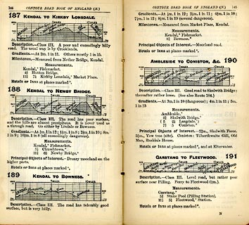 click to enlarge click to enlargeIG5187.jpg Itinerary, with gradient diagram, routes 187, Kendal to Kirkby Lonsdale, 188, Kendal to Newby Bridge, 189, Kendal to Bowness, and 190, Ambleside to Coniston etc, Westmorland and Lancashire, 1898. item:- JandMN : 763.19 Image © see bottom of page |
|||
|
|
||||
 Act of Parliament Act of Parliament |
||||
|
|
||||
| places:- | old route Kendal Crosthwaite, Crosthwaite and Lyth Bowland Bridge, Crosthwaite and Lyth Newby Bridge |
|||
|
|
||||
| places:- |
|
|||
|
||||
|
||||
|
||||
Lakes Guides menu.