 Old Cumbria Gazetteer
 |
 |
|
| milestone, Cartmel Fell (2) | ||
| site name:- | road, Kendal to Newby Bridge | |
| civil parish:- | Cartmel Fell (formerly Lancashire) | |
| county:- | Cumbria | |
| locality type:- | milestone | |
| coordinates:- | SD40858915 | |
| 1Km square:- | SD4089 | |
| 10Km square:- | SD48 | |
|
|
||
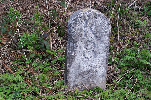 BLZ18.jpg Inscribed stone:- "K 8" (taken 28.4.2006) |
||
|
|
||
| evidence:- | old map:- OS County Series (Lan 8) |
|
| source data:- | Maps, County Series maps of Great Britain, scales 6 and 25
inches to 1 mile, published by the Ordnance Survey, Southampton,
Hampshire, from about 1863 to 1948. "M.S. KENDAL 8" |
|
|
|
||
| evidence:- | database:- Listed Buildings 2010 |
|
| source data:- | courtesy of English Heritage "MILESTONE APPROXIMATELY 180 METRES EAST OF LIGHTWOOD / / / CARTMEL FELL / SOUTH LAKELAND / CUMBRIA / II / 75575 / SD4086189159" |
|
| source data:- | courtesy of English Heritage "Milestone. Late C18 or early C19. For Kirkby Kendal to Kirkby Ireleth Turnpike Trust. Stone round-headed post inscribed: "K/8" (miles to Kendal)." |
|
|
|
||
 Lakes Guides menu.