 Old Cumbria Gazetteer
 |
 |
|
| Addingham, Glassonby | ||
| Addingham | ||
| civil parish:- | Glassonby (formerly Cumberland) | |
| county:- | Cumbria | |
| locality type:- | locality | |
| coordinates:- | NY57453834 (etc) | |
| 1Km square:- | NY5738 | |
| 10Km square:- | NY53 | |
|
|
||
| evidence:- | old map:- Donald 1774 (Cmd) placename:- Addingham |
|
| source data:- | Map, hand coloured engraving, 3x2 sheets, The County of Cumberland, scale about 1
inch to 1 mile, by Thomas Donald, engraved and published by Joseph Hodskinson, 29
Arundel Street, Strand, London, 1774.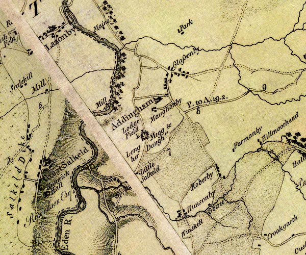 D4NY53NE.jpg "Addingham" blocks, and usually a church, labelled in upright lowercase; a village item:- Carlisle Library : Map 2 Image © Carlisle Library |
|
|
|
||
| evidence:- | old text:- Camden 1789 (Gough Additions) placename:- Addingham placename:- Ald Hengham item:- placename, Addingham |
|
| source data:- | Book, Britannia, or A Chorographical Description of the Flourishing Kingdoms of England,
Scotland, and Ireland, by William Camden, 1586, translated from the 1607 Latin edition
by Richard Gough, published London, 1789. goto source goto sourcePage 190:- "..." "Long Meg and her daughters, in Addingham parish, q.d. Ald Hengham, a town at the old hanging stones, ..." |
|
|
|
||
| evidence:- | old map:- Ford 1839 map placename:- Addingham |
|
| source data:- | Map, uncoloured engraving, Map of the Lake District of
Cumberland, Westmoreland and Lancashire, scale about 3.5 miles
to 1 inch, published by Charles Thurnam, Carlisle, and by R
Groombridge, 5 Paternoster Row, London, 3rd edn 1843.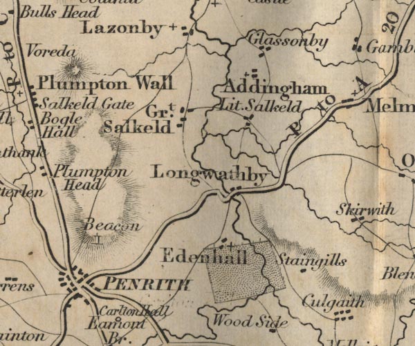 FD02NY53.jpg "Addingham" item:- JandMN : 100.1 Image © see bottom of page |
|
|
|
||
| evidence:- | old map:- Garnett 1850s-60s H placename:- Aldingham |
|
| source data:- | Map of the English Lakes, in Cumberland, Westmorland and
Lancashire, scale about 3.5 miles to 1 inch, published by John
Garnett, Windermere, Westmorland, 1850s-60s.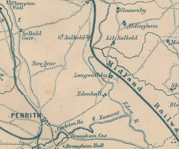 GAR2NY53.jpg "Aldingham" blocks, settlement item:- JandMN : 82.1 Image © see bottom of page |
|
|
|
||
Lakes Guides menu.