 Old Cumbria Gazetteer
 |
 |
|
| Plump Bridge, Plump | ||
| Plump Bridge | ||
| site name:- | Sark, River | |
| locality:- | Plump | |
| civil parish:- | Kirkandrews (formerly Cumberland) | |
| county:- | Cumbria | |
| locality type:- | bridge | |
| coordinates:- | NY33166801 | |
| 1Km square:- | NY3368 | |
| 10Km square:- | NY36 | |
|
|
||
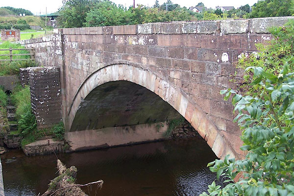 BOB12.jpg (taken 31.8.2007) 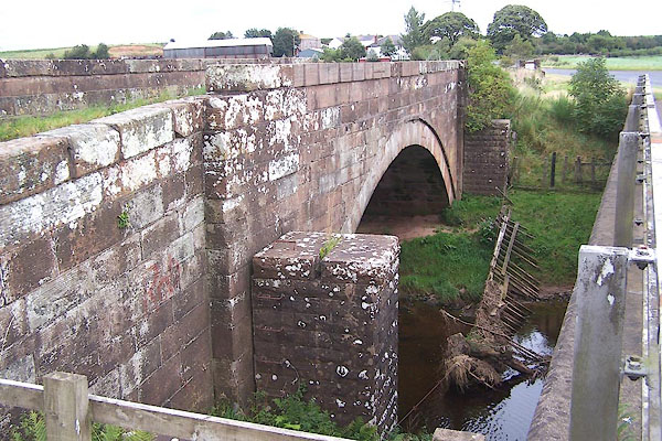 BOB11.jpg (taken 31.8.2007) |
||
|
|
||
| evidence:- | old map:- Donald 1774 (Cmd) |
|
| source data:- | Map, hand coloured engraving, 3x2 sheets, The County of Cumberland, scale about 1
inch to 1 mile, by Thomas Donald, engraved and published by Joseph Hodskinson, 29
Arundel Street, Strand, London, 1774.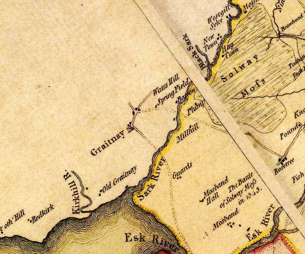 D4NY36NW.jpg road across a river; a bridge? over the Sark item:- Carlisle Library : Map 2 Image © Carlisle Library |
|
|
|
||
| evidence:- | old map:- Bell 1892 placename:- Sark Bridge |
|
| source data:- | Map, colour lithograph, Road Map of Cumberland, by George Joseph
Bell, scale about 2.5 miles to 1 inch, printed by Charles
Thurnam and Sons, Carlisle, Cumberland, 1892.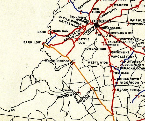 BEL9NY36.jpg "SARK" bridge symbol Road map of Cumberland showing County Bridges item:- Carlisle Library : Map 38 Image © Carlisle Library |
|
|
|
||
 Lakes Guides menu.