 Old Cumbria Gazetteer
 |
 |
|
| milestone, Kirkandrews (12) | ||
| site name:- | road, Longtown to Gretna | |
| locality:- | Millhill | |
| civil parish:- | Kirkandrews (formerly Cumberland) | |
| county:- | Cumbria | |
| locality type:- | milestone | |
| coordinates:- | NY33856790 | |
| 1Km square:- | NY3367 | |
| 10Km square:- | NY36 | |
|
|
||
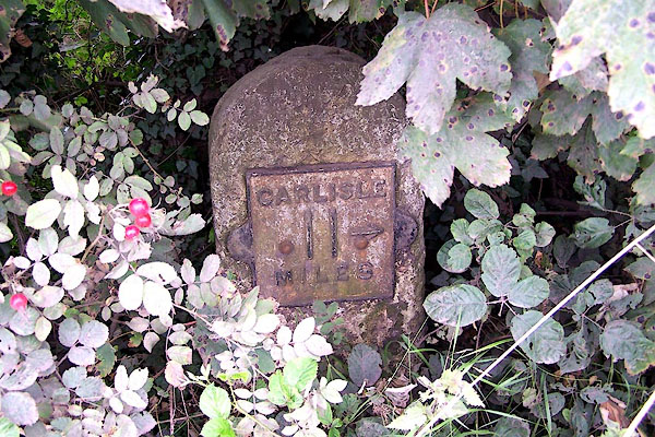 BOB17.jpg Cast iron plate on stone:- "CARLISLE 11 MILES" (taken 31.8.2007) |
||
|
|
||
| evidence:- | old map:- OS County Series (Cmd 10 5) placename:- |
|
| source data:- | Maps, County Series maps of Great Britain, scales 6 and 25
inches to 1 mile, published by the Ordnance Survey, Southampton,
Hampshire, from about 1863 to 1948. "M.S.Carlisle 11" |
|
|
|
||
 Lakes Guides menu.