 |
 |
|
|
|
|
Allerdale above Derwent Ward |
|
Allerdale-above-Derwent Ward |
| county:- |
Cumbria (Cumberland) |
| locality type:- |
ward |
| references:- |
Dawson 1830s
|
|
|
| evidence:- |
old map:- Morden 1695 (Cmd)
placename:- South Allerdale Ward
|
| source data:- |
Map, uncoloured engraving, Cumberland, scale about 4 miles to 1
inch, by Robert Morden, 1695, published by Abel Swale, the
Unicorn, St Paul's Churchyard, Awnsham, and John Churchill, the
Black Swan, Paternoster Row, London, 1695-1715.
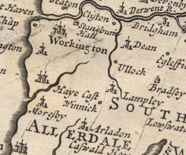
MD12NY02.jpg
"SOUTH ALLERDALE WARD"
Labelling a large area.
item:- JandMN : 90
Image © see bottom of page
|
|
|
| evidence:- |
old map:- Moll 1724
placename:- South Allerdale Ward
|
| source data:- |
Maps, Westmorland, scale about 5.5 miles to 1 inch, and
Cumberland, scale about 7 miles to 1 inch, by Herman Moll,
London, 1724; published 1724-53.
|
|
|
| evidence:- |
descriptive text:- Simpson 1746
placename:- South Ward
|
| source data:- |
Atlas, three volumes of maps and descriptive text published as
'The Agreeable Historian, or the Compleat English Traveller
...', by Samuel Simpson, 1746.
 goto source goto source
"... It [Cumberland] is not divided into Hundreds, as most other Counties are, but
Wards, of which there are five, viz. South-Ward, North-Ward, West-Ward, Leath-Ward,
and Eskdale-Ward,"
|
|
|
| evidence:- |
old map:- Bowen 1763
placename:- South Allerdale Ward
|
| source data:- |
Map, Improved Map of the Counties of Cumberland and
Westmoreland, scale about 5.5 miles to 1 inch, derived from a
larger map by Bowen or Kitchin, by Emanuel Bowen, London, about
1763; published 1763-1828.
|
|
|
| evidence:- |
old map:- Cooke 1802
placename:- Allerdale above Derwent Ward
|
| source data:- |
Map, Cumberland, scale about 15.5 miles to 1 inch, by George
Cooke, 1802, bound in Gray's New Book of Roads, 1824, published
by Sherwood, Jones and Co, Paternoster Road, London, 1824.
 click to enlarge click to enlarge
GRA1Cd.jpg
"Allerdale above Derwent [Ward]"
area 5
item:- Hampshire Museums : FA2000.62.2
Image © see bottom of page
|
|
|
| evidence:- |
old map:- Cooper 1808
placename:- Allerdale above Derwent Ward
|
| source data:- |
Map, uncoloured engraving, Cumberland, scale about 10.5 miles to
1 inch, drawn and engraved by Cooper, published by R Phillips,
Bridge Street, Blackfriars, London, 1808.
 click to enlarge click to enlarge
COP3.jpg
"Wards. / 1 Allerdale (above Derwent.)"
number on map, table on right
item:- JandMN : 86
Image © see bottom of page
|
|
|
| evidence:- |
old map:- Dawson 1830s
placename:- Allerdale above Derwent Ward
|
| source data:- |
Political maps, Westmoreland, scale about 4 miles to 1 inch, and
Cumberland, scale about 7.5 miles to 1 inch, showing the
proposed parliamentary divisions, and town maps Carlisle,
Kendal, Cockermouth, Whitehaven, Workington, at larger scales,
made for the Reform Bill 1832, by Lieut Robert K Dawson RE, 1831.
|
|
|
