 Old Cumbria Gazetteer
 |
 |
|
| Mill Bridge, Grasmere | ||
| Mill Bridge | ||
| site name:- | Tongue Gill | |
| locality:- | Town Head | |
| locality:- | Grasmere | |
| civil parish:- | Lakes (formerly Westmorland) | |
| county:- | Cumbria | |
| locality type:- | bridge | |
| coordinates:- | NY33610914 | |
| 1Km square:- | NY3309 | |
| 10Km square:- | NY30 | |
|
|
||
| evidence:- | old map:- OS County Series (Wmd 18 16) placename:- Mill Bridge |
|
| source data:- | Maps, County Series maps of Great Britain, scales 6 and 25
inches to 1 mile, published by the Ordnance Survey, Southampton,
Hampshire, from about 1863 to 1948. |
|
|
|
||
| evidence:- | old map:- Ogilby 1675 (plate 96) |
|
| source data:- | Road strip map, hand coloured engraving, the Road from Kendal to
Cockermouth, and the Road from Egremond to Carlisle, scale about
1 inch to 1 mile, by John Ogilby, London, 1675.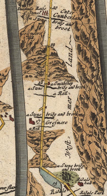 OG96m015.jpg In mile 17, Westmerland. Road crosses:- "a Stone bridg and brook" no bridge drawn. item:- JandMN : 22 Image © see bottom of page |
|
|
|
||
 Lakes Guides menu.