 Old Cumbria Gazetteer
 |
 |
|
| Baneriggs, Grasmere | ||
| Baneriggs | ||
| locality:- | Grasmere | |
| civil parish:- | Lakes (formerly Westmorland) | |
| county:- | Cumbria | |
| locality type:- | area | |
| locality type:- | wood | |
| coordinates:- | NY34440623 (etc) | |
| 1Km square:- | NY3406 | |
| 10Km square:- | NY30 | |
|
|
||
| evidence:- | old map:- OS County Series (Wmd 26 1) placename:- Baneriggs |
|
| source data:- | Maps, County Series maps of Great Britain, scales 6 and 25
inches to 1 mile, published by the Ordnance Survey, Southampton,
Hampshire, from about 1863 to 1948. |
|
|
|
||
| evidence:- | old map:- Ogilby 1675 (plate 96) |
|
| source data:- | Road strip map, hand coloured engraving, the Road from Kendal to
Cockermouth, and the Road from Egremond to Carlisle, scale about
1 inch to 1 mile, by John Ogilby, London, 1675.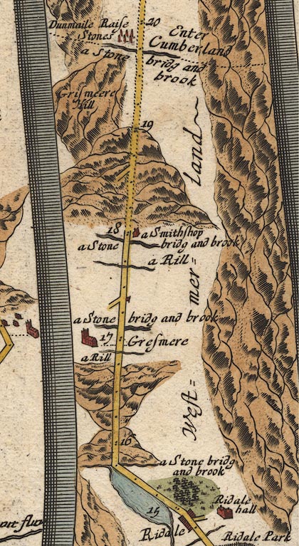 OG96m015.jpg In mile 16, Westmerland. Road ascends and descends a hill. item:- JandMN : 22 Image © see bottom of page |
|
|
|
||
| evidence:- | perhaps old print:- Goodwin 1887 (edn 1890) |
|
| source data:- | Print, etching? The Heathclad Rocks Grasmere, perhaps Baneriggs? Westmorland, by Harry
Goodwin, published by Swan Sonnenschein and Co, Paternoster Square, London, 1890.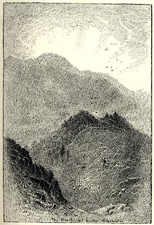 click to enlarge click to enlargePR1589.jpg Tipped in opposite p.86 of Through the Wordsworth Country, by William Knight. printed at lower centre:- "The Heathclad Rocks Grasmere" item:- JandMN : 382.19 Image © see bottom of page |
|
|
|
||
 Lakes Guides menu.