 Old Cumbria Gazetteer
 |
 |
|
| Windermere Station, Windermere | ||
| Windermere Station | ||
| site name:- | Kendal and Windermere Railway | |
| locality:- | Windermere | |
| civil parish:- | Windermere (formerly Westmorland) | |
| county:- | Cumbria | |
| locality type:- | railway station | |
| coordinates:- | SD41389864 | |
| 1Km square:- | SD4198 | |
| 10Km square:- | SD49 | |
| SummaryText:- | Opened with the railway 1847. | |
|
|
||
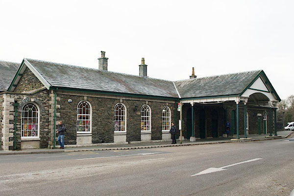 BRY17.jpg (taken 1.12.2009) 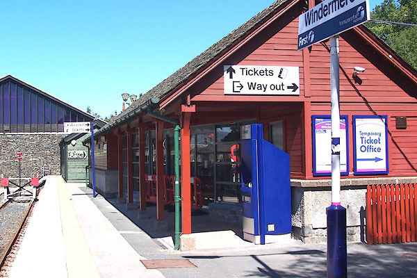 BML82.jpg (taken 3.8.2006) |
||
|
|
||
| evidence:- | old map:- OS County Series (Wmd 32 8) placename:- Windermere Station item:- railway signal |
|
| source data:- | Maps, County Series maps of Great Britain, scales 6 and 25
inches to 1 mile, published by the Ordnance Survey, Southampton,
Hampshire, from about 1863 to 1948.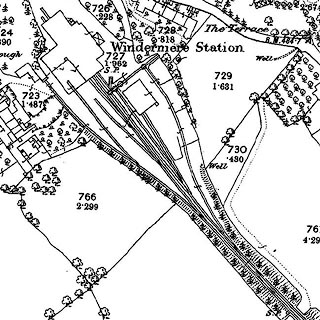 click to enlarge click to enlargeCSRY0174.jpg "Windermere Station / S.P." |
|
|
|
||
| evidence:- | old text:- Martineau 1855 |
|
| source data:- | Guide book, A Complete Guide to the English Lakes, by Harriet
Martineau, published by John Garnett, Windermere, Westmorland,
and by Whittaker and Co, London, 1855; published 1855-76. goto source goto sourcePage 3:- "A few years ago there was only one meaning to the word WINDERMERE. It then meant a lake lying among mountains, and so secluded that it was some distinction even for the travelled man to have seen it. Now, there is a Windermere railway station, ..." "The traveller arrives, we must suppose, by the railway from Kendal, having been dropped at the Oxenholme Junction by the London train from the south, or the Edinburgh and Carlisle train from the north." |
|
|
|
||
| evidence:- | old photograph:- item:- locomotive; Victorious |
|
| source data:- | Photograph, sepia, locomotive at Windermere Station, Windermere, Westmorland, 1900s?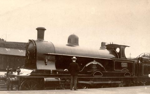 click to enlarge click to enlargePH0073.jpg London and North Western Railway, LNWR, 4-4-0 locomotive no.1950, Victorious. item:- Armitt Library : 1958.4318 Image © see bottom of page |
|
|
|
||
| evidence:- | old map:- Postlethwaite 1877 (3rd edn 1913) |
|
| source data:- | Map, uncoloured engraving, Map of the Lake District Mining Field, Westmorland, Cumberland,
Lancashire, scale about 5 miles to 1 inch, by John Postlethwaite, published by W H
Moss and Sons, 13 Lowther Street, Whitehaven, Cumberland, 1877 edn 1913.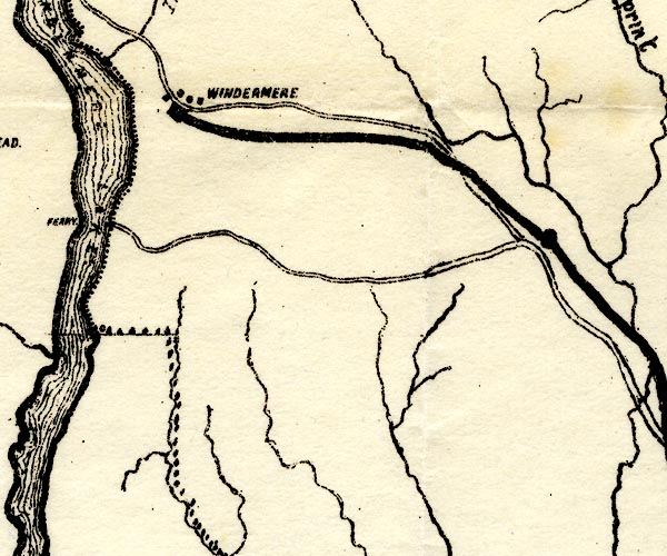 PST2SD49.jpg "WINDERMERE" station on railway item:- JandMN : 162.2 Image © see bottom of page |
|
|
|
||
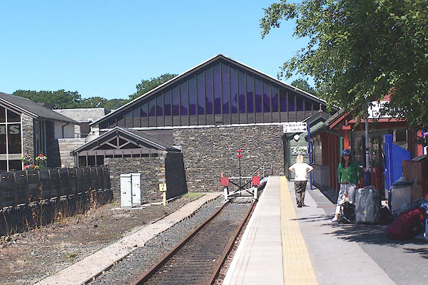 BML81.jpg (taken 3.8.2006) 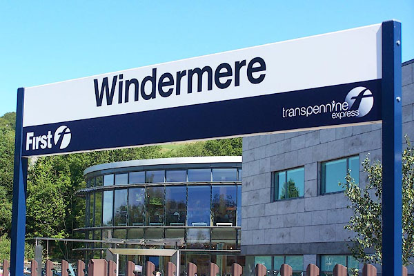 BML83.jpg (taken 3.8.2006) 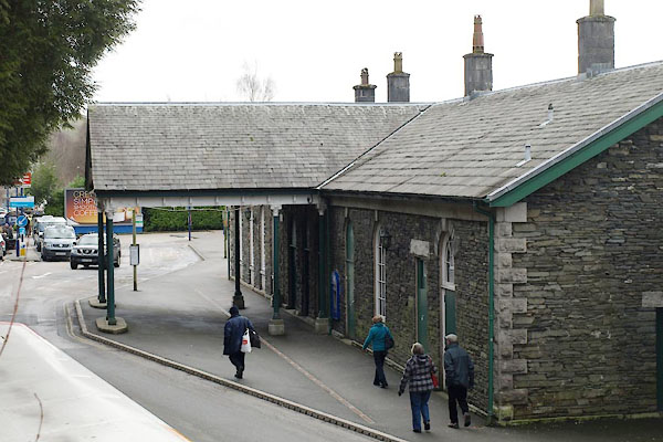 BXW18.jpg (taken 15.2.2013) 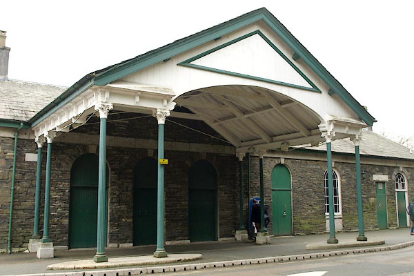 BXW19.jpg (taken 15.2.2013) 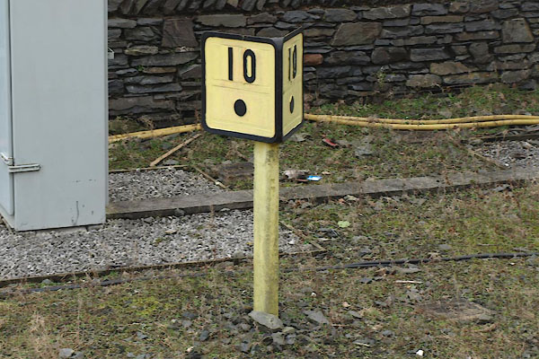 BXW20.jpg Milepost; 10¼miles (taken 15.2.2013) 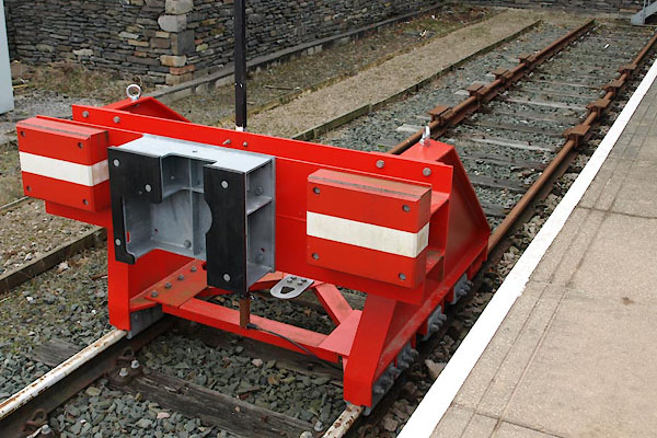 BXW21.jpg Buffers. (taken 15.2.2013)  BML80.jpg View S from the station. (taken 3.8.2006) |
||
|
|
||
| hearsay:- |
This marks the furthest point reached by the railway in 1847. Wordsworth and others
bitterly opposed its development, fearing it would bring hordes of trippers. The original
station was large, having four platforms, signal box, engine shed, turntable, carriage
sidings, goods shed and coal yard. More than 60 railwaymen would have worked here,
and thousands of visitors, hordes of trippers, have passed through. At one time the
goods transported through here would have been timber, coal, coke, cattle, animal
feed, flour, gunpowder (from Elterwater) and fish. |
|
| The goods yard closed in 1969, and the site is now occupied by Lakeland, a thriving
local firm. The train shed and station buildings were sold to E H Booth, who opened
their supermarket in 1985. |
||
|
|
||
Lakes Guides menu.