 Old Cumbria Gazetteer
 |
 |
|
| Water Head Pier, Coniston | ||
| Water Head Pier | ||
| site name:- | Coniston Water | |
| locality:- | Water Head | |
| civil parish:- | Coniston (formerly Lancashire) | |
| county:- | Cumbria | |
| locality type:- | boat house | |
| locality type:- | landing stage | |
| locality type:- | slipway | |
| coordinates:- | SD31009718 | |
| 1Km square:- | SD3197 | |
| 10Km square:- | SD39 | |
|
|
||
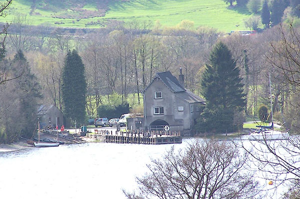 BLZ85.jpg (taken 28.4.2006) |
||
|
|
||
| evidence:- | perhaps descriptive text:- West 1778 (11th edn 1821) item:- slate |
|
| source data:- | Guide book, A Guide to the Lakes, by Thomas West, published by
William Pennington, Kendal, Cumbria once Westmorland, and in
London, 1778 to 1821. goto source goto sourcePage 53:- "... The eastern shore is not less bold and embayed [1]." "[1] The slate brought down from the mountains is laid up here, till put on board boats that transport it to Water-foot." |
|
|
|
||
| evidence:- | presumably old map:- Crosthwaite 1783-94 (Con) |
|
| source data:- | Map, uncoloured engraving, An Accurate Map of Coniston Lake,
scale about 3 inches to 1 mile, by Peter Crosthwaite, Keswick,
Cumberland, 1788, version published 1809.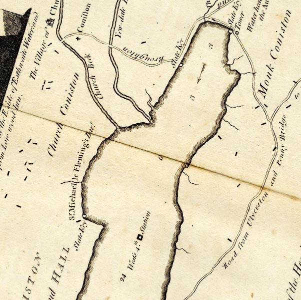 CTESD39D.jpg "Slate Key" ?jetty marked on lake item:- JandMN : 182.5 Image © see bottom of page |
|
|
|
||
| evidence:- | old photograph:- Bell 1880s-1940s item:- cattle item:- steam yacht; Gondola; boat |
|
| source data:- | Photograph, black and white, steam yacht Gondola, and cattle at Water Head Pier, Coniston
Water, Lancashire, by Herbert Bell, Ambleside, Westmorland, 1890s.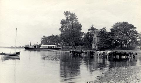 click to enlarge click to enlargeHB0453.jpg stamped at reverse:- "HERBERT BELL / Photographer / AMBLESIDE" item:- Armitt Library : ALPS112 Image © see bottom of page |
|
|
|
||
Lakes Guides menu.